
Projects
Open Space Case Studies
Design Framework
Helping government to deliver blue green infrastructure
Planning for healthy cities
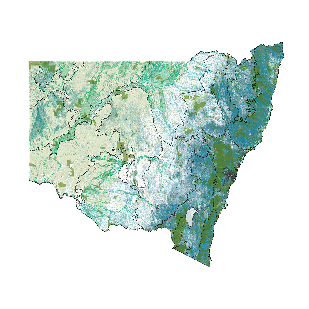
We take a multi-scale approach to open space planning and design. At a regional level it is critical to protect biodiversity in national parks, bushland reserves, mature trees and healthy waterways. The health and resilience of each ecological community can be assessed, restored if appropriate or enhanced with additional species. New projects should consider their unique setting, biophysical context and potential to link existing patches, creating connective green threads of interesting streets, parks, rooftops and courtyards.

Natural systems of blue and green infrastructure can underpin development as a core component of contemporary city life.

Case studies help to identify project opportunities and potential for collaboration across cadastral and government boundaries.

In each project we investigate how biodiversity and natural systems can be protected, restored, enhanced and created to provide a connected network of blue green infrastructure.
Advocating for generous, connected and diverse open space
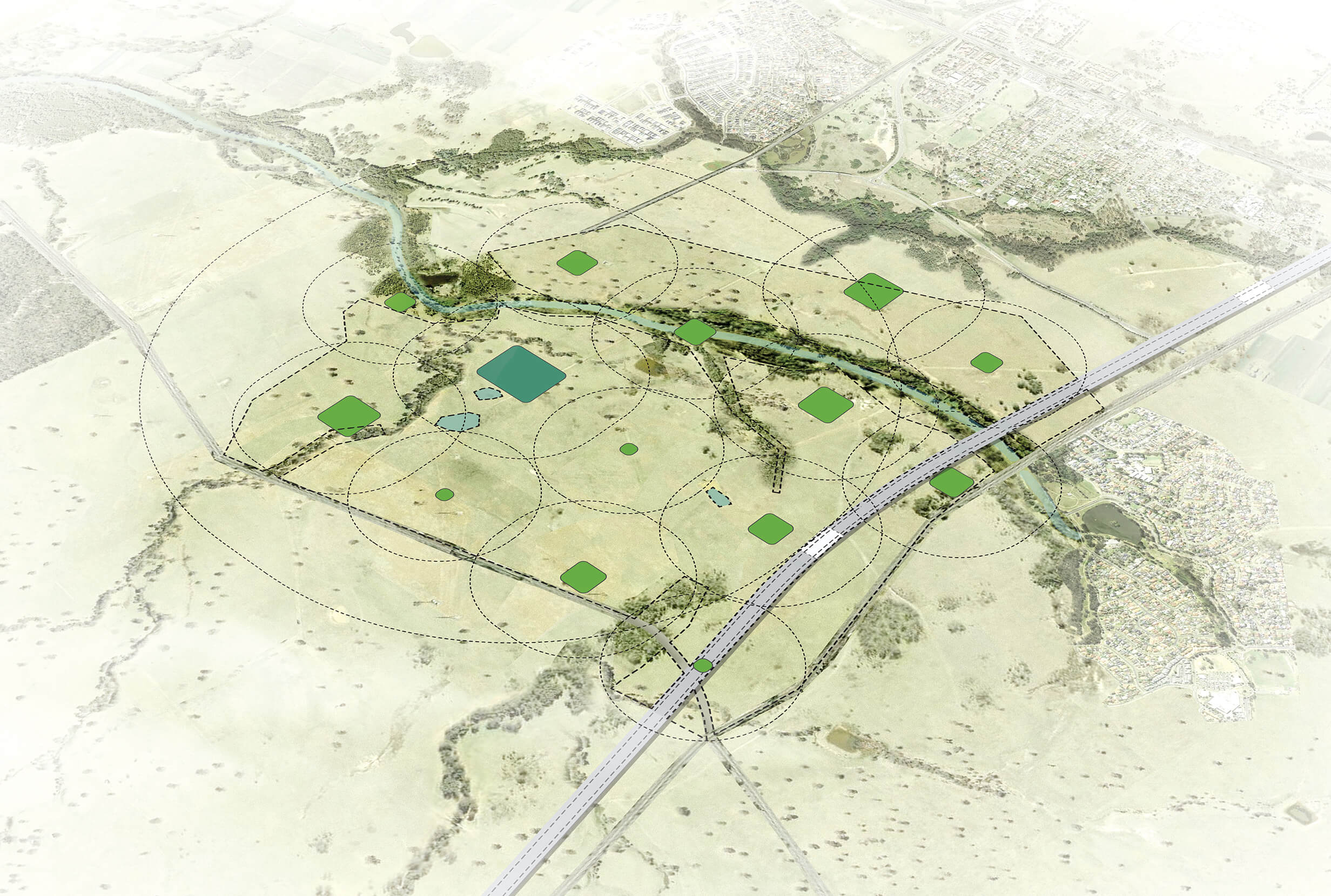
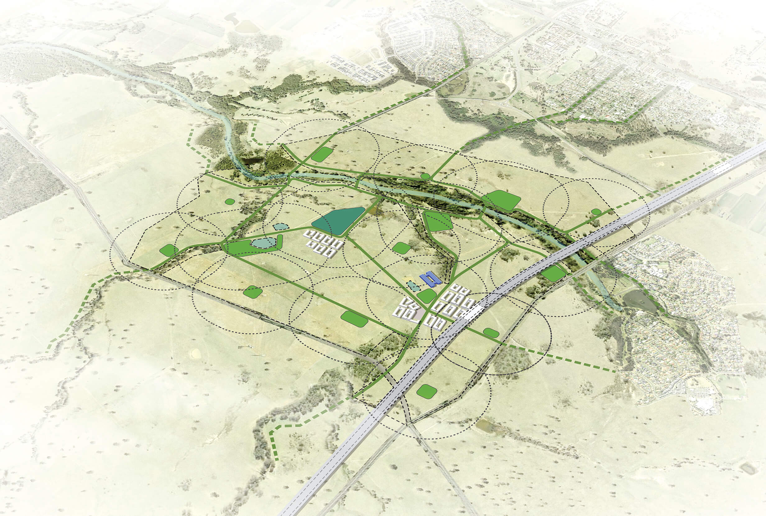
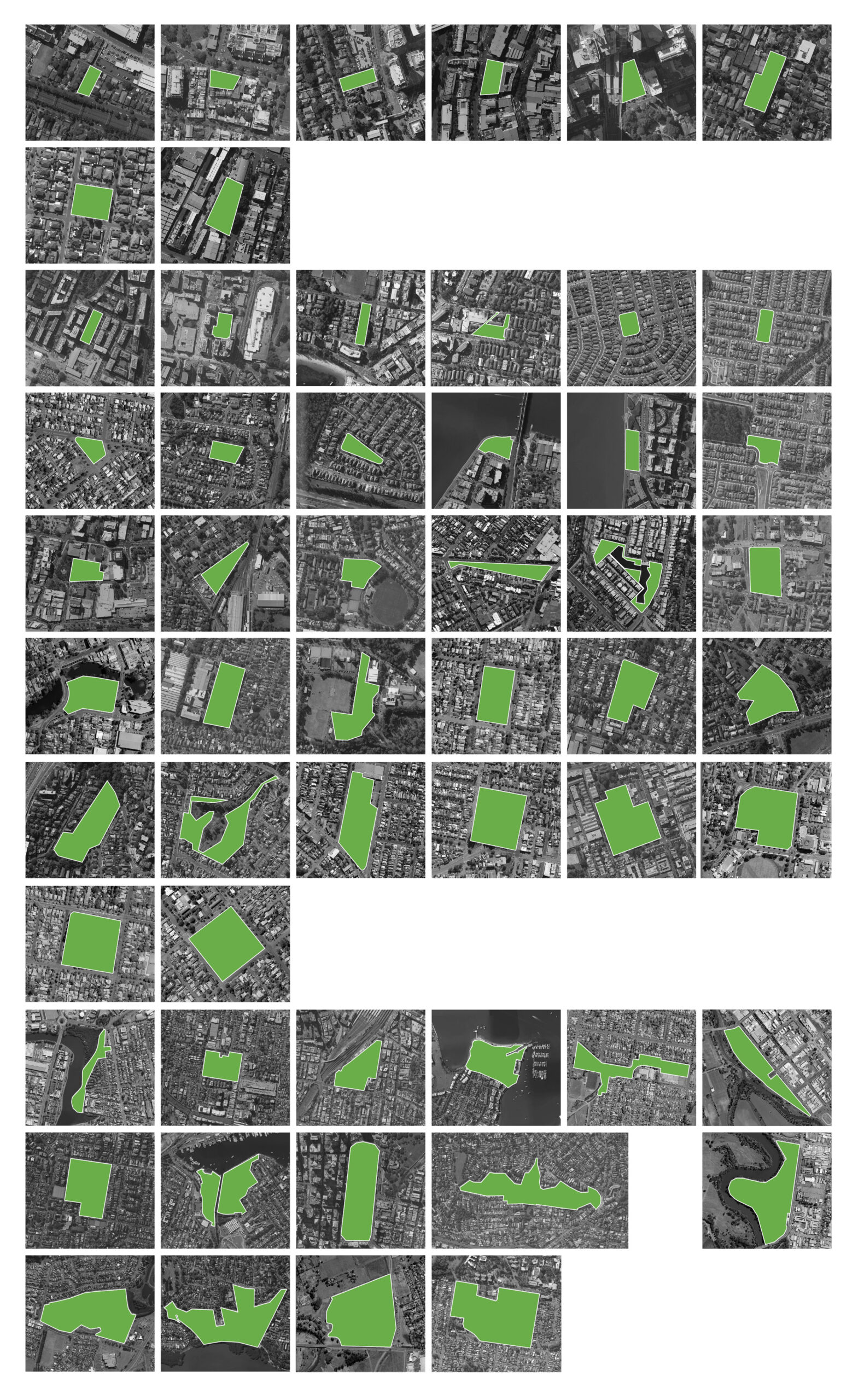
We help government partners investigate site opportunities in low density greenfield developments including open space requirements, location and sizing, as well as broader opportunities for connectivity with natural systems. We assessed different types of development including regional towns, low density subdivision, mid-density urban development, urban renewal development precincts of 5-50 hectares and small urban renewal development sites 1-5 hectares.

Case studies and visualisations are useful to understand potential for open space location, distribution and size, as well as broader opportunities for connectivity with natural systems.
Case studies and visualisations are useful to understand potential for open space location, distribution and size, as well as broader opportunities for connectivity with natural systems.
Case studies and visualisations are useful to understand potential for open space location, distribution and size, as well as broader opportunities for connectivity with natural systems.

Case studies and visualisations are useful to understand potential for open space location, distribution and size, as well as broader opportunities for connectivity with natural systems.
Rigorous analysis, clear synthesis
Our projects often include the analysis of current open space provision methods and percentages, integrating relevant strategic documents, preparing open space calculations and testing sizes for local and district parks. We use case studies to test metrics across a range of typical scenarios including urban and regional settings, development types and density. We study desirable and successful characteristics of open space across small, local, district, linear, regional and metropolitan parks. This data helps us to assess trends, identify problems and weaknesses within these areas and suggest improvements.

Defining open space in high and medium density includes linking to open space beyond the development site, focusing open space in generous local parks, providing small parks to support local walking catchments, and linking them together with linear parks and green streets.
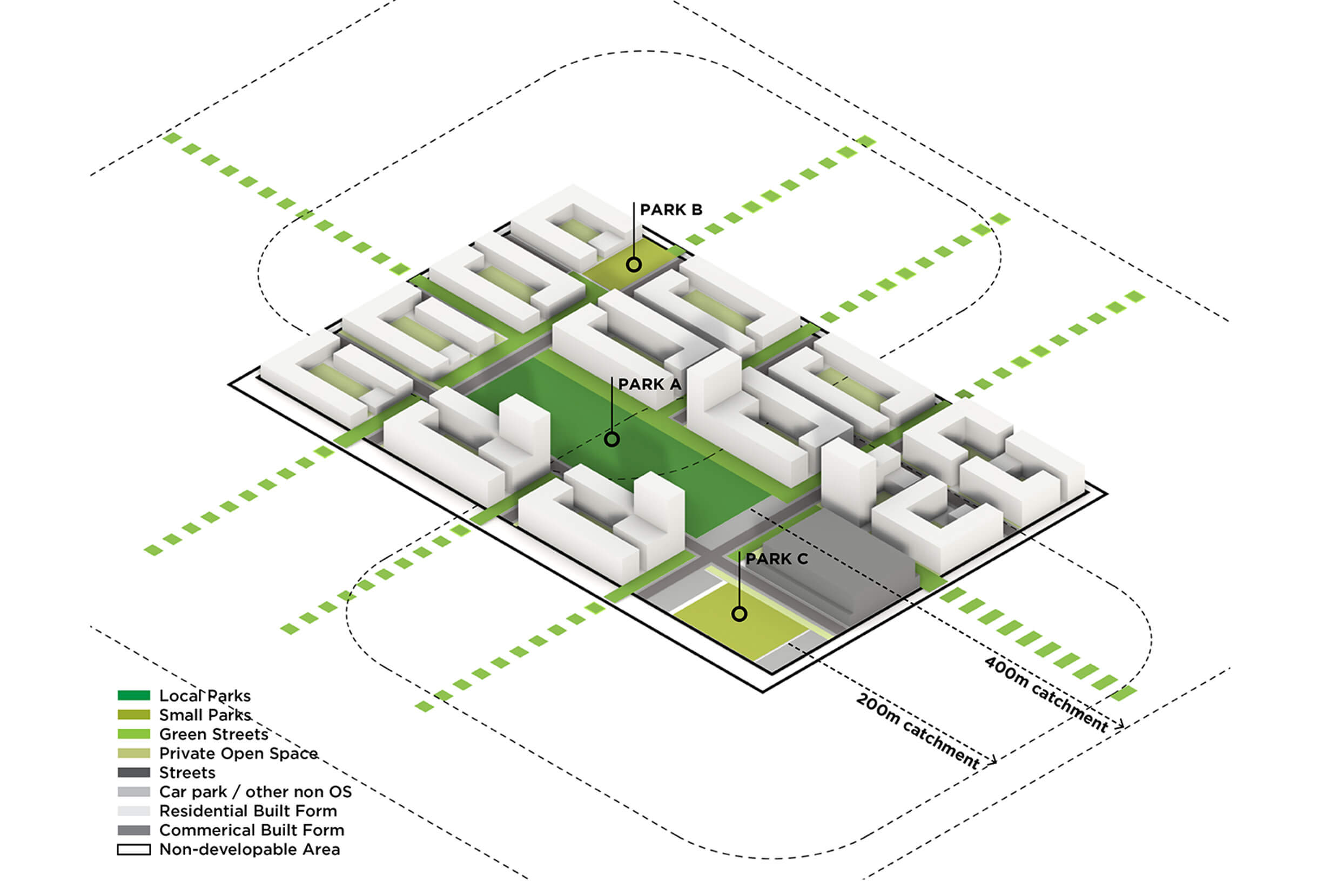
Diagram of a network system in an urban context that includes local parks at 400m walking catchments, small parks at 200m walking catchments, and connected linear parks or green streets.
Building an evidence base
Over the last decade we’ve worked closely with state government to advise on proposed methods and metrics for the provision of open space in NSW. Methods had to be robust, site responsive and easy to follow. Metrics needed to be clear and simple, including minimum, maximum and median sizes for open space, as well as network distribution, walking and population catchments. The aim for our studies was to suggest a base spatial standard to underpin site specific urban design and city planning.
Our studies investigate appropriate dimensions for all types of public open space and how they are best located to achieve amenity and connectivity. This allows us to provide clear insights into open space provision using a broad evidence base.
Interested in learning more about Tyrrell Studio? Get in touch.