
Projects
Shale Hills Parklands
Catalyst Project
‘Quality green open space on the doorstep of the future Aerotropolis’ Jury Report
Winner of the 2020 AILA NSW Award of Excellence for Parks and Open Space
Reframing an Undeveloped Landscape
The Western Sydney Parklands Trust wanted a masterplan for Shale Hills to showcase the recreation potential of the Parklands and engage the West Hoxton community. Research and talks with the community revealed that a dog park was lacking in the area. But instead of the usual low key, low budget affair, we designed a highly sculptural contemporary park with unique features and details to ensure the park attracted repeat visits and felt like part of the distinctive Western Sydney landscape. Local residents who used to view Shale Hills as a blank expanse of remnant farmland now see it as their place, a valued local resource that’s become part of their daily routine.

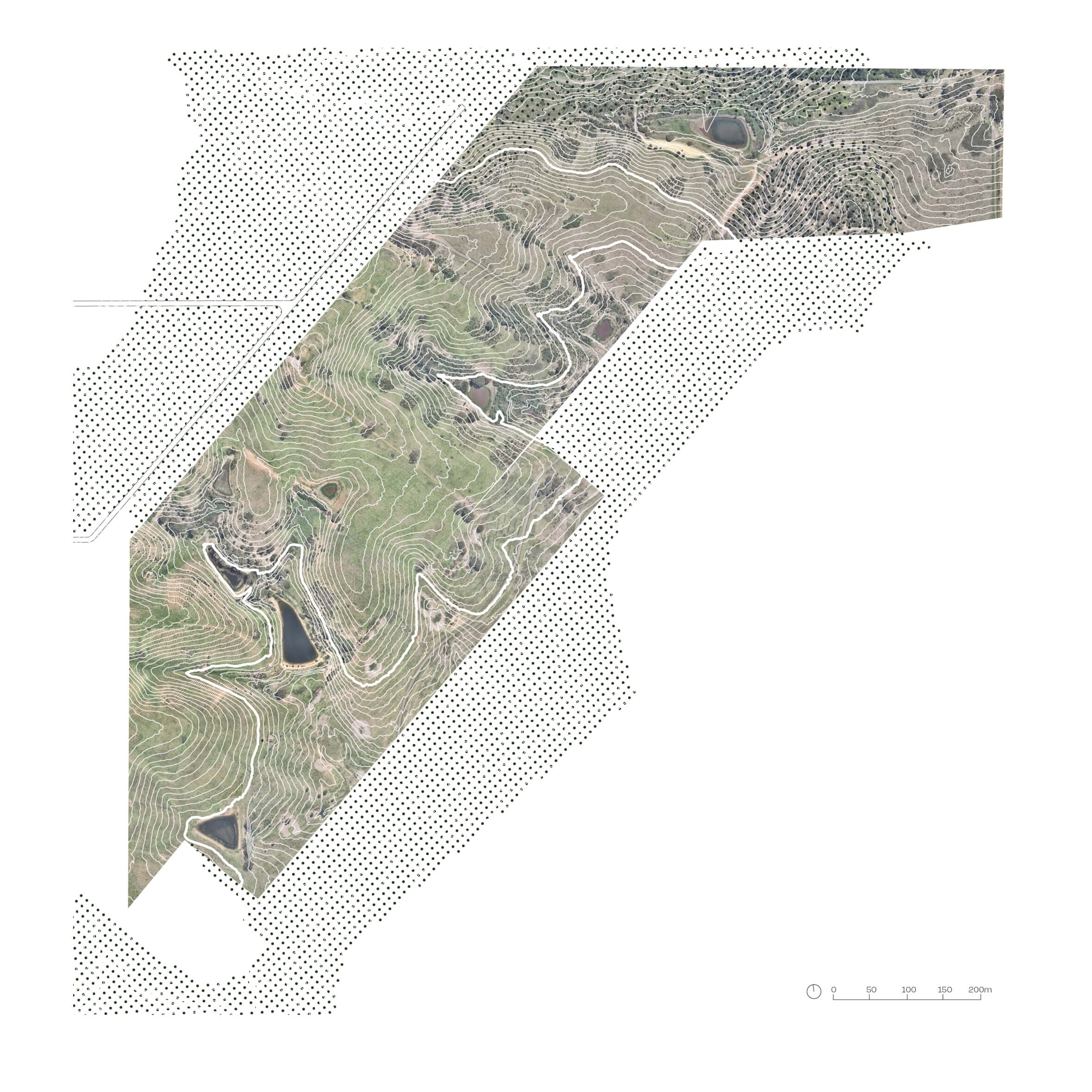
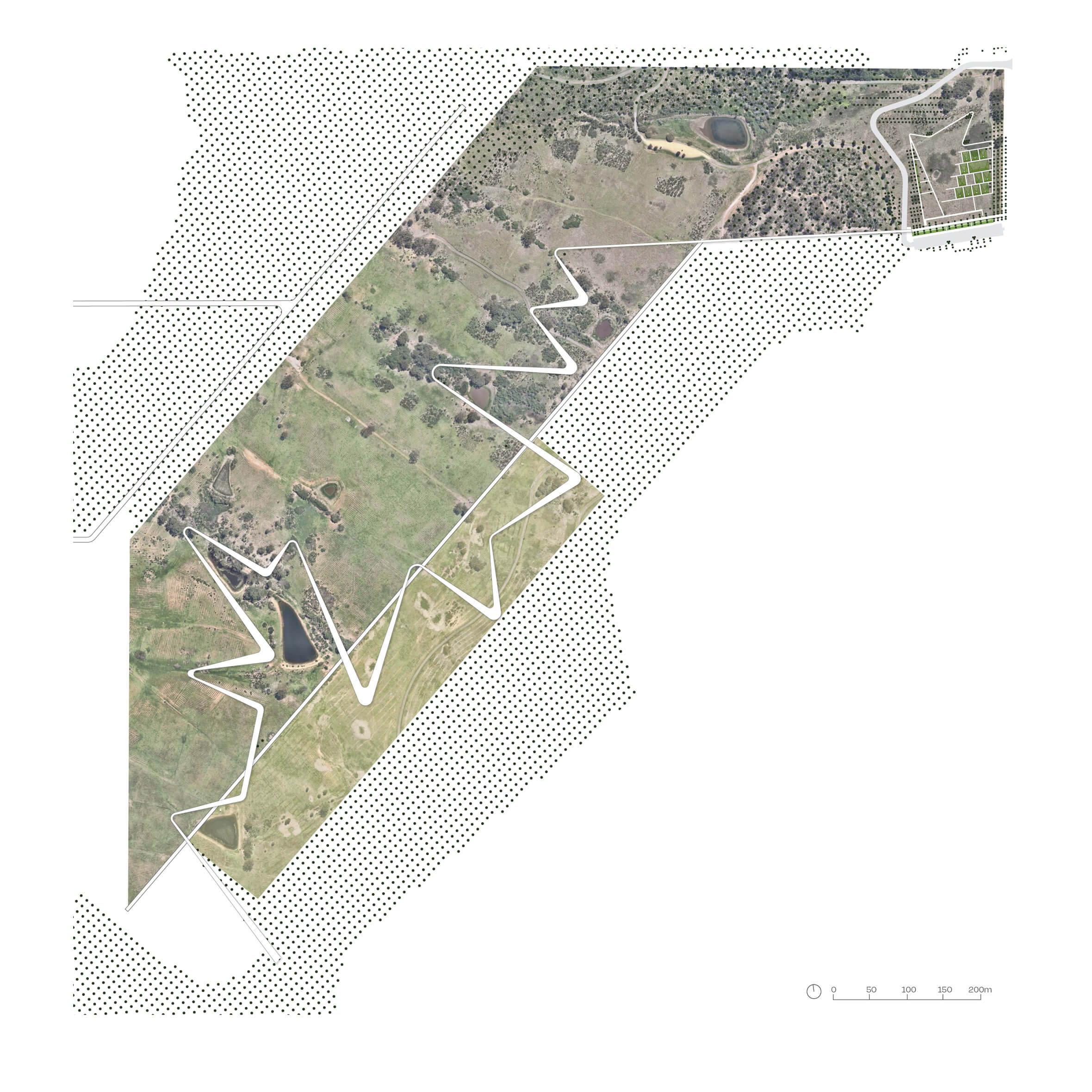
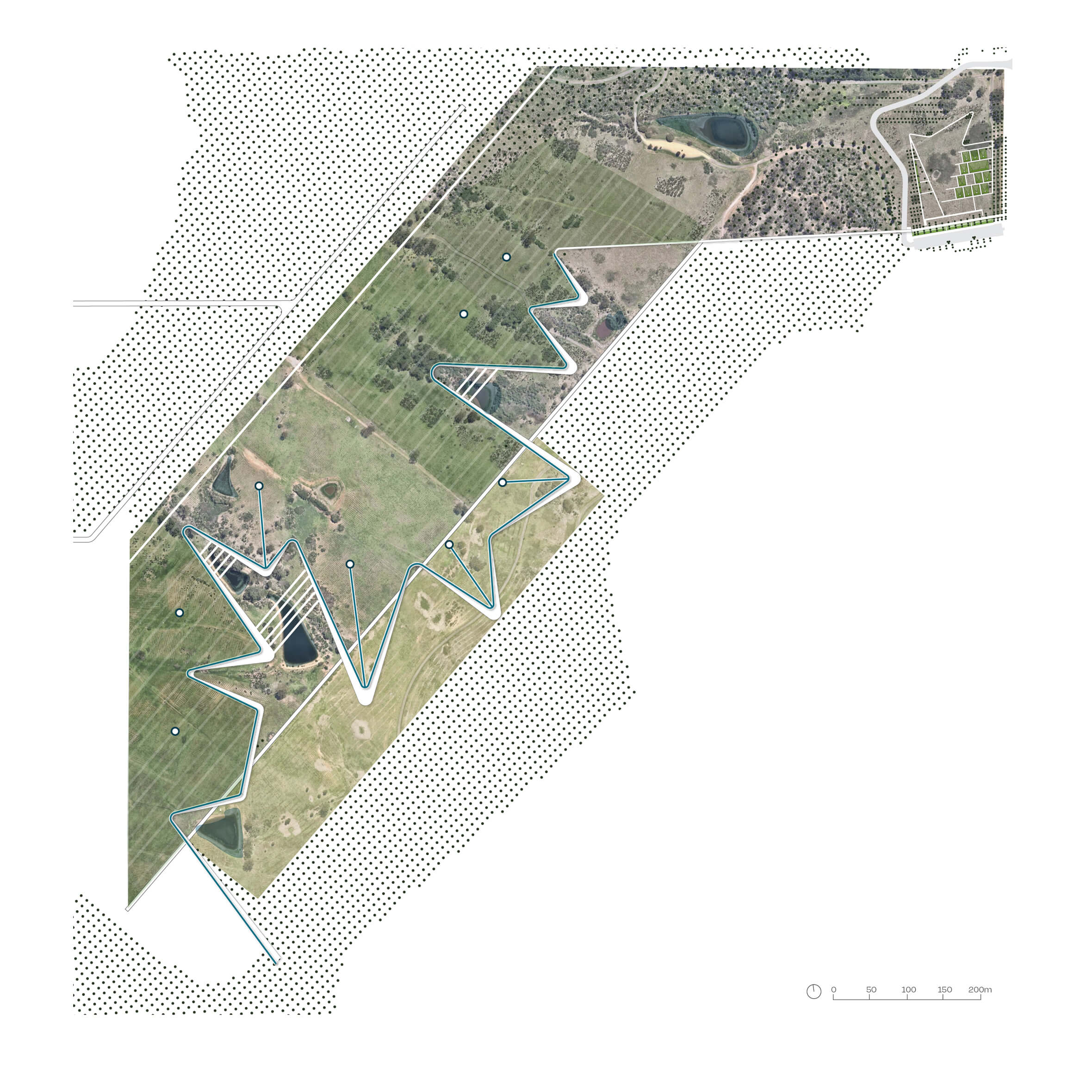
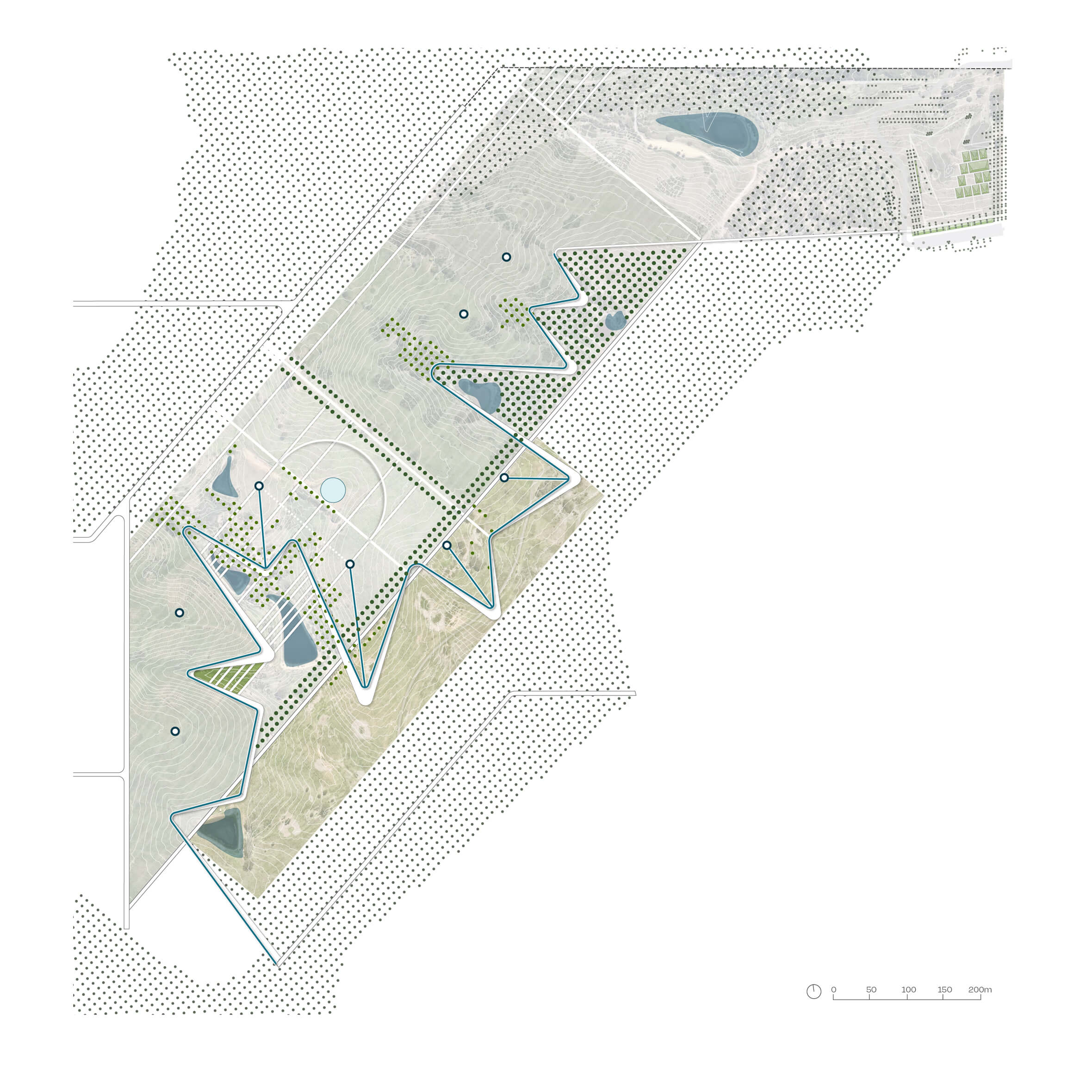
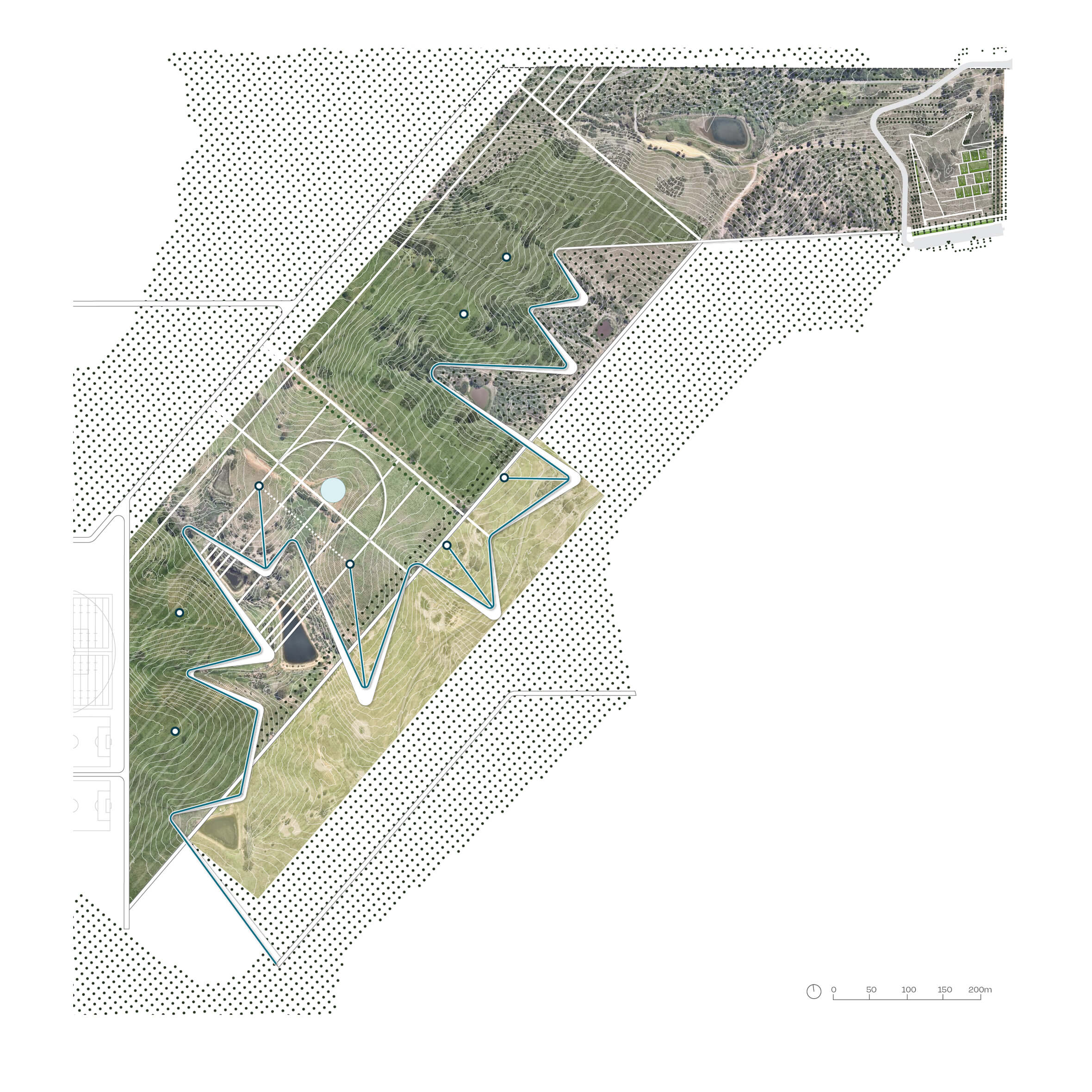
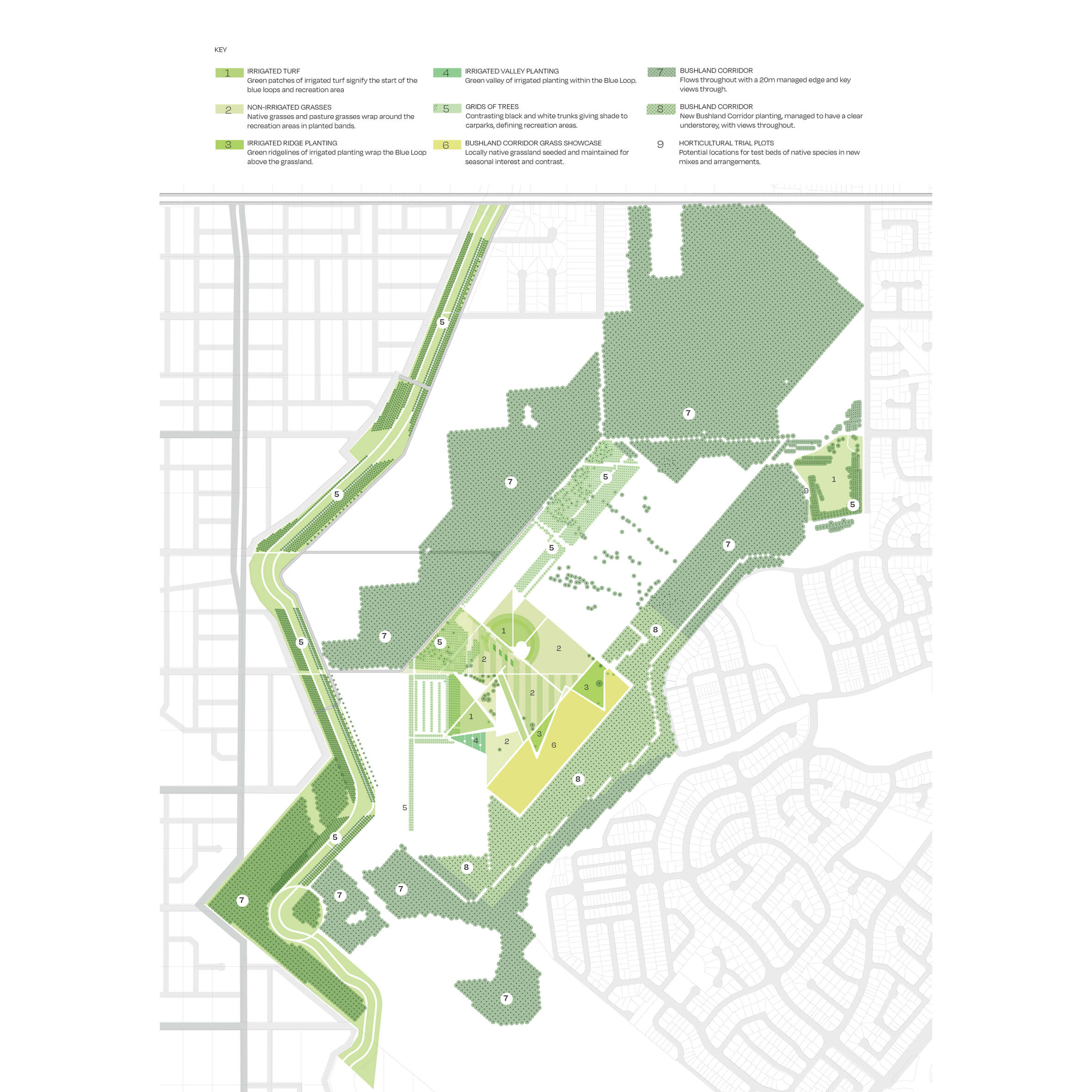
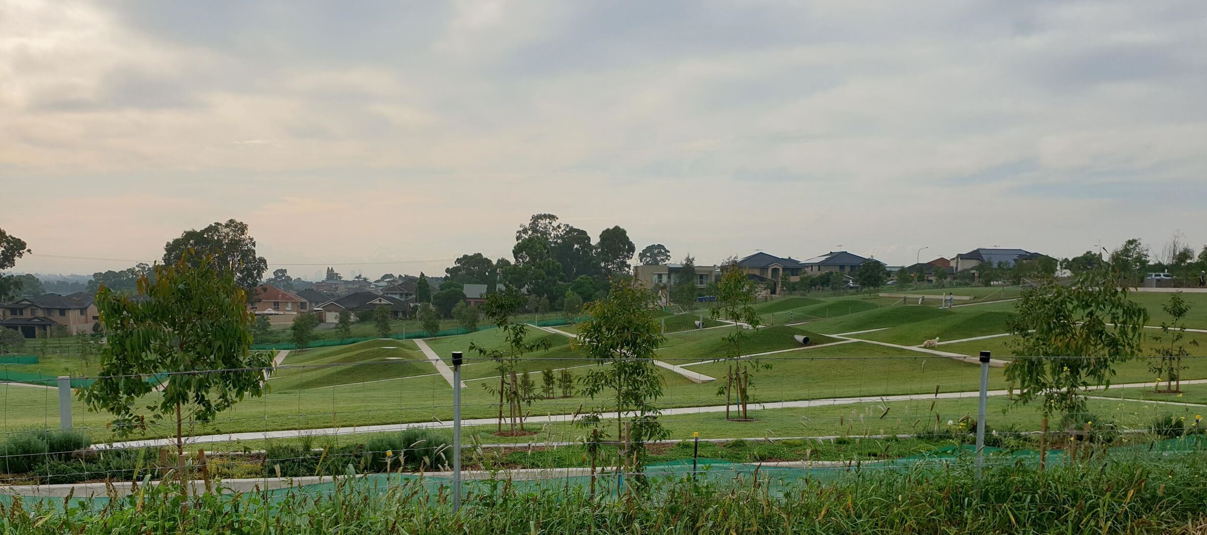
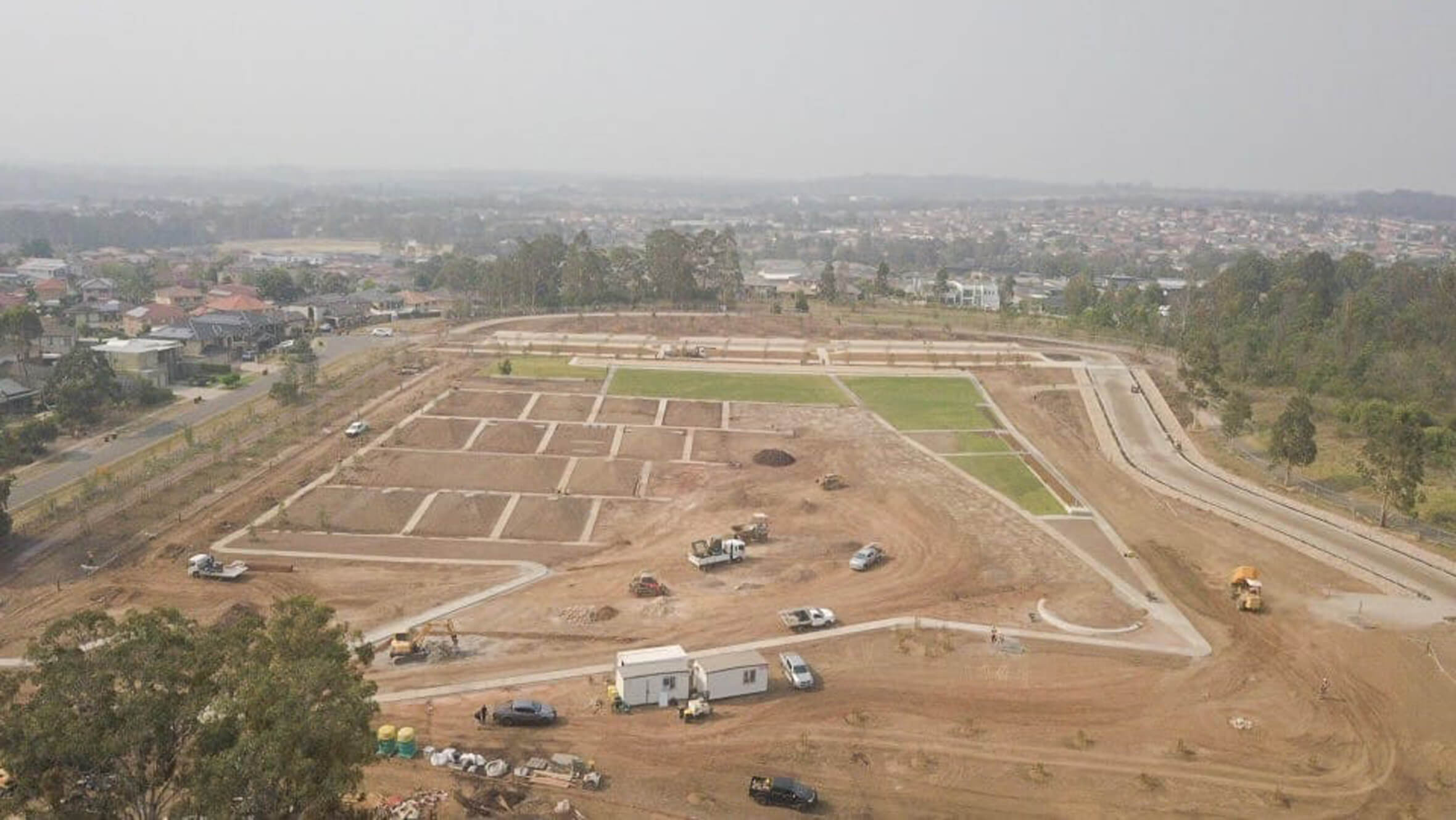
We studied the landform to draw out keylines and level paths through rolling hills and gullies. People follow the path of water, tracing cool blue loops around farm dams and gathering at storage tanks on ridge lines. The dog park can be seen in the top right corner.
We studied the landform to draw out keylines and level paths through rolling hills and gullies. People follow the path of water, tracing cool blue loops around farm dams and gathering at storage tanks on ridge lines. The dog park can be seen in the top right corner.
We studied the landform to draw out keylines and level paths through rolling hills and gullies. People follow the path of water, tracing cool blue loops around farm dams and gathering at storage tanks on ridge lines. The dog park can be seen in the top right corner.
We studied the landform to draw out keylines and level paths through rolling hills and gullies. People follow the path of water, tracing cool blue loops around farm dams and gathering at storage tanks on ridge lines. The dog park can be seen in the top right corner.
We studied the landform to draw out keylines and level paths through rolling hills and gullies. People follow the path of water, tracing cool blue loops around farm dams and gathering at storage tanks on ridge lines. The dog park can be seen in the top right corner.
We studied the landform to draw out keylines and level paths through rolling hills and gullies. People follow the path of water, tracing cool blue loops around farm dams and gathering at storage tanks on ridge lines. The dog park can be seen in the top right corner.

We studied the landform to draw out keylines and level paths through rolling hills and gullies. People follow the path of water, tracing cool blue loops around farm dams and gathering at storage tanks on ridge lines. The dog park can be seen in the top right corner.
We studied the landform to draw out keylines and level paths through rolling hills and gullies. People follow the path of water, tracing cool blue loops around farm dams and gathering at storage tanks on ridge lines. The dog park can be seen in the top right corner.
We studied the landform to draw out keylines and level paths through rolling hills and gullies. People follow the path of water, tracing cool blue loops around farm dams and gathering at storage tanks on ridge lines. The dog park can be seen in the top right corner.
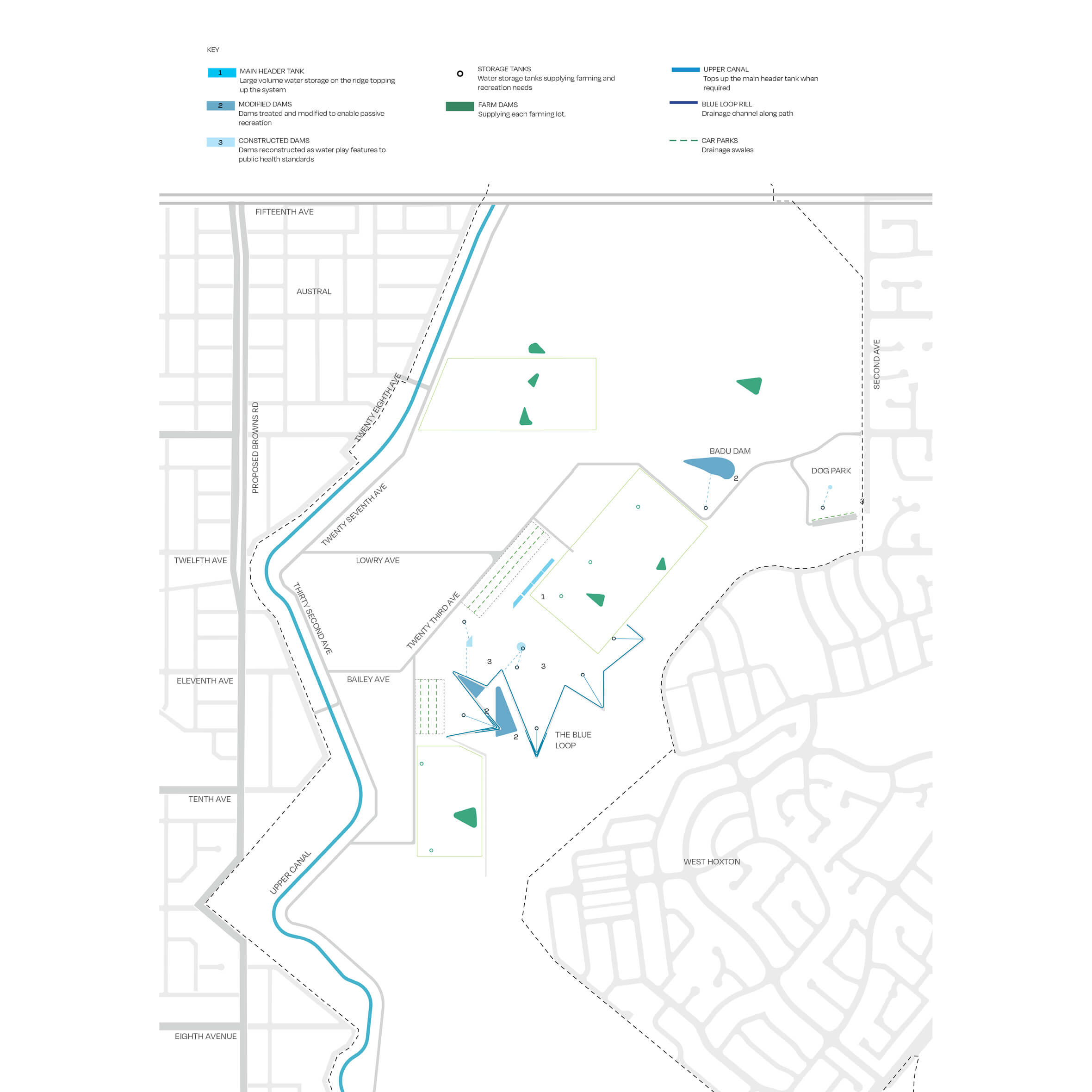
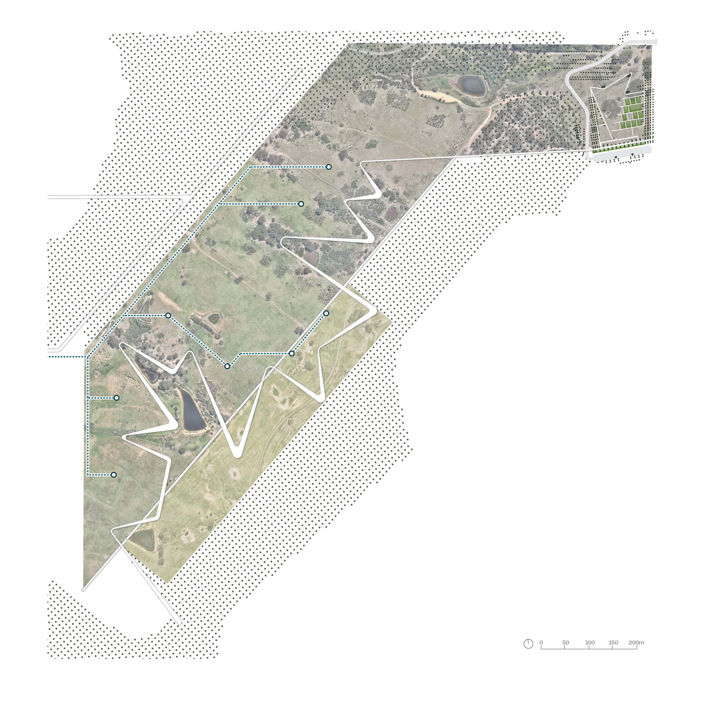
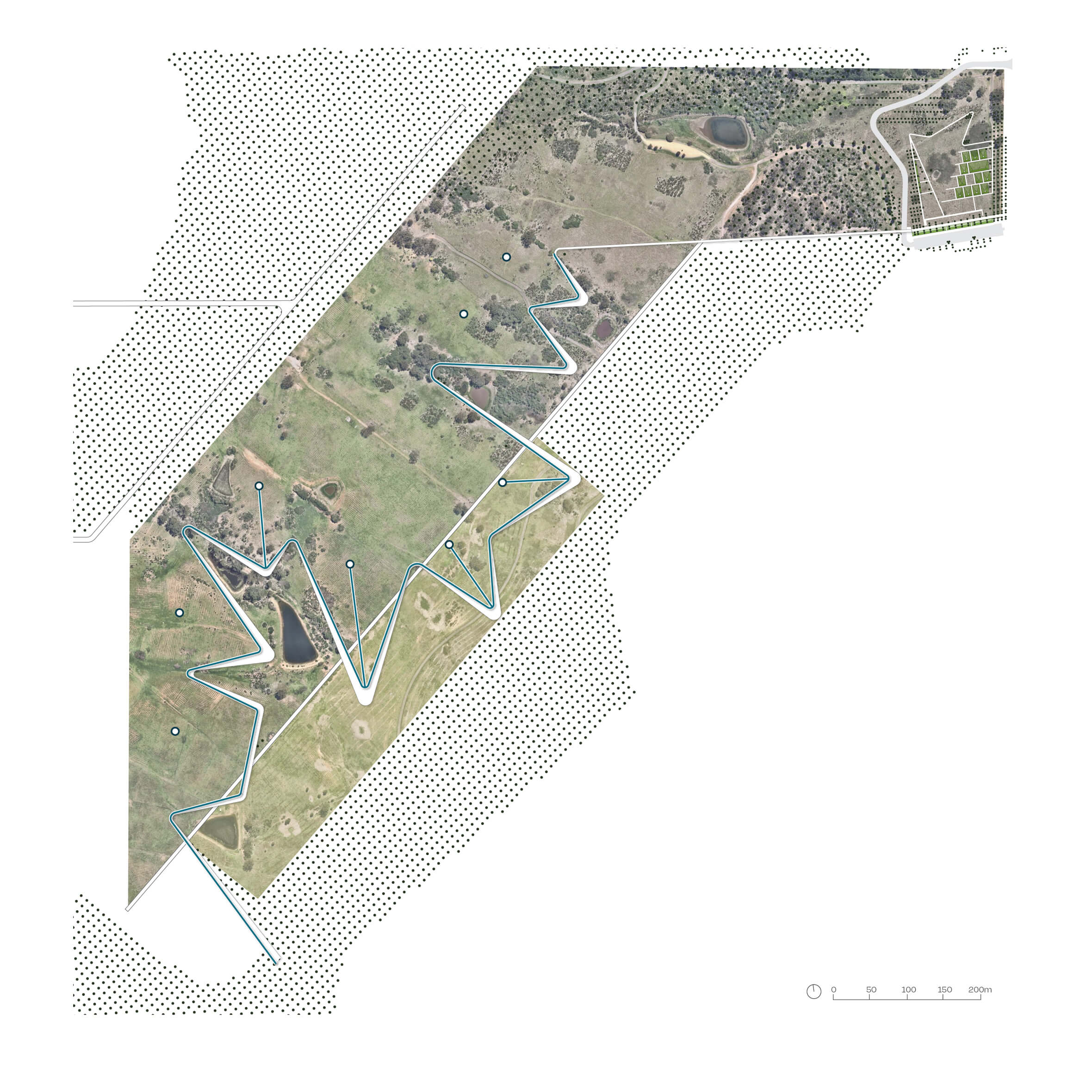
People naturally seek cool and shade in the hot western Sydney landscape. Our masterplan starts with blue and green infrastructure to create a logic for movement, dwelling and resource management.
People naturally seek cool and shade in the hot western Sydney landscape. Our masterplan starts with blue and green infrastructure to create a logic for movement, dwelling and resource management.
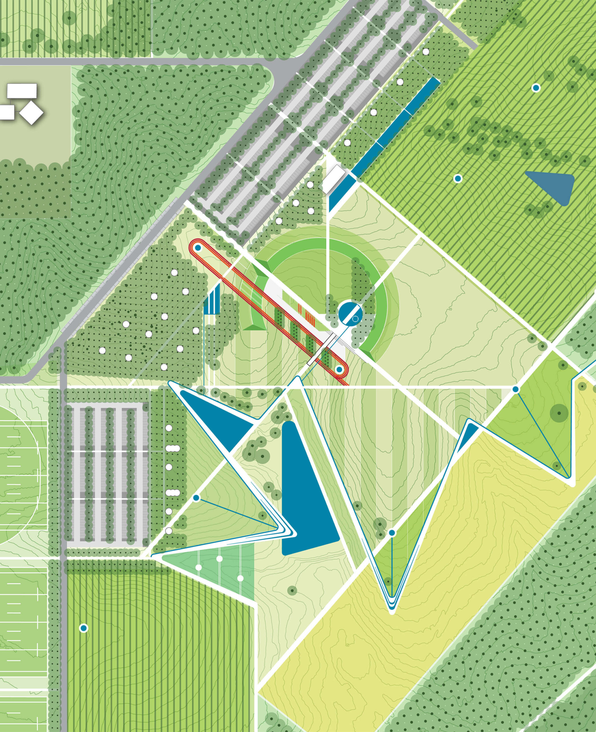
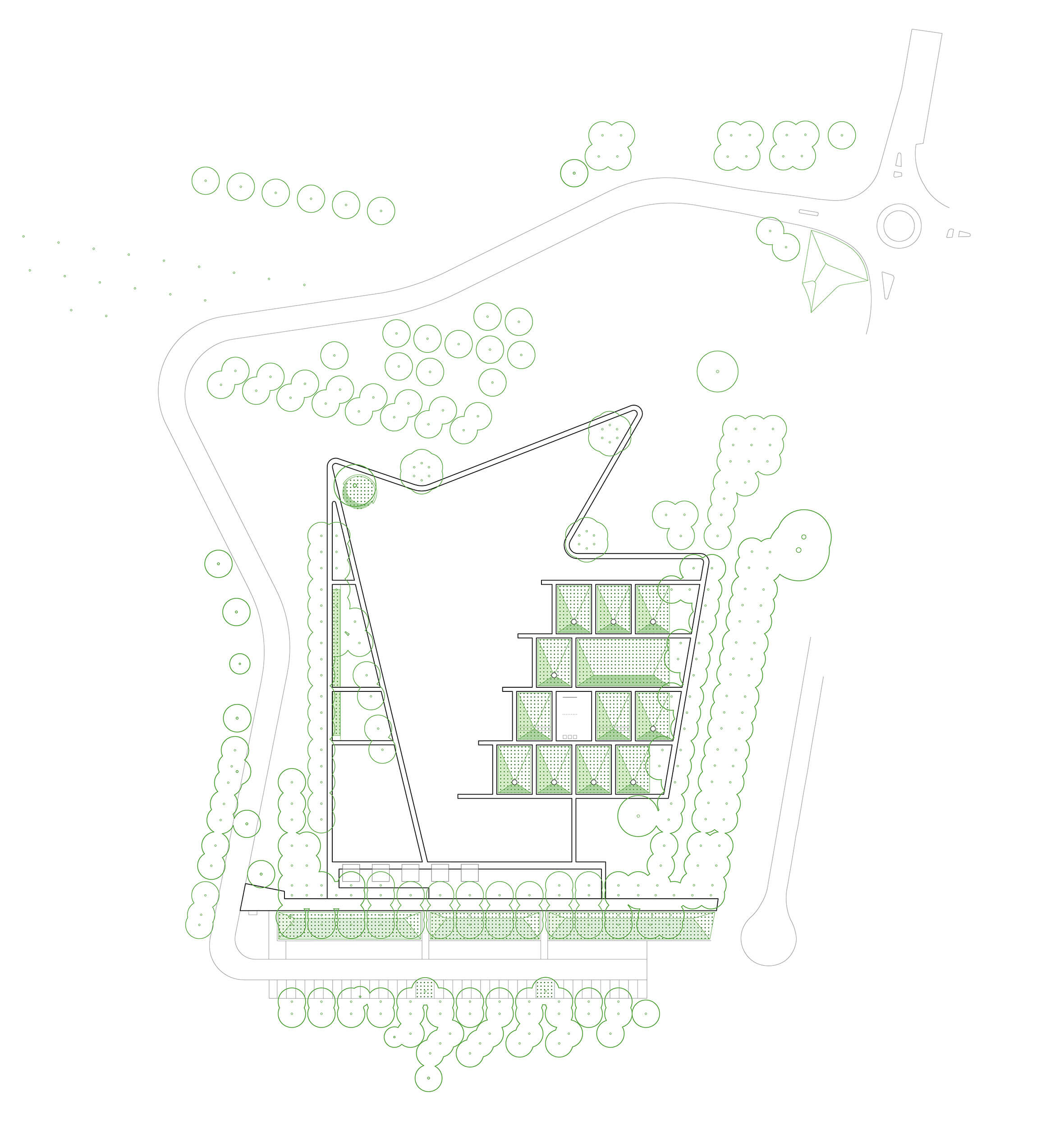
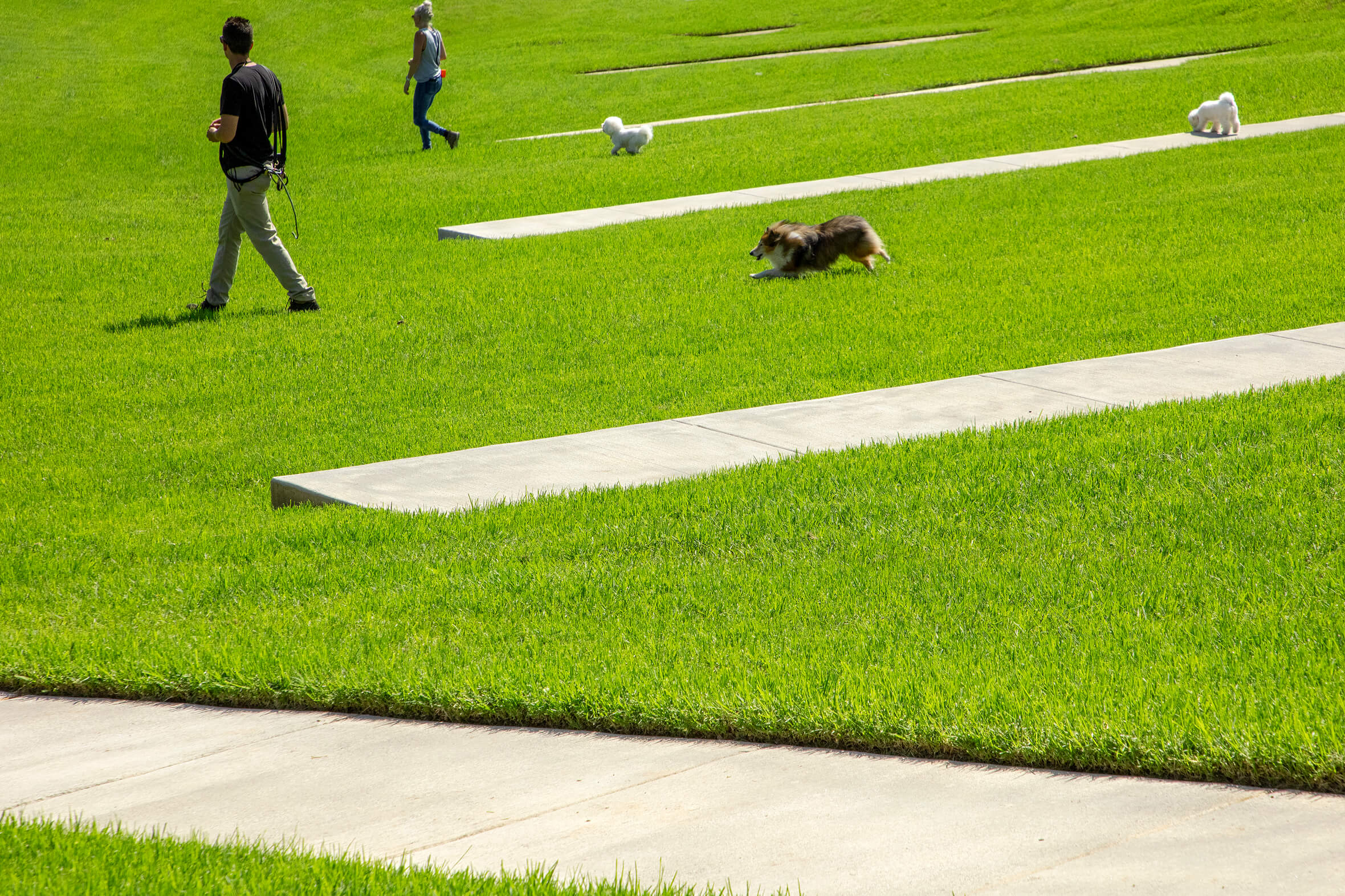
The Shale Hills Parklands masterplan introduces new uses to the semi-rural landscape. Bold sculptural and geometric forms define different land uses and reveal natural systems. Playgrounds, car parking, grassland and bushland are held within a clear path system that provides different experiences for visitors.
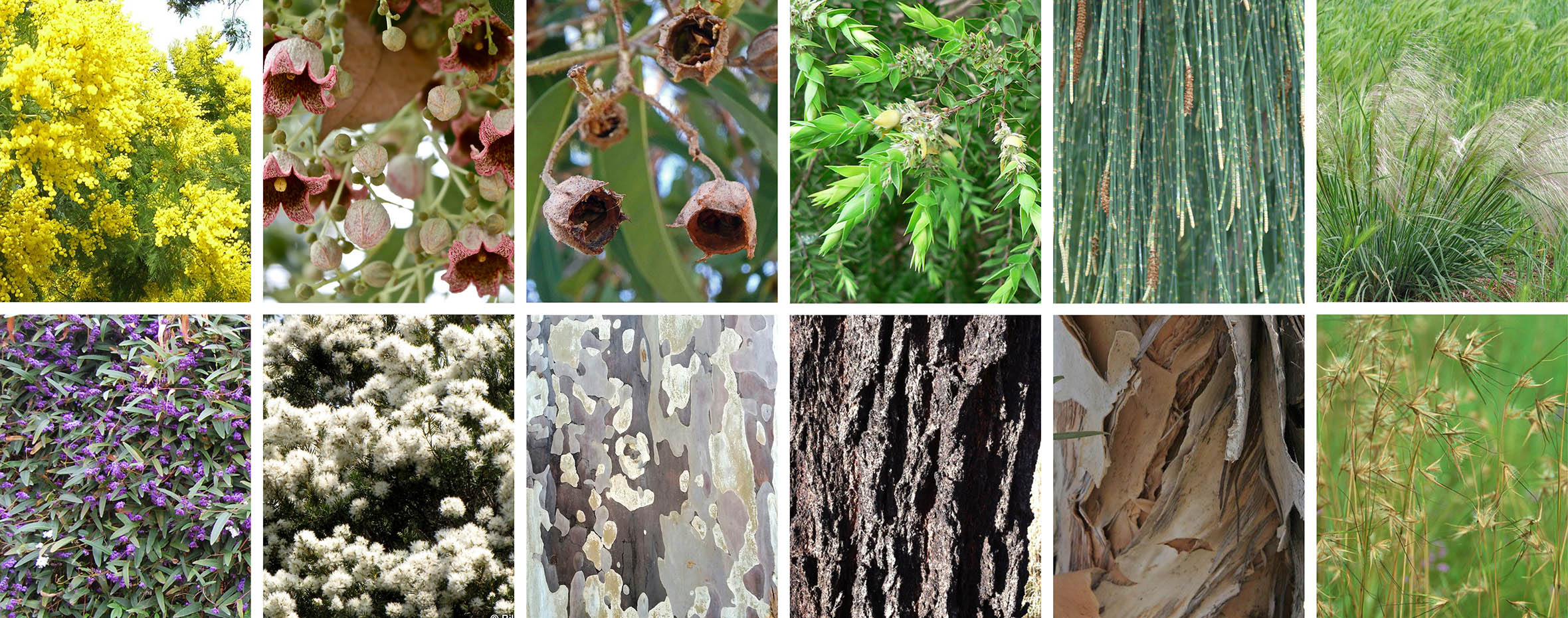
A locally native planting approach retains mature vegetation and features star species of the Cumberland Plain Woodland.
Never ‘just a dog park’
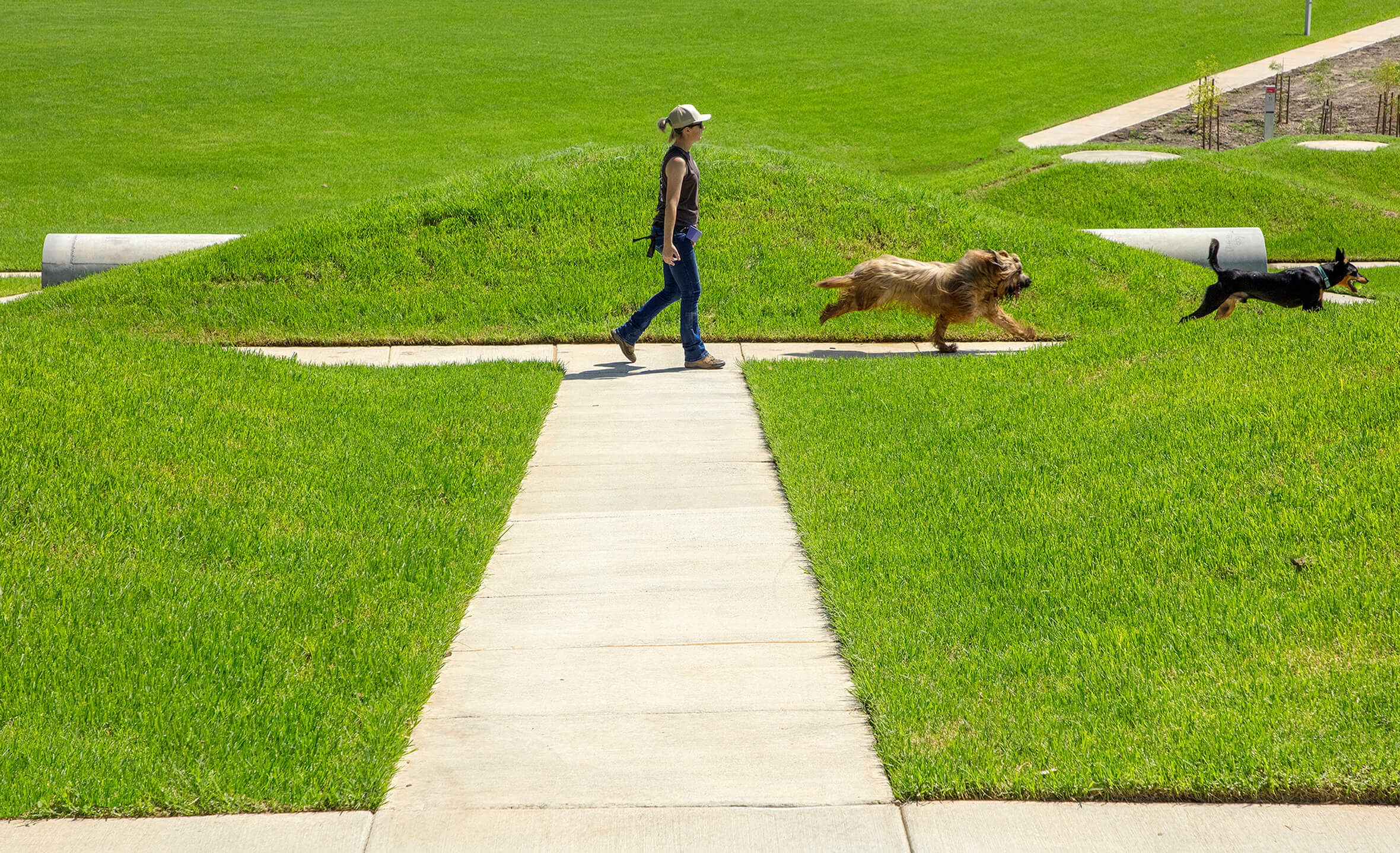
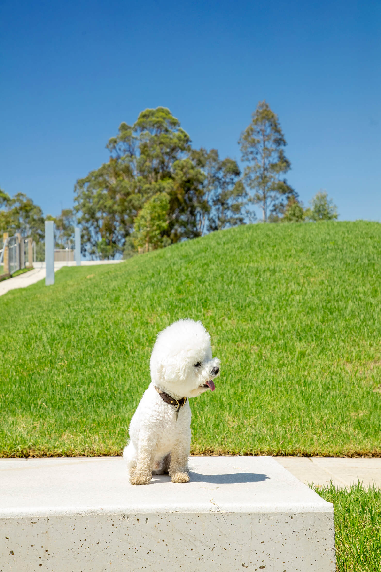
The Shale Hills Dog Park was an important proof of concept. Delivered well, it would be a transformational project for the Parklands. At five hectares, the dog park needed to be bold and memorable with instant appeal. We worked closely with the Trust to create a high quality user experience for people and their pets. The park is an essential resource for Western Sydney’s growing population, delivering social, environmental and health benefits. It’s 500 plus Google reviews describe a park that has been wholeheartedly embraced by the Western Sydney community.
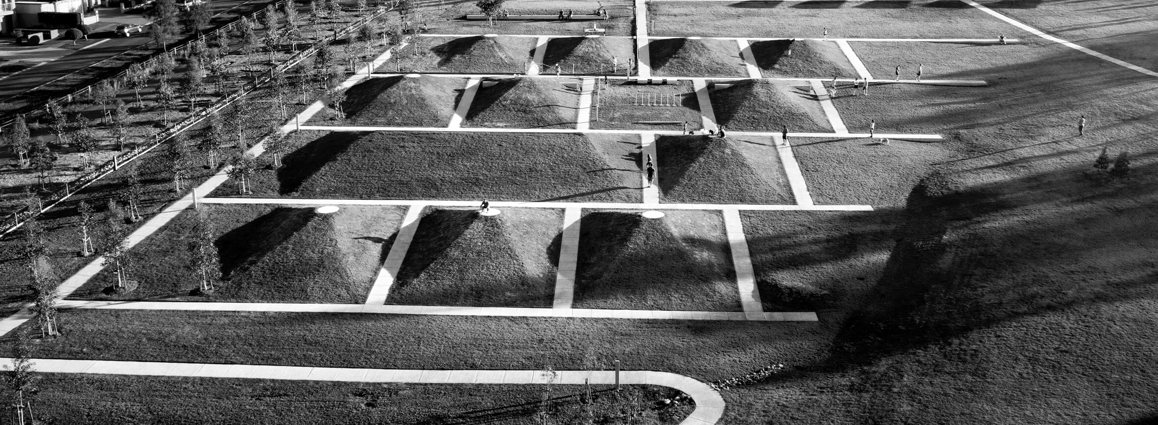
Twelve structured turf mounds create peaks and valleys for prospect and refuge along a grid of paths.
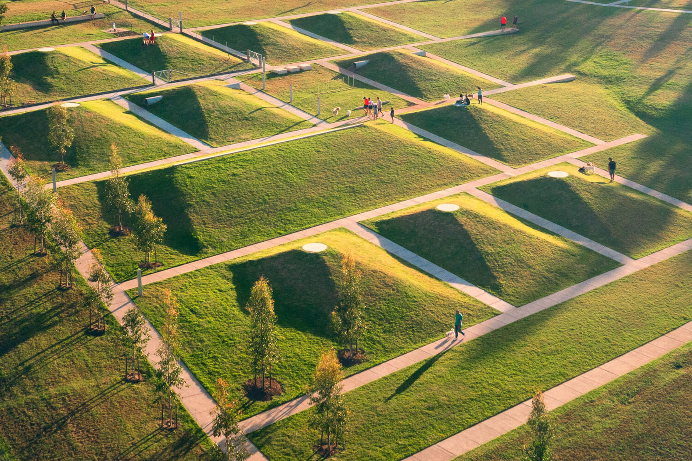
The vast scale of the dog park inspired bold design moves in response.
The entry road and carpark are concealed by topography and planted mounds to maximise the sense of green when arriving in the dog park.
Double avenues of Eucalypts provide shade to the perimeter walking track and a buffer to the adjacent residences.
A loop path around the park includes a ten-stop self-guided course on how to teach dogs to sit, stay, lie down, look, stop, walk fast and walk slow.
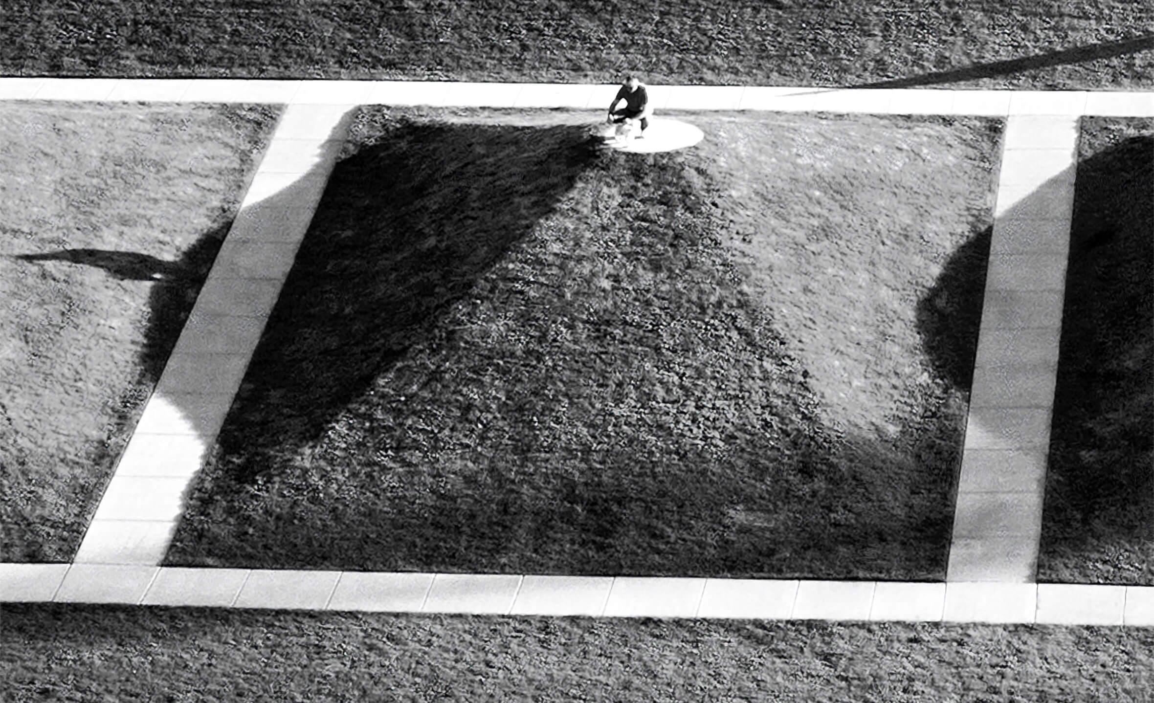
The top of each mound is a perfect spot to sit, stay and survey the surroundings, proving equally popular with humans and dogs.
A separate fenced area can be used by small, older or timid dogs to rest and engage at their own pace.
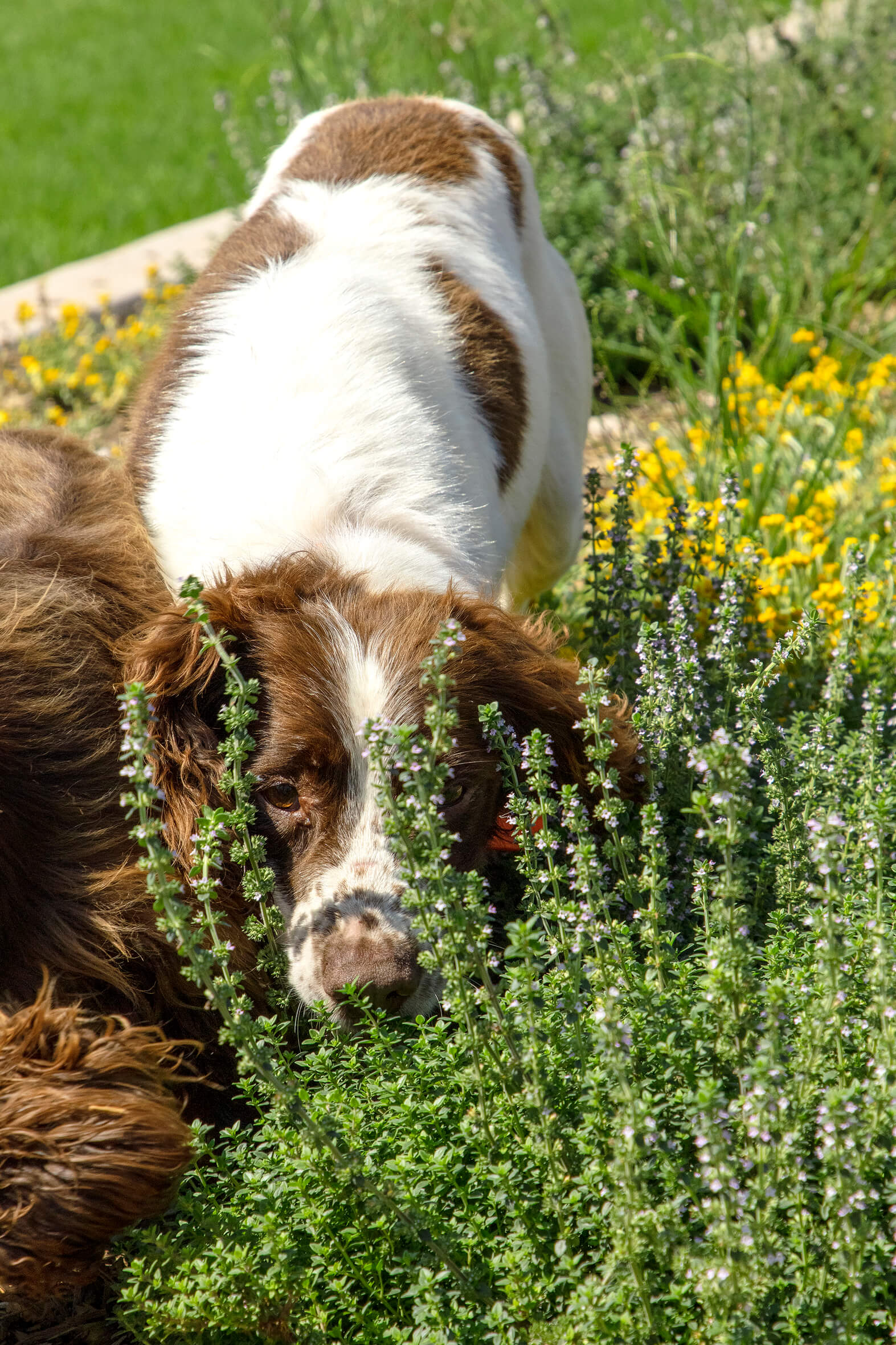
The sensory garden allows dogs to self-select textured and scented plants including lavender, thyme and mint.
The dog park has been embraced by the greater Western Sydney community and recommended by professional dog trainers.
The Shale Hills Dog park is the first portion of our Southern Parklands Framework Plan to be constructed.
Interested in learning more about Tyrrell Studio? Get in touch.