
Projects
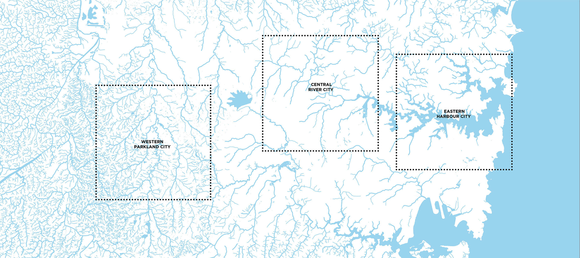
Western Parkland City
Urban Strategy
‘This work, this process… is indeed a breath of clean air…’ Jury Report
Winner of the 2022 AILA National Award of Excellence for Landscape Planning
‘Sidestepping yet another planning report’
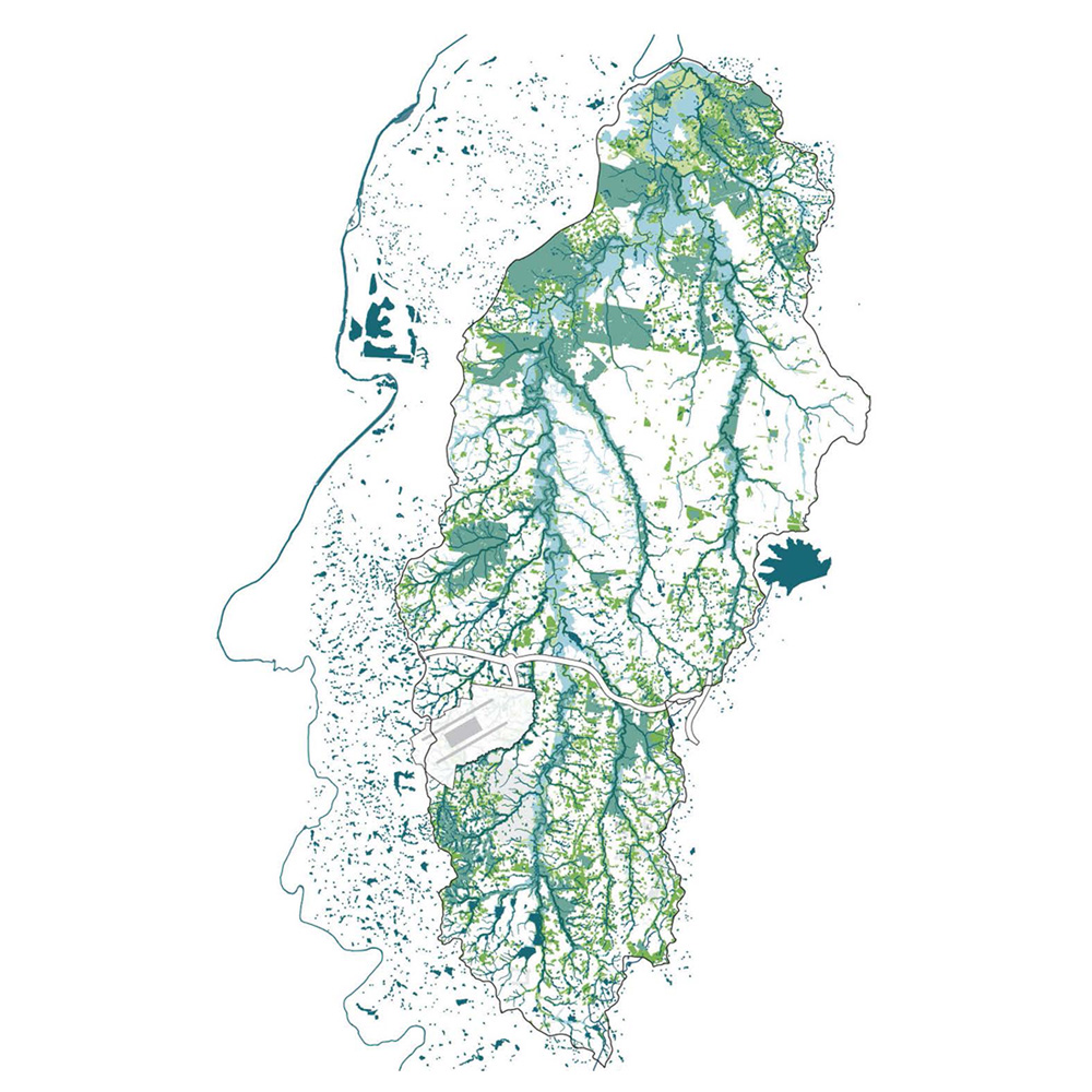
This project harnessed the potential of blue green infrastructure to lay out Sydney’s newest city, the Western Sydney Aerotropolis. In the six months before statutory instruments were created, our aspirational city plan made its way to the very top of government – a Parkland City laid out around a connected system of blue and green infrastructure, designed with respect for Country. Although never made public, the plan was translated into guidelines that influenced politicians and inspired precinct planners to promote a new type of urbanism – one led by landscape architecture, that respects rather than degrades the landscape and its natural systems.
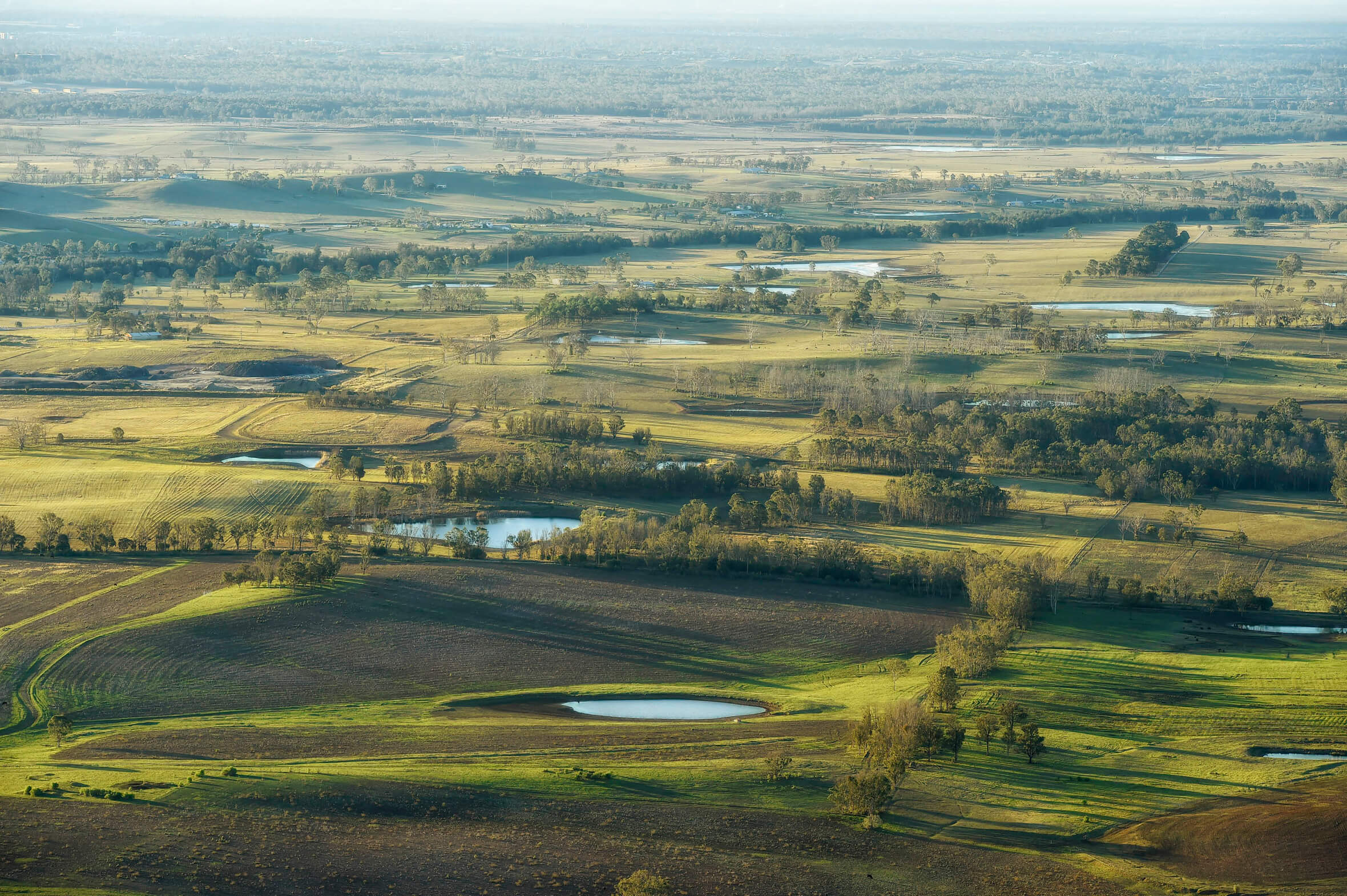
By 2056, more than 1.5 million people will live in the Western Parkland City, equivalent to the current population of Adelaide. A significant proportion of the city lies within the fragile landscape of the Wianamatta / South Creek Catchment.
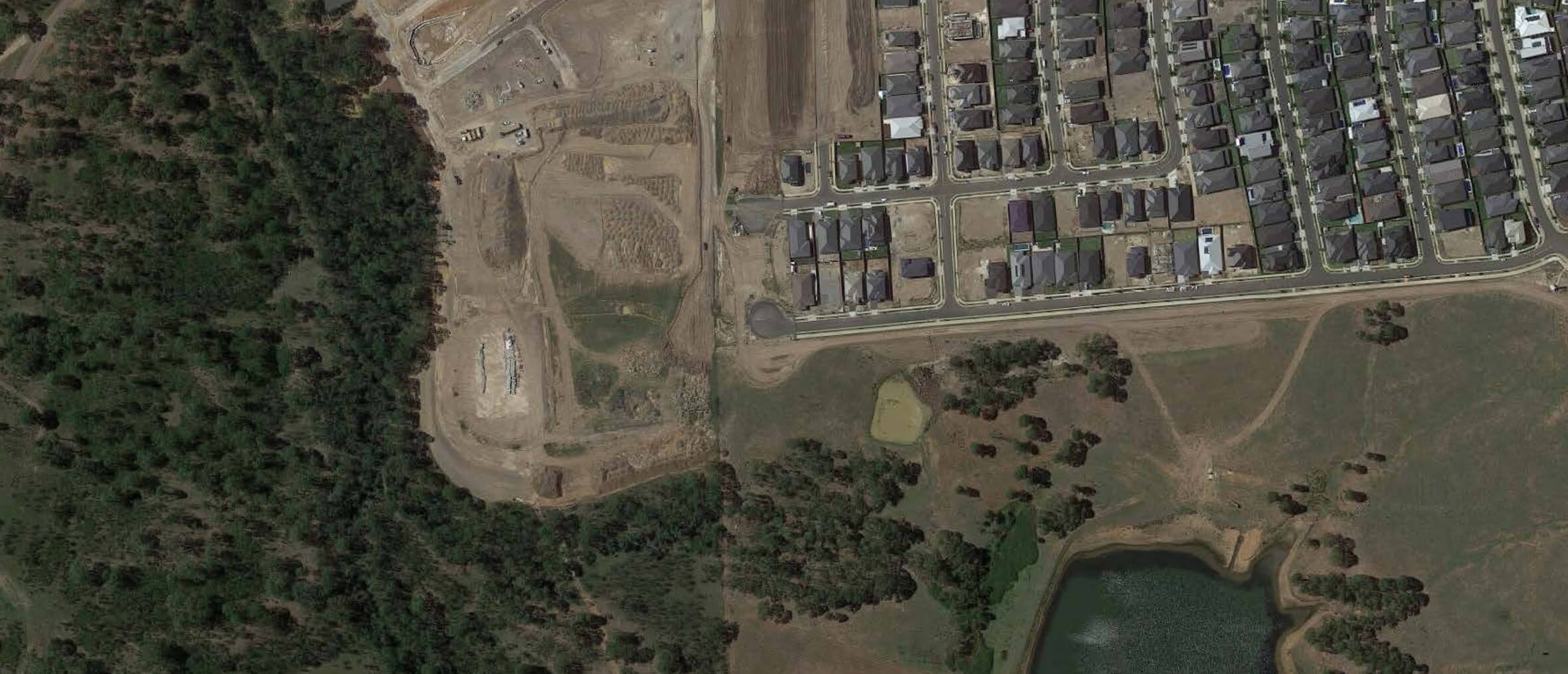
Our client was ready to challenge the business-as-usual planning approach to development (pictured). So instead of wholesale land clearing, we investigated how bushland, topography and waterways could become integral assets in a type of city plan not seen since Griffin & Mahony’s plan for Canberra.
We mapped the sandstone topography of Sydney Harbour, alluvial sands of the Parramatta River and semipermanent creeks on Wianamatta clay. We linked the unique identity of the western Sydney landscape to the future liveability of the Parkland city and argued for its long term environmental, social and economic value.
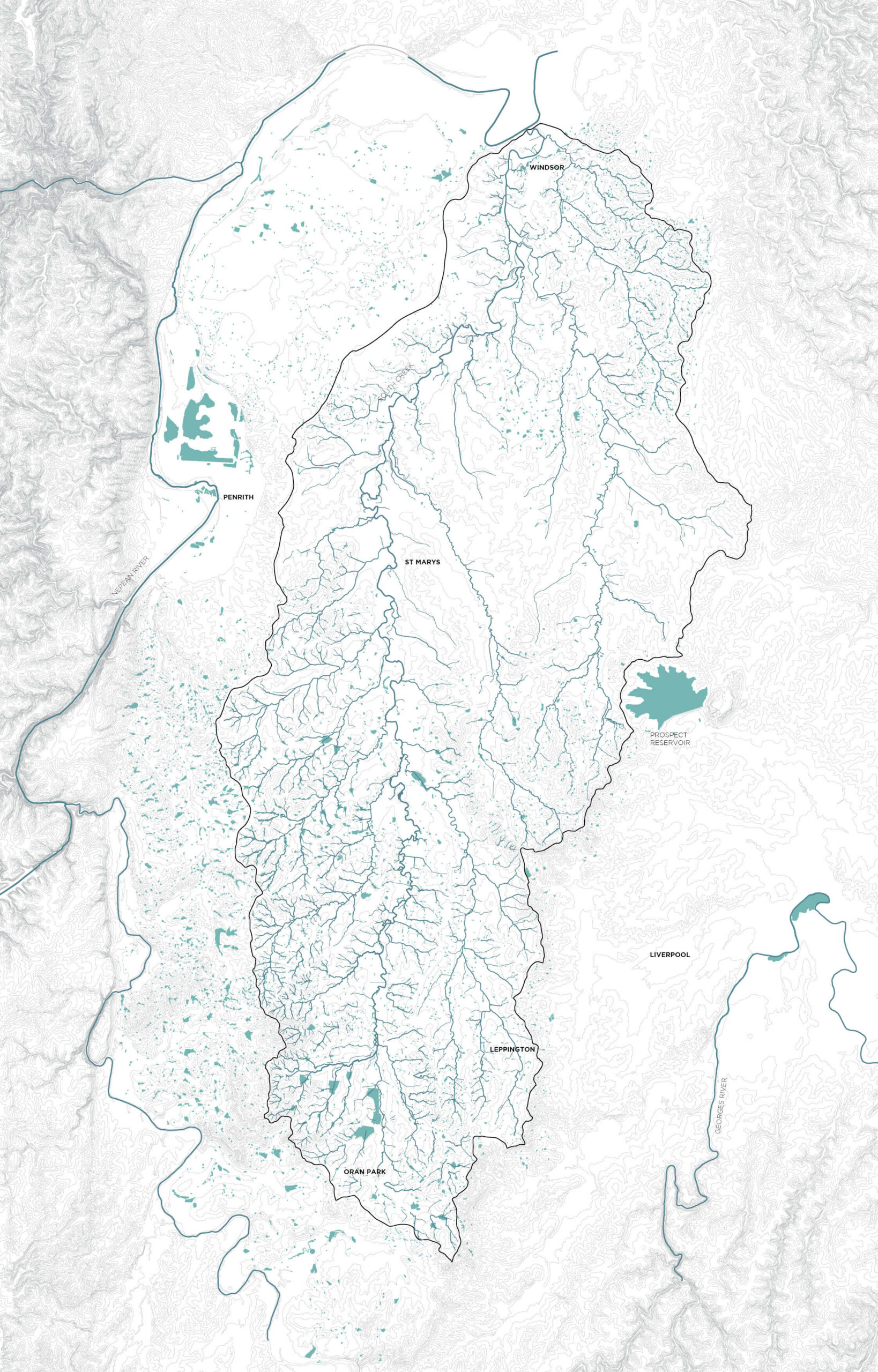
Wianamatta is the original name for South Creek from the Dharug language meaning ‘Mother Place’. Shaping the Parkland City around the Wianamatta system provides an opportunity to connect the city to living Indigenous culture.
Changing the conversation
When we began the project, we were asked: what are we going to do about South Creek? At that stage, South Creek was graphically represented in plans as a featureless, flood-prone spine, and in 3D visualisations as a wide, glassy waterway curving dramatically through the future city. One representation was reductive, and the other misleading. Our work filled an important gap in the planning process to communicate the actual character of the landscape. We overlaid flood zones with existing roads, vegetation, topography, views and certified urban footprint areas to understand their combined potential. Our work enabled government stakeholders to move past habitual stalemates and discuss actual possibilities: how large parks can create a city’s identity, the importance of cooling breezes on ridgelines and how future residents might interact with the water systems that sustain their daily lives.
Our landscape led design and guidelines for the Parkland City proposed blue-green systems as the bones of the future city – its frame.
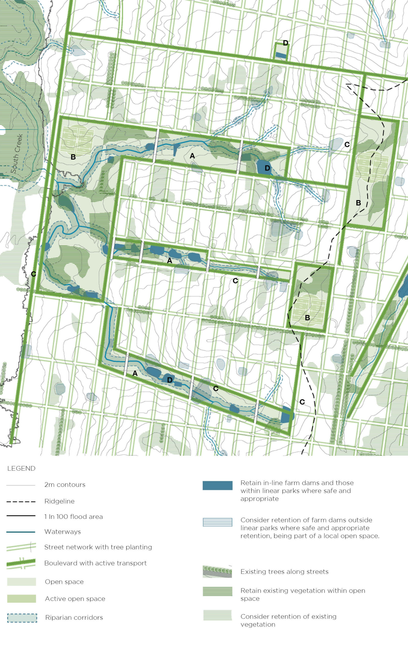
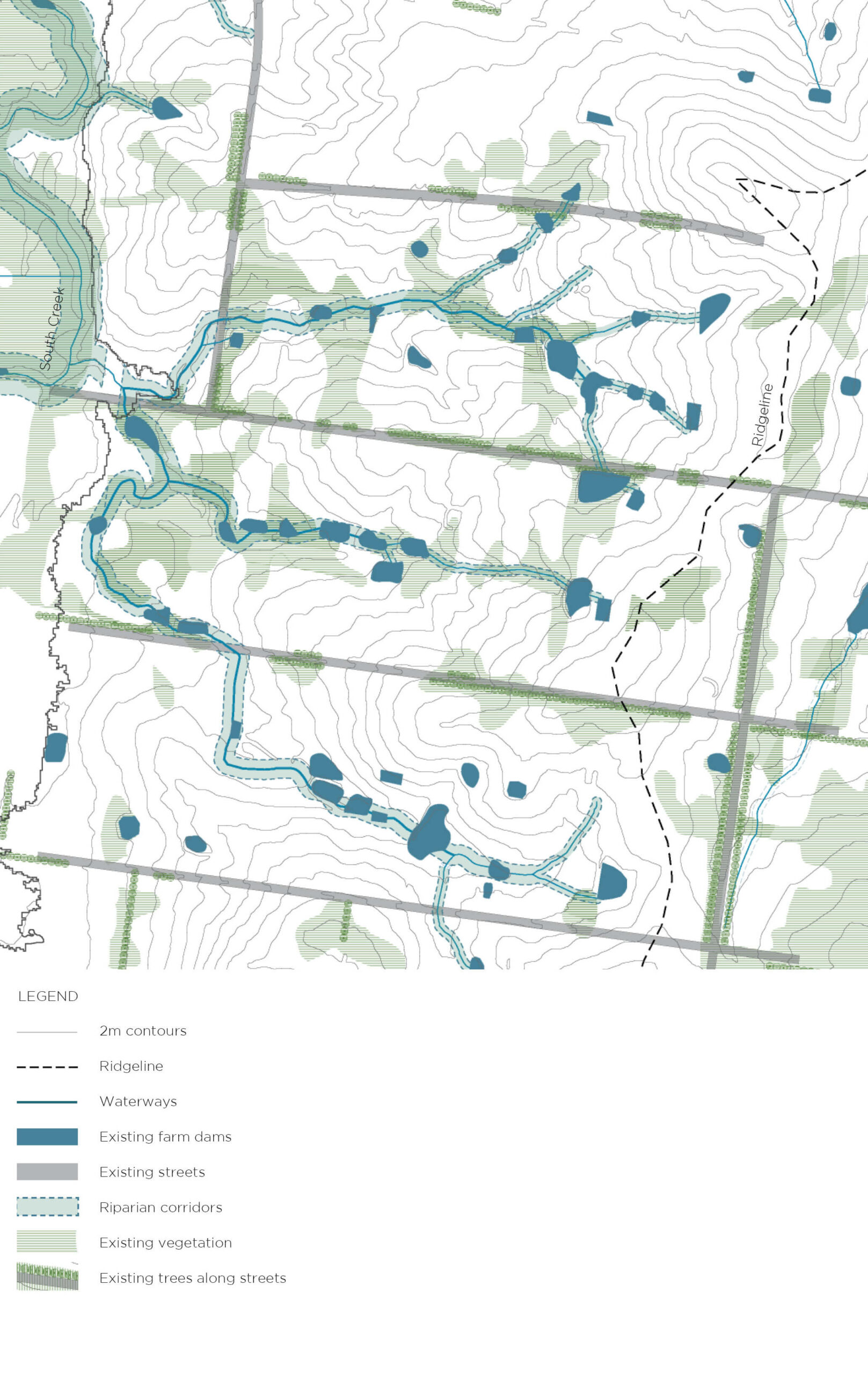
The water systems, or blue grid, of the South Creek catchment (including tributaries and farm dams) underpinned urban form and shaped open space networks of the new city – its public, urban, blue-green grids.
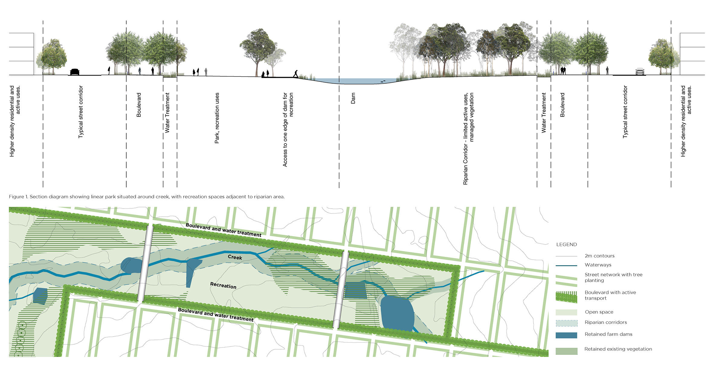
Linear parks connect ridges and floodplains with local open space located around creek lines, farm dams and riparian corridors.
A city that respects Country
Our plan comprised one of the first data-driven visualisations of the Parkland City that showed state government clients a path forward. We used GIS desktop mapping, site visits and compelling graphics to capture an elusive vision on paper, so people could start to grasp the scale and implications of what ‘Parkland City’ could really mean. The plan drew on a body of work developed during our Sydney Green Grid project, collaborations with Western Sydney Parklands Trust and urban design character studies of South Creek for DPIE. Our expertise in blue green infrastructure and deep knowledge of Sydney’s historical development gave our client the confidence to challenge standard approaches to city planning and embed blue green infrastructure in the precinct plans.
Read the Landscape Australia article here.
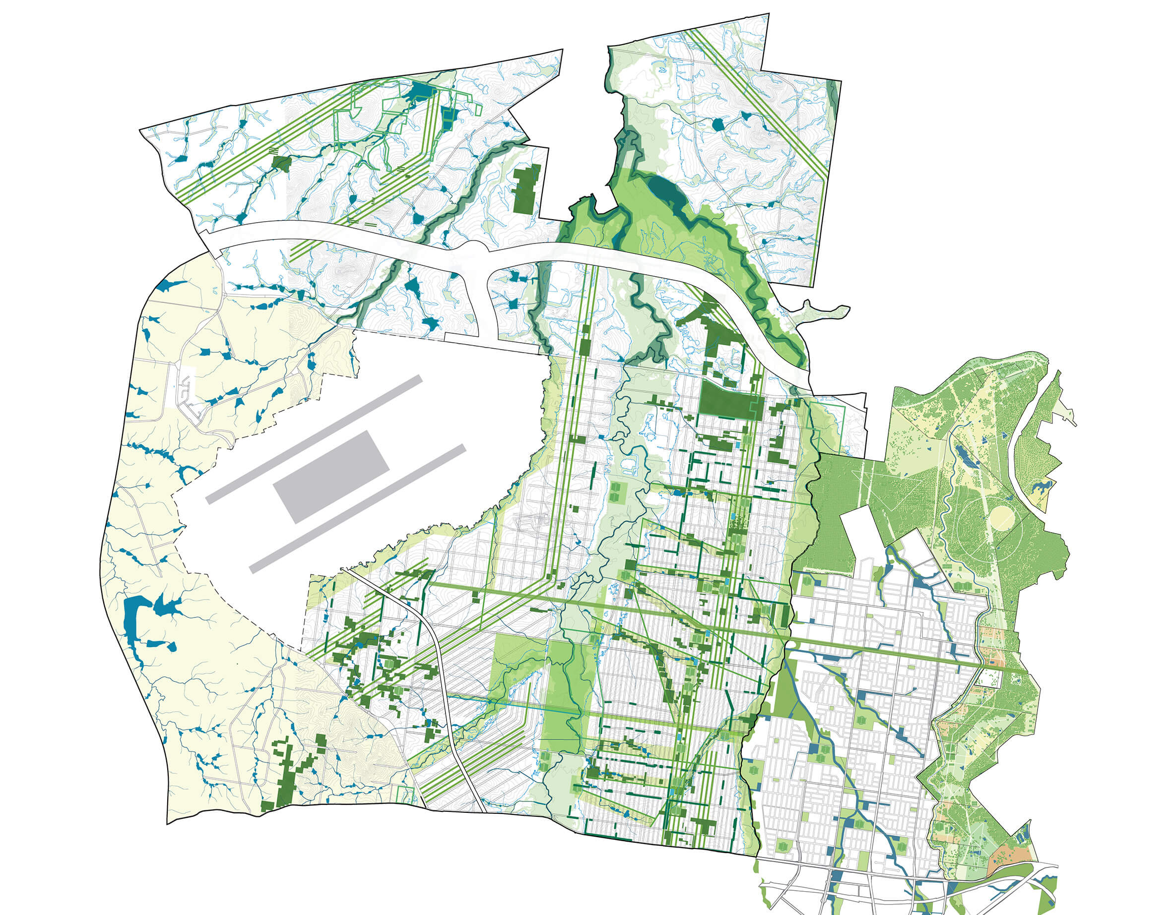
Our aspirational Parkland City vision showed a combination of regional parks, linear parks and local parks to give the city a unique, green identity. The plan shows the new airport and the M12 motorway in white and our Southern Parklands plan to the east which will in time become the most important parkland asset for the Parkland City (now named Bradfield)
Interested in learning more about Tyrrell Studio? Get in touch.