
Projects
Southern Parklands Framework
Design Framework
Rethinking the role of green open space in a changing urban context.
Winner of the 2019 AILA National Award of Excellence for Parks and Open Space
A new type of park
The Southern Parklands Framework is a creative and aspirational design strategy for Sydney’s largest urban park. It aims to increase visitation to the Western Sydney Parklands, protect its unique landscape and ignite dialogue between new communities and an ancient Country. The framework prioritises living practices of Indigenous culture through a rich arts and culture strategy tied to key mega-scaled, highly sculptural landscape gestures.
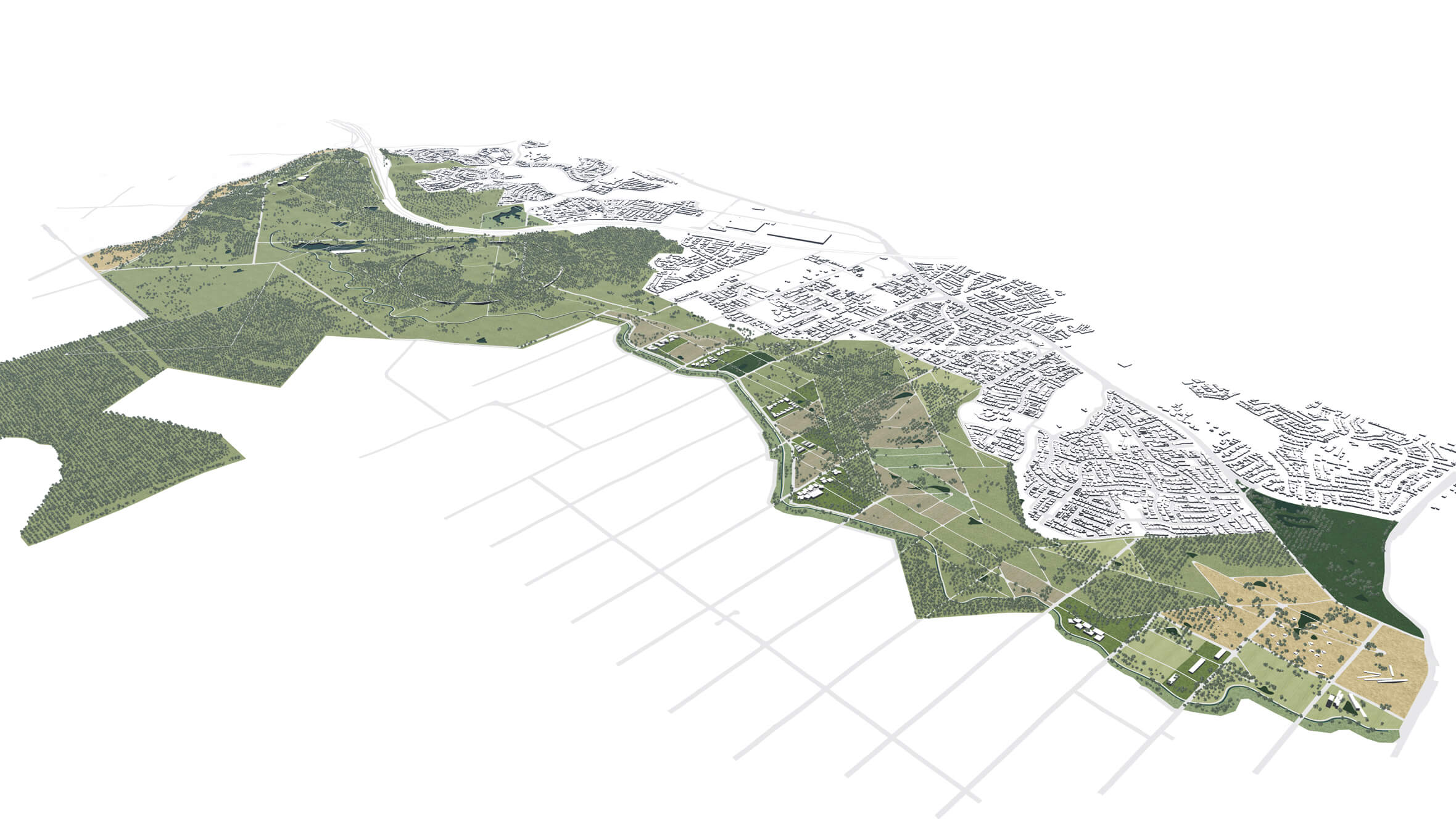
The Landscape Framework Plan provides a long term physical plan for the 1500-hectare Southern Parklands.
Southern Parklands Framework flythrough
The evolving role of parks as infrastructure
The Southern Parklands Framework repositions a former greenbelt barrier as an inclusive open space for the new Western Parkland City. This shift required collaboration, negotiation and communication of a compelling strategy. Our ideas and expertise in blue green infrastructure encouraged government partners to consider the recreation and tourism potential of their assets.
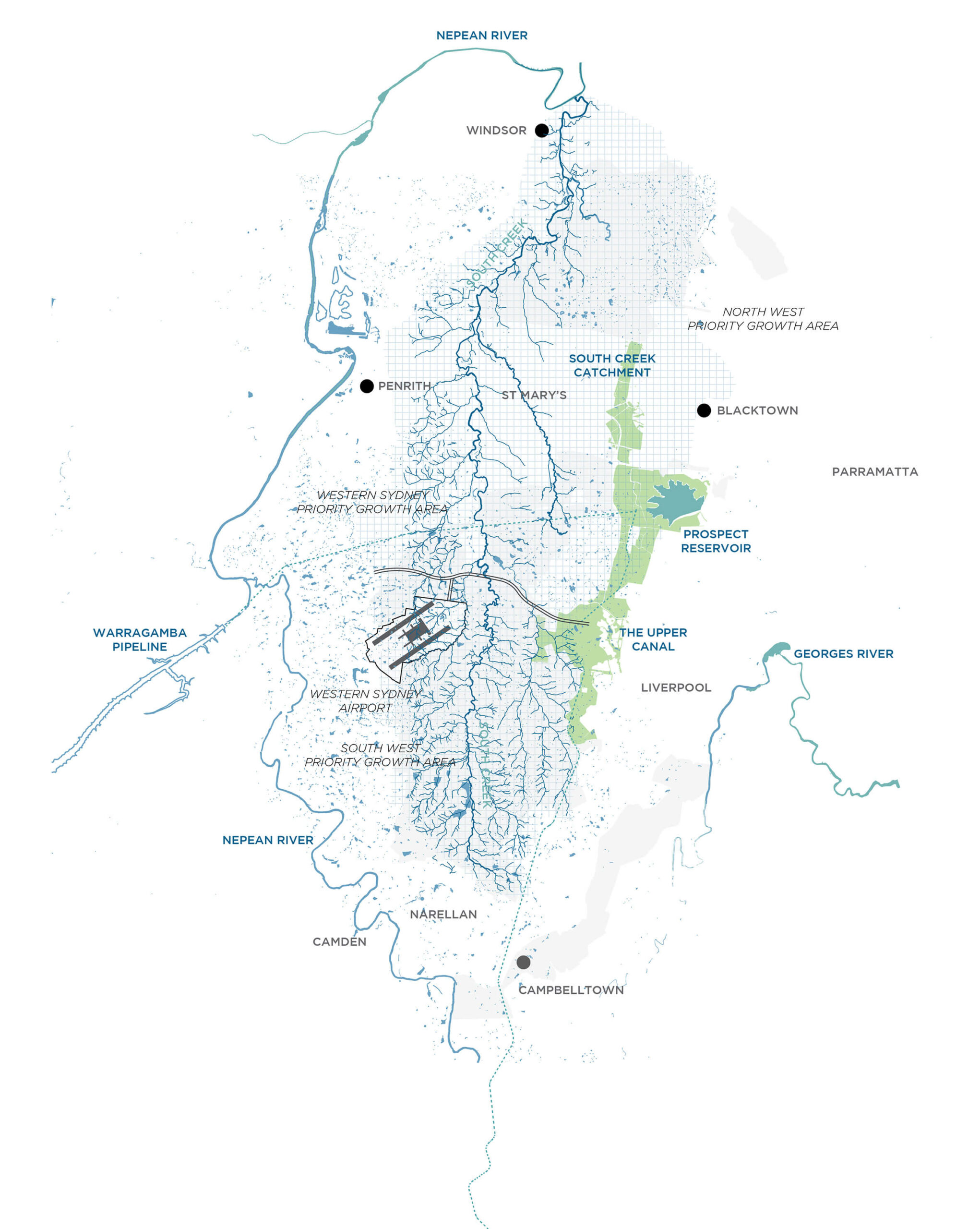
As Greater Sydney continues to expand west, the former greenbelt will transition into a landscape that supports growth through open space provision, while maintaining its critical role as an infrastructure corridor. The Southern Parklands will become one of the key recreational and community resources for western Sydney.
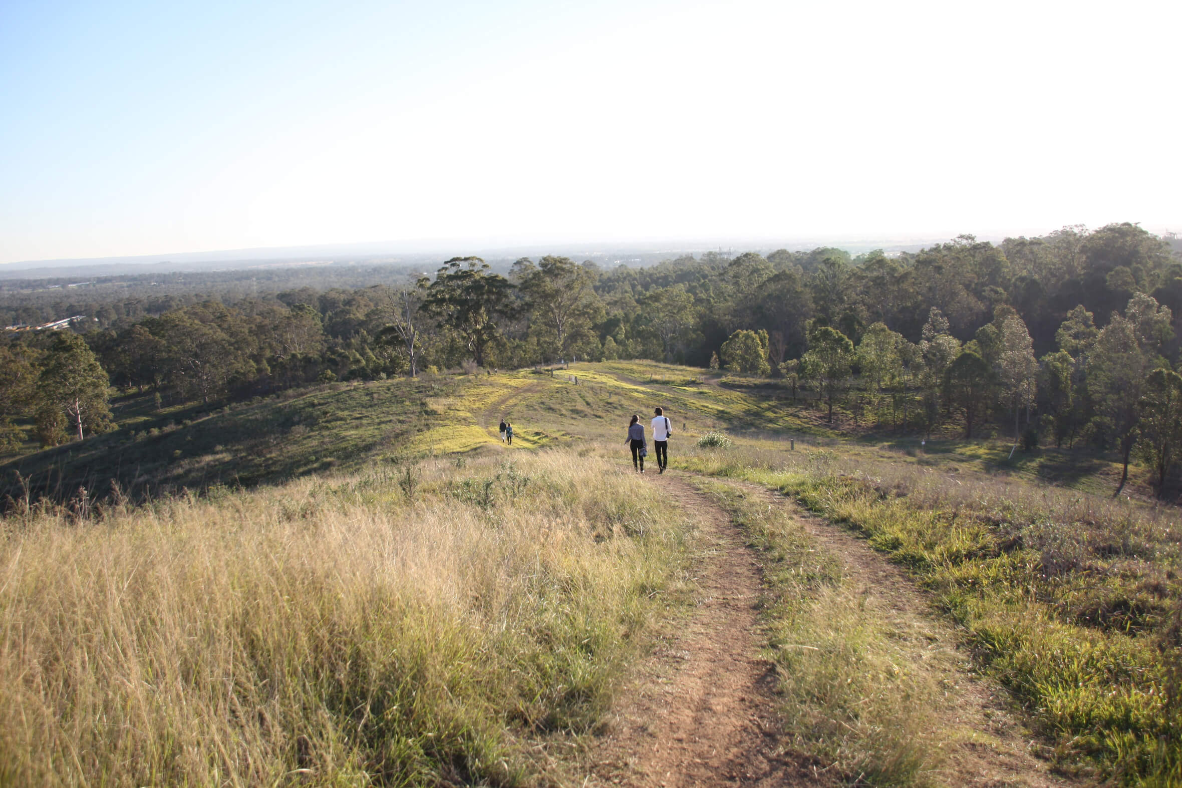
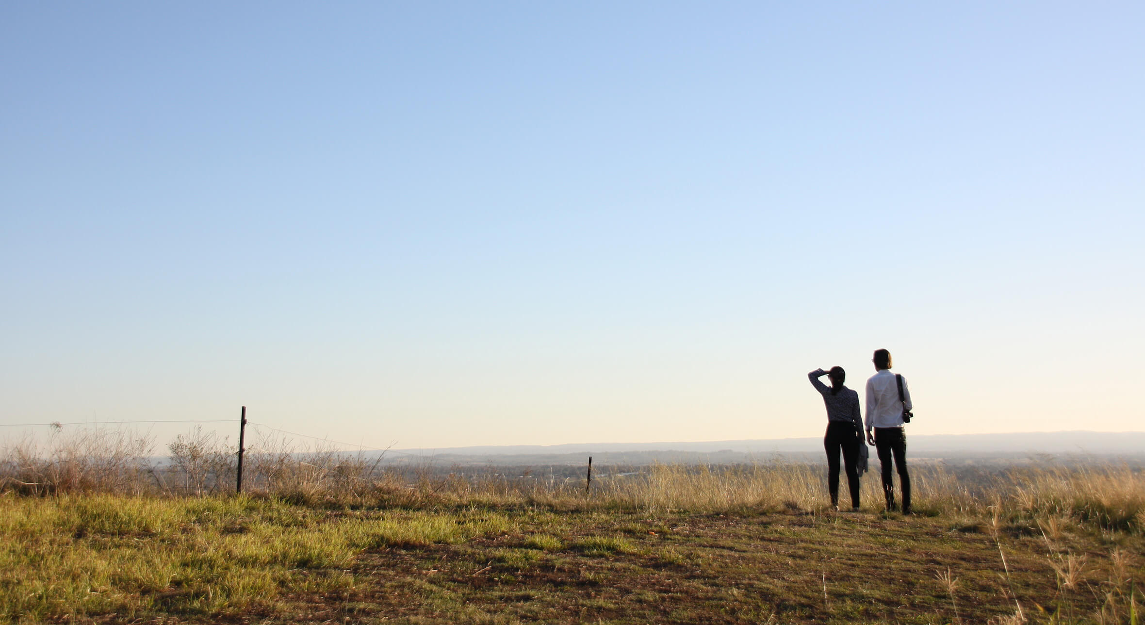
A ridge track descends from exposed hilltops into the tree line. From here the stunning western views all the way to the Blue Mountains can be appreciated.
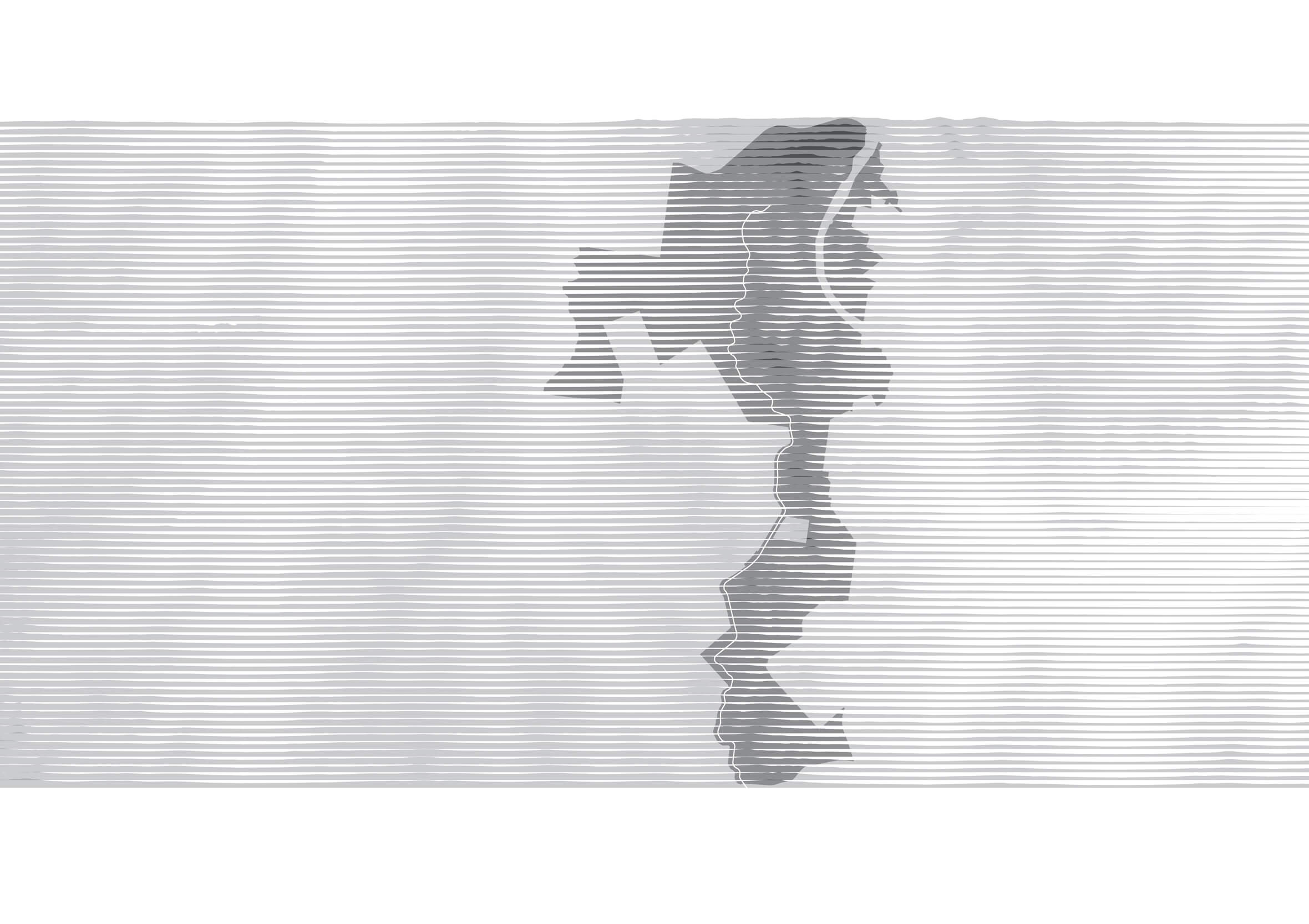
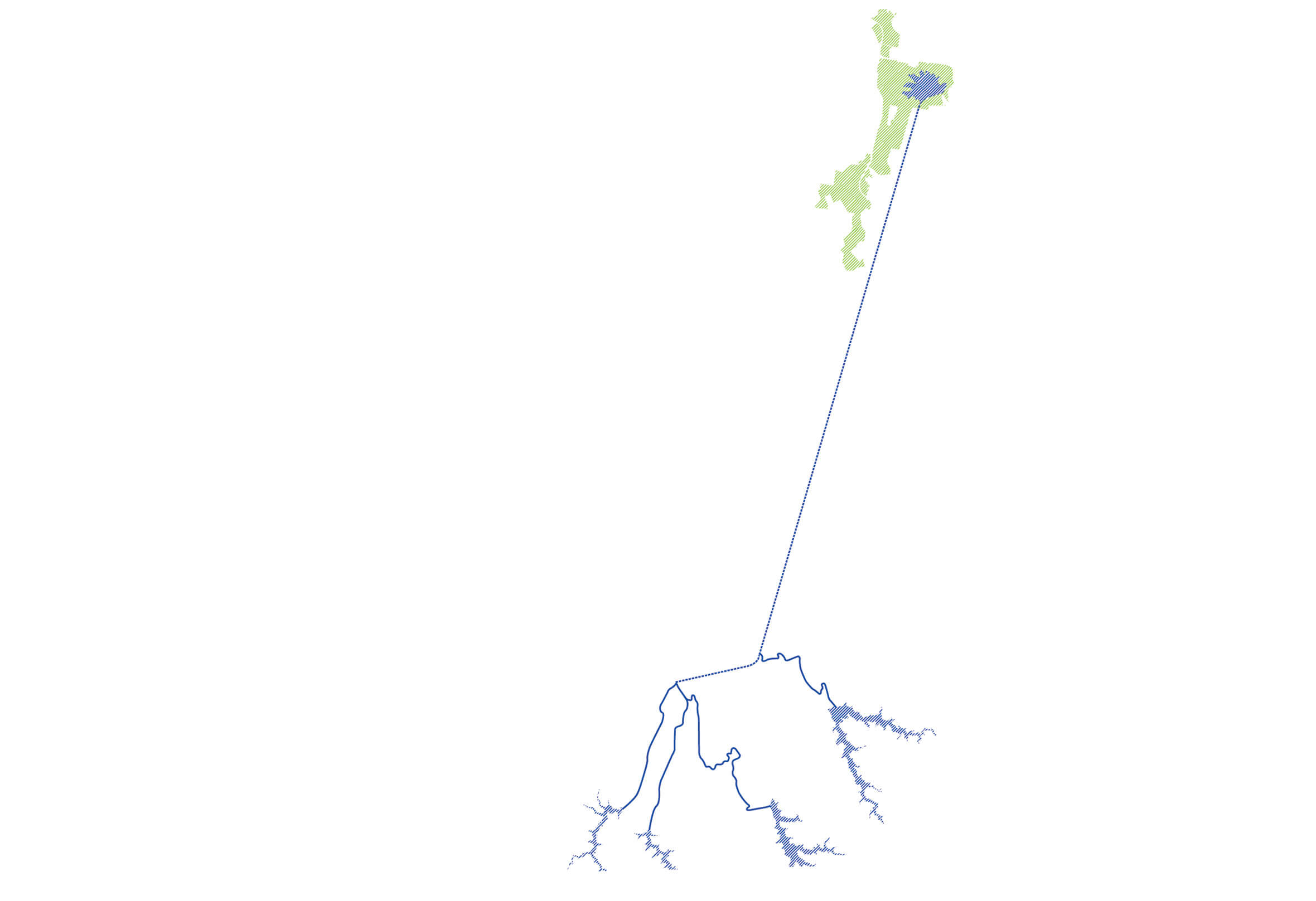
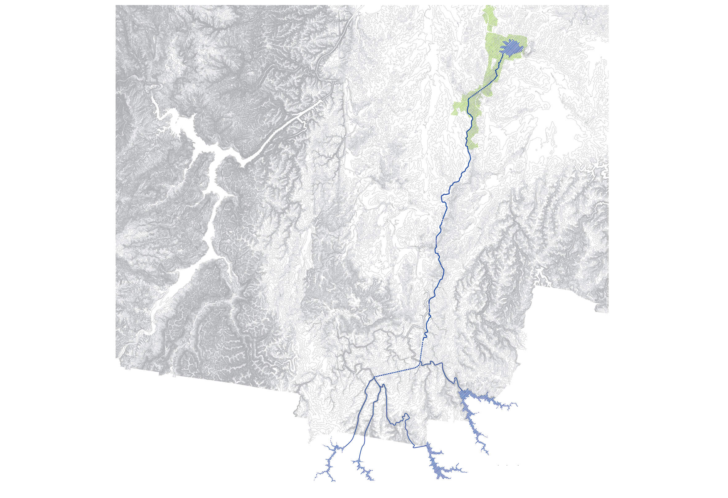
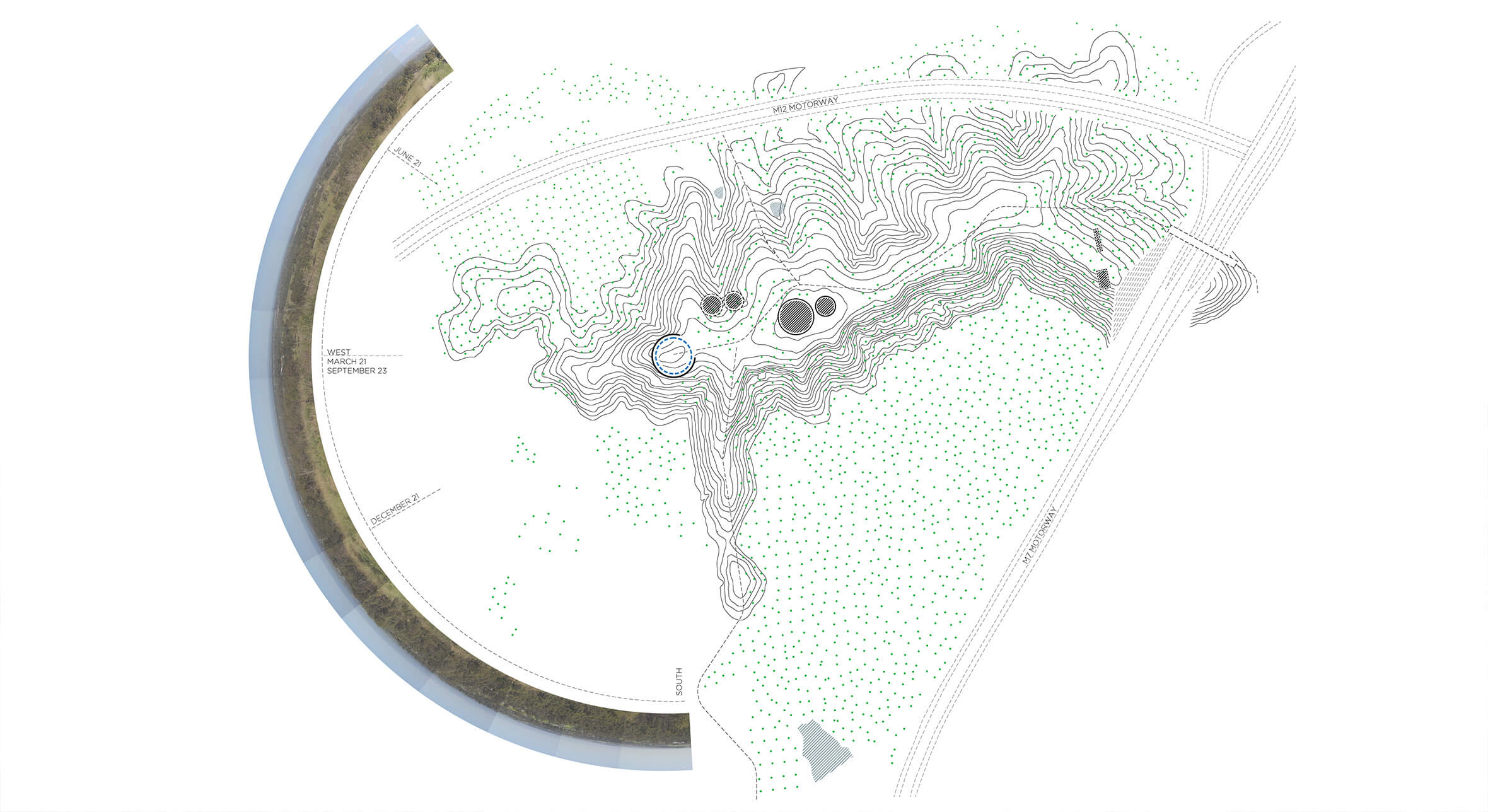
The north south ridge is the defining feature of the Southern Parklands. It has likely been in use for many tens of thousands of years by local peoples as it offers significant prospect over the surrounding landscape.
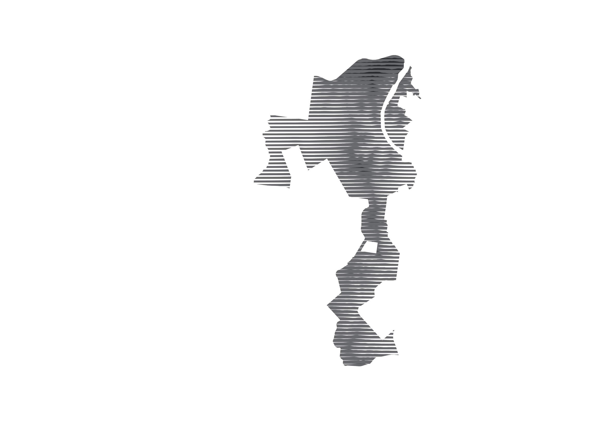
The north south ridge is the defining feature of the Southern Parklands. It has likely been in use for many tens of thousands of years by local peoples as it offers significant prospect over the surrounding landscape.
The north south ridge is the defining feature of the Southern Parklands. It has likely been in use for many tens of thousands of years by local peoples as it offers significant prospect over the surrounding landscape.
The north south ridge is the defining feature of the Southern Parklands. It has likely been in use for many tens of thousands of years by local peoples as it offers significant prospect over the surrounding landscape.
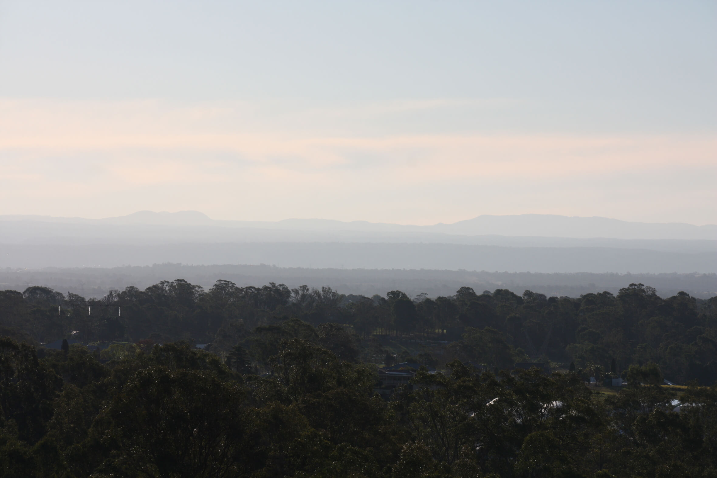
The ridge peaks in the north of the site at The Beauty Spot with sublime views to the Blue Mountains.
A broad view of the site shows the farm dams characteristic of western Sydney. Dams cycle between lush wetland or cracked claypan depending on the year’s rainfall.
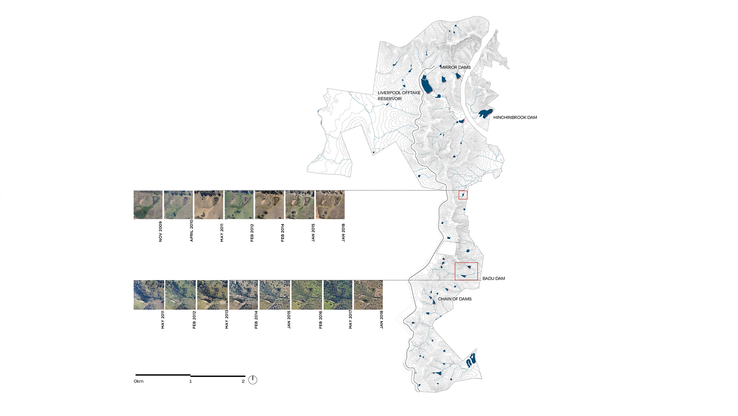
A broad view of the site shows the farm dams characteristic of western Sydney. Dams cycle between lush wetland or cracked claypan depending on the year’s rainfall.
Program and reveal the landscape
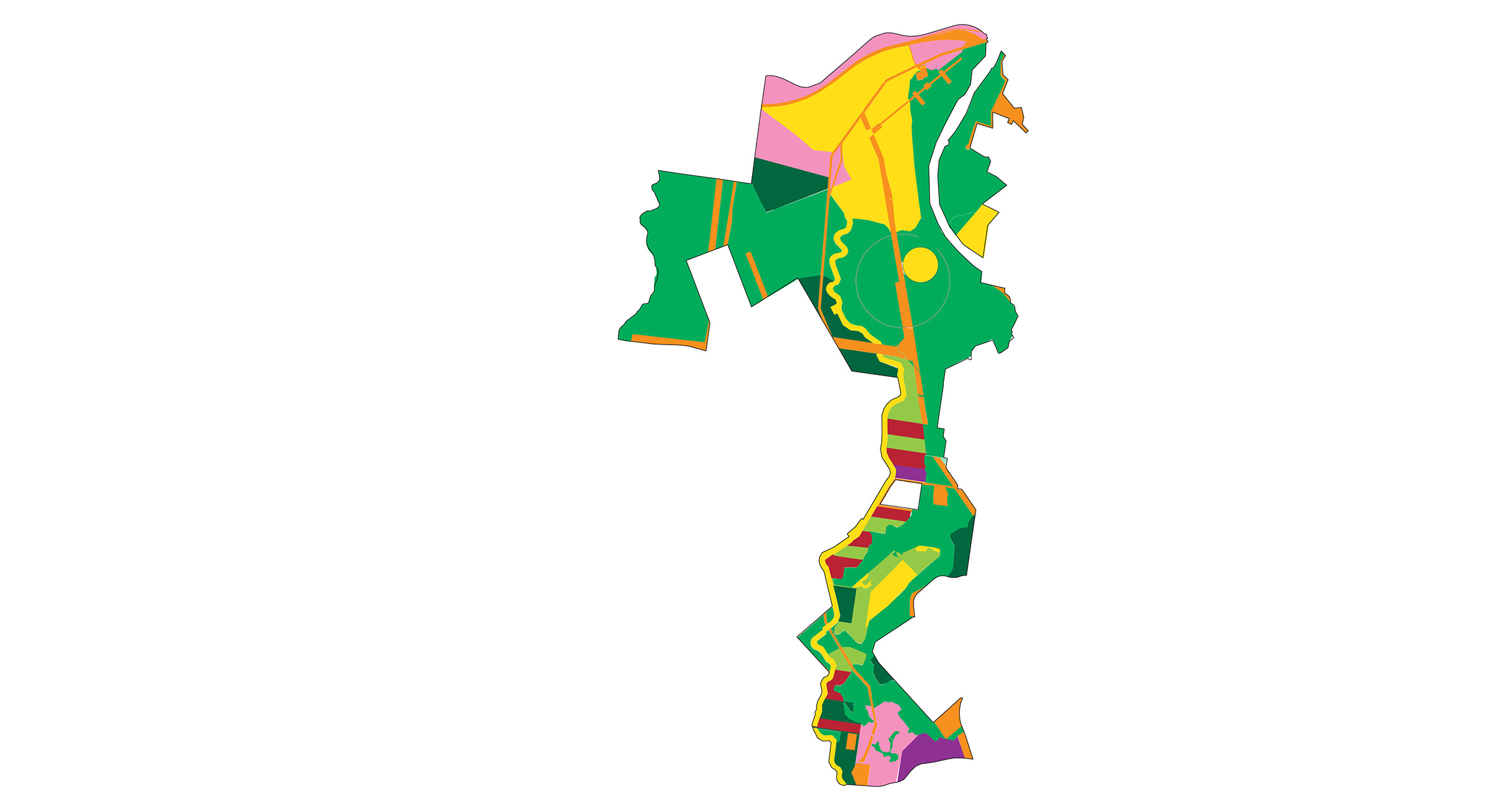
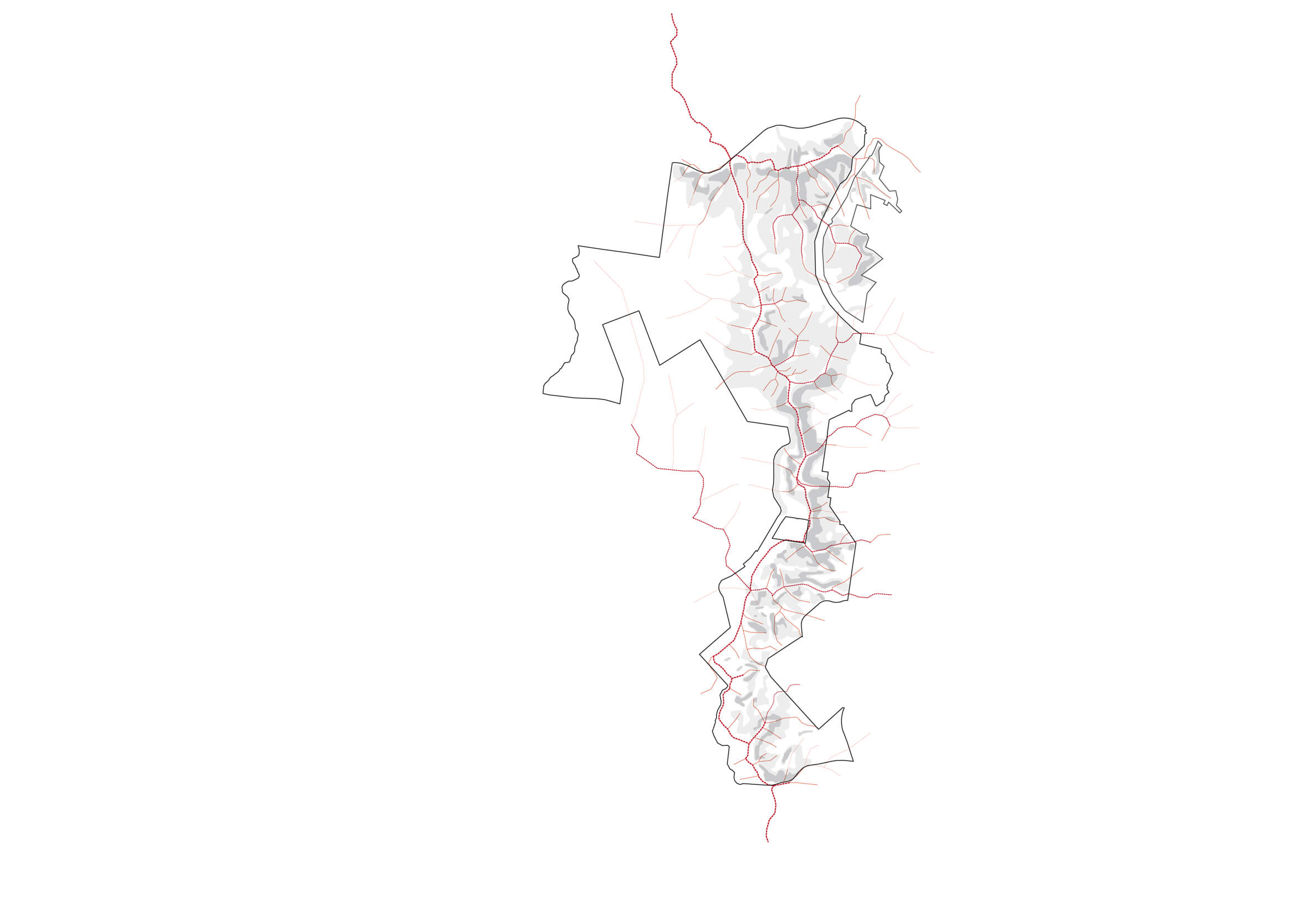
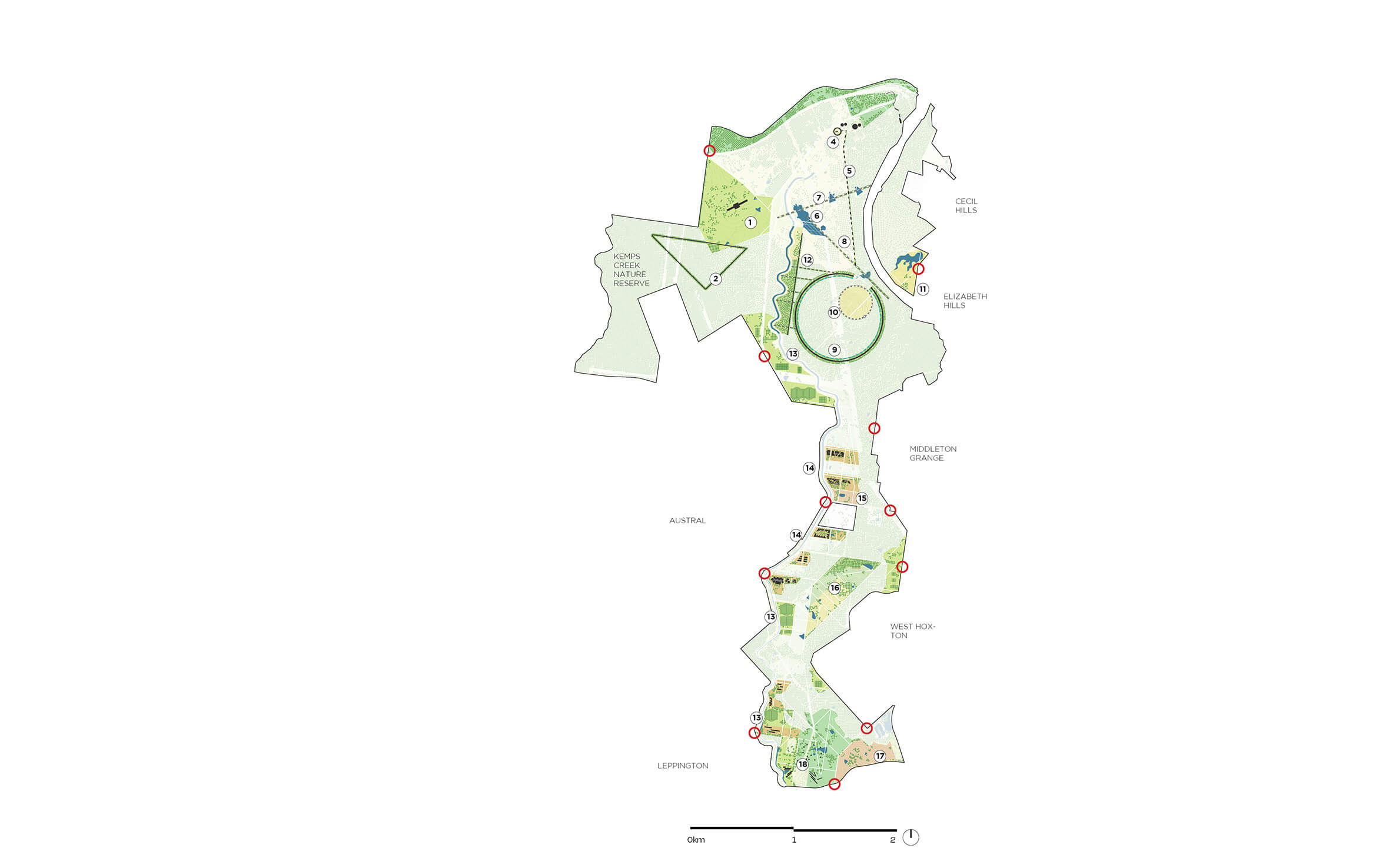
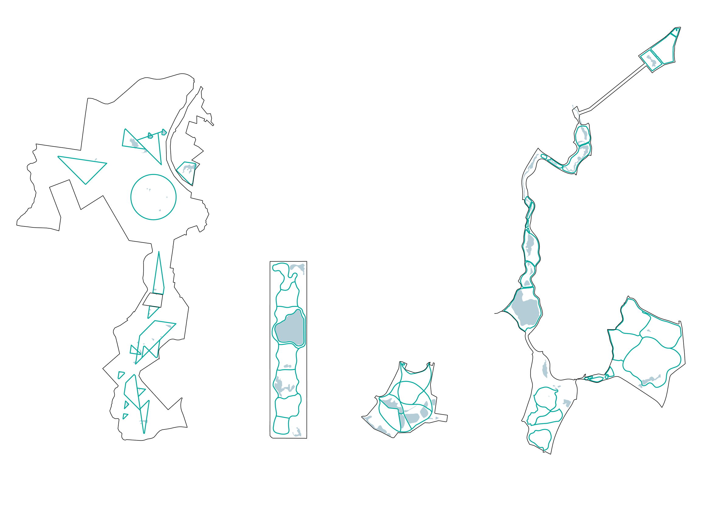
Our framework seeks to fit the quantum of land use designated by the Plan of Management to the land itself. This diagram shows infrastructure easements, natural and cultural heritage conservation, active and passive recreation, urban farming and rural uses, community facilities, tourism and business hubs. We arranged them all carefully around the specific qualities of the site.
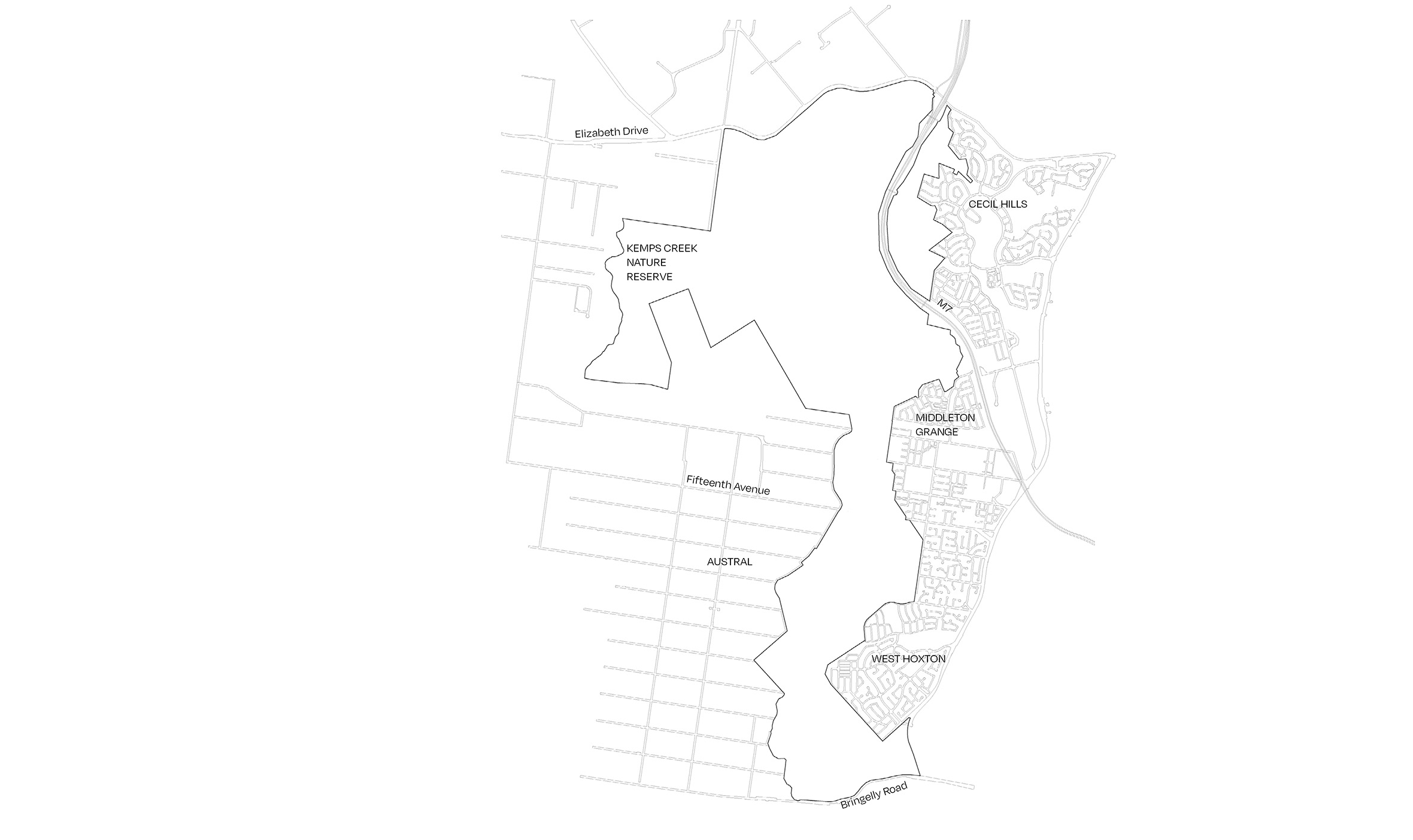
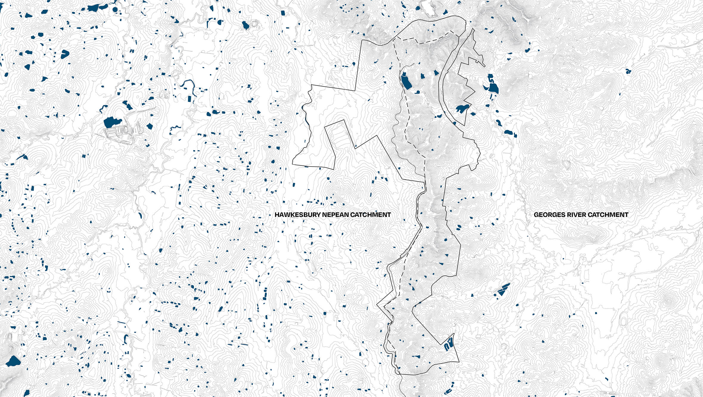
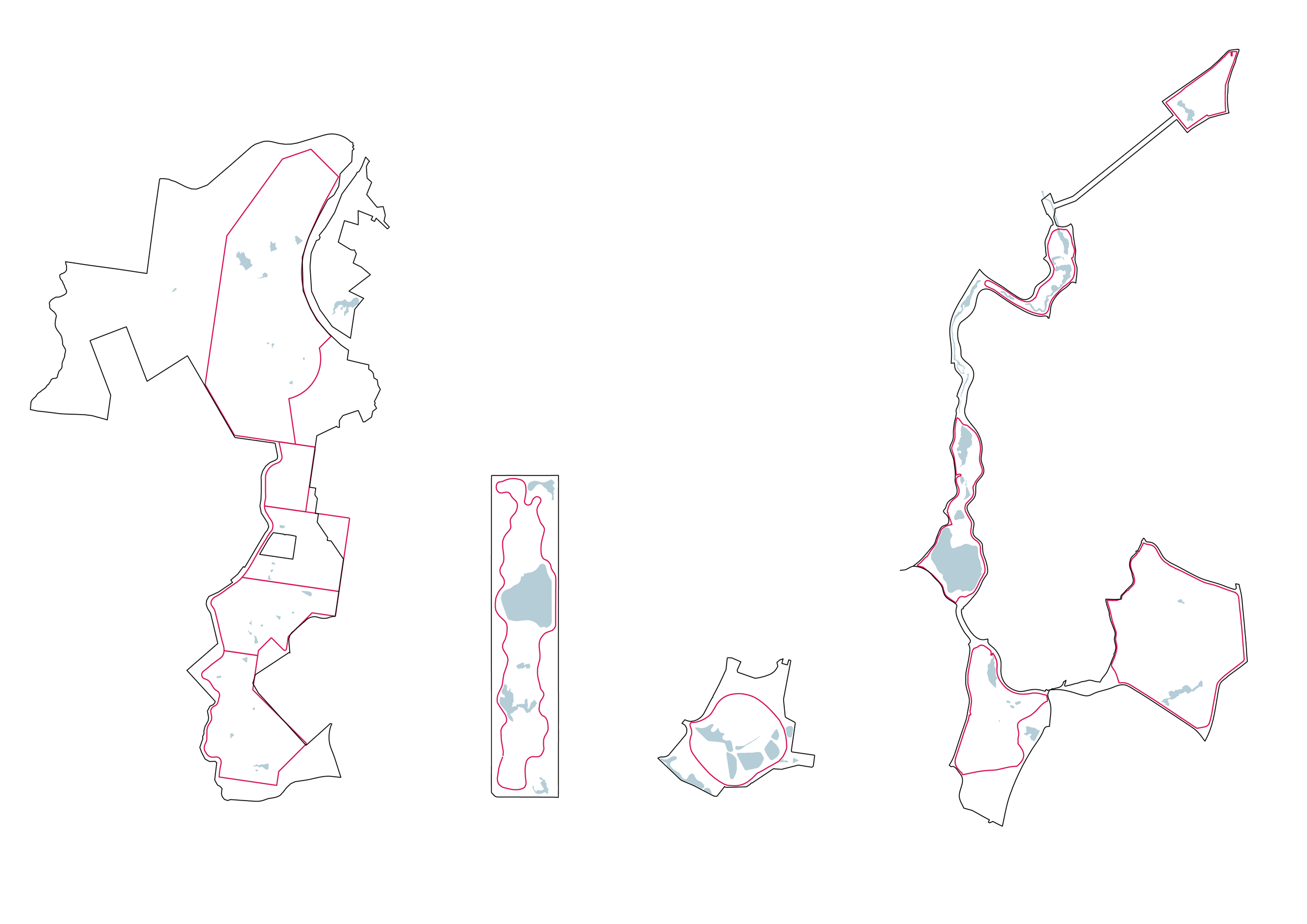
The Southern Parklands has limited access due to barriers created by motorways, nature reserves and the Upper Canal, plus residential back fences and dead end streets in surrounding suburbs.
The Southern Parklands has limited access due to barriers created by motorways, nature reserves and the Upper Canal, plus residential back fences and dead end streets in surrounding suburbs.
The north of the site offers potential for a regional destination of special character including outdoor adventure activities not usually found in a typical urban parkland. The south offers better connections to surrounding suburbs, making it suitable as a hybrid local/regional park with community facilities.
The north of the site offers potential for a regional destination of special character including outdoor adventure activities not usually found in a typical urban parkland. The south offers better connections to surrounding suburbs, making it suitable as a hybrid local/regional park with community facilities.
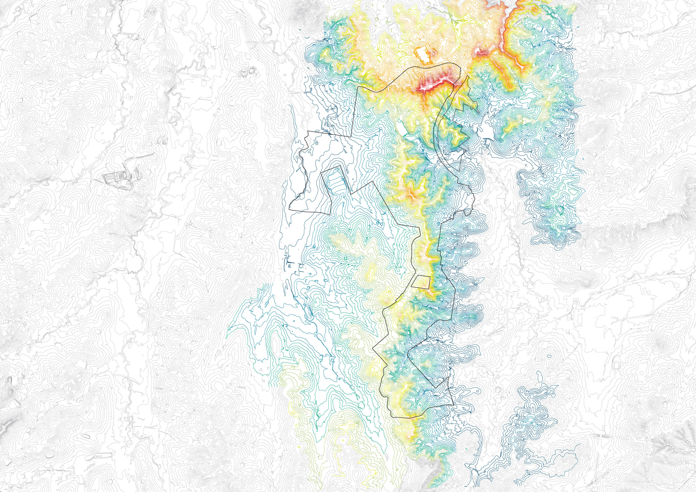
Understanding and framing the landscape
People and activity breathe life into a park. One challenge of a 1500-hectare park is that visitation and investment could be spread thinly across its vast scale, and the best parts of the landscape could be missed entirely in a day trip. For this reason, design interventions need to gather people along key armatures and points of the landscape. These armatures often form the path system of a park, however this landscape offers the opportunity to lift paths beyond the utilitarian and, in the spirit of the Upper Canal, to make the system of moving people a heightened experience of the best parts of the landscape.
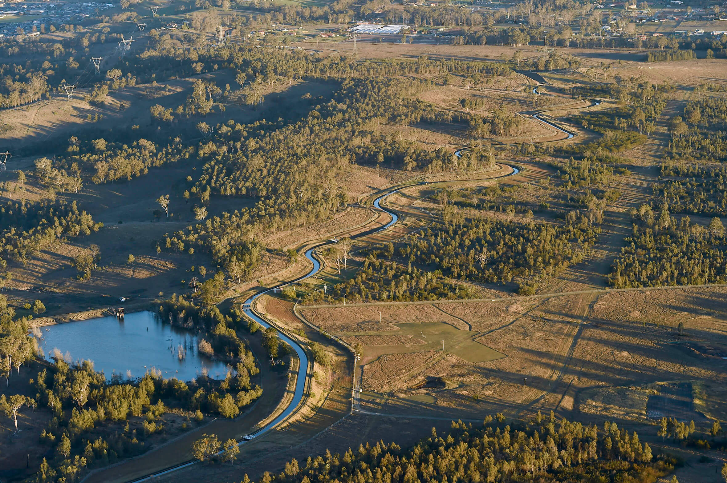
Aerial view of the Upper Canal as it passes the Liverpool Offtake Reservoir. Source: Greater Sydney Commission
A typical piece of infrastructure would supply in a direct line from source to use. Instead, the Upper Canal strikes a 0.1% keyline through the landscape, revealing the subtle contours and forming a unique feature in the parklands.
A typical piece of infrastructure would supply in a direct line from source to use. Instead, the Upper Canal strikes a 0.1% keyline through the landscape, revealing the subtle contours and forming a unique feature in the parklands.
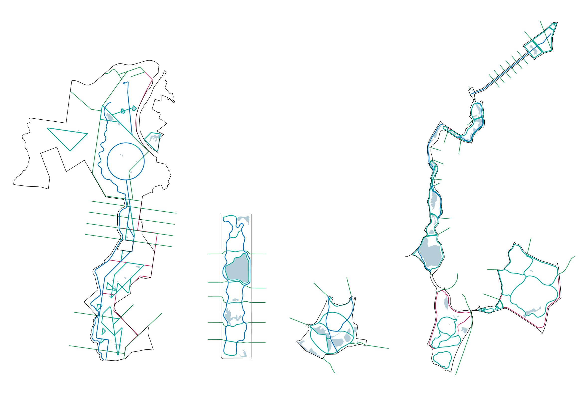
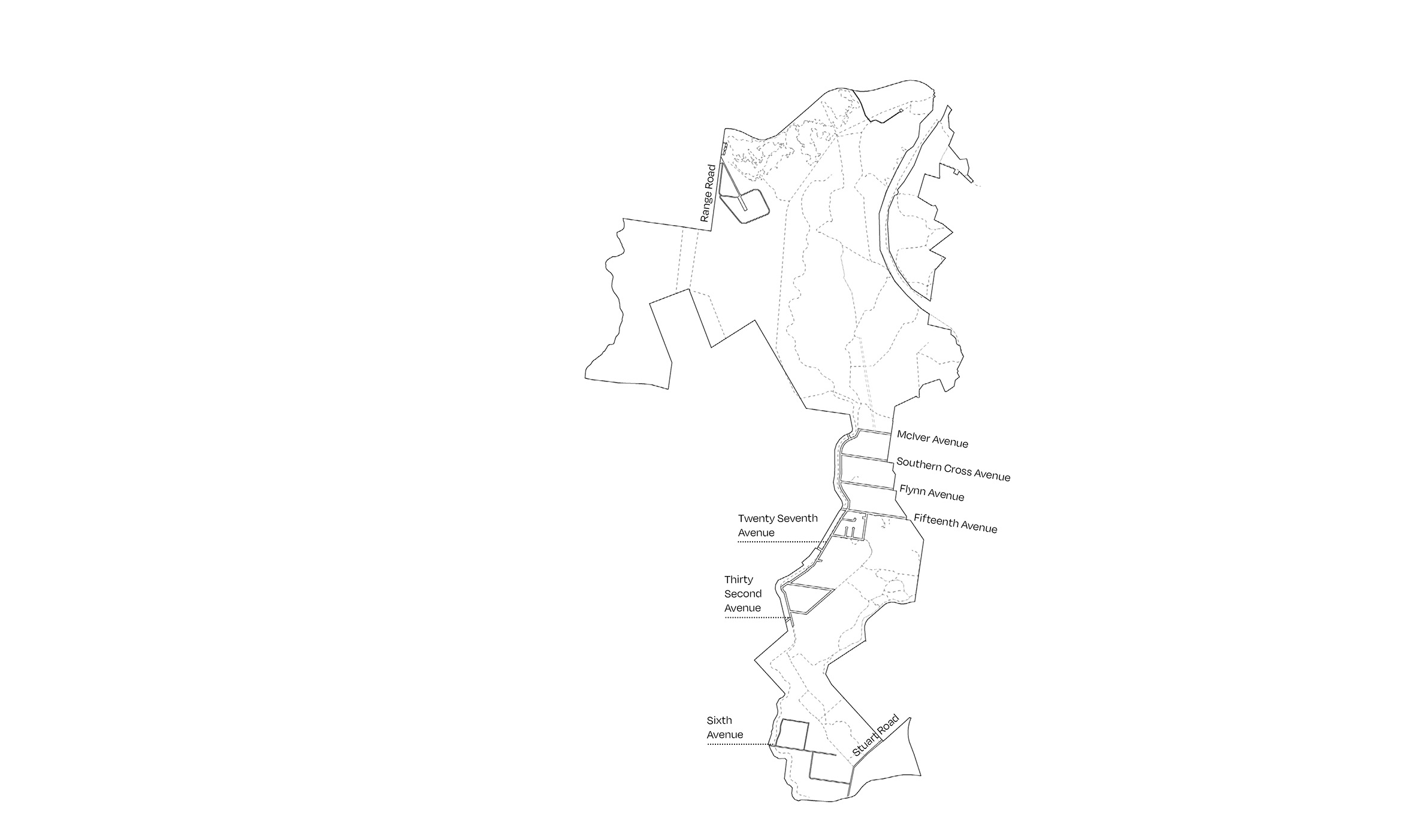
We benchmarked our circulation strategy against some of the world’s great parks, including Central Park (New York), Centennial Park (Sydney) and the Emerald Necklace (Boston). A suite of long spines, local loops, short walks and through links across the park captures a range of experiences from a 20-minute jog to a day-long hike.
We benchmarked our circulation strategy against some of the world’s great parks, including Central Park (New York), Centennial Park (Sydney) and the Emerald Necklace (Boston). A suite of long spines, local loops, short walks and through links across the park captures a range of experiences from a 20-minute jog to a day-long hike.
We benchmarked our circulation strategy against some of the world’s great parks, including Central Park (New York), Centennial Park (Sydney) and the Emerald Necklace (Boston). A suite of long spines, local loops, short walks and through links across the park captures a range of experiences from a 20-minute jog to a day-long hike.
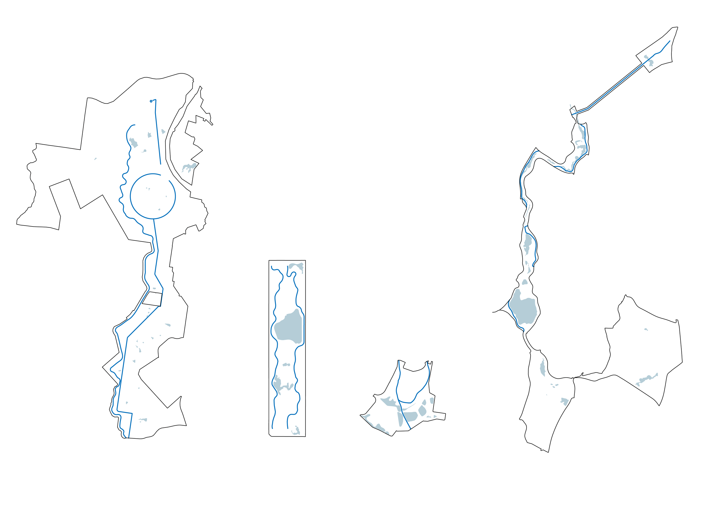
We benchmarked our circulation strategy against some of the world’s great parks, including Central Park (New York), Centennial Park (Sydney) and the Emerald Necklace (Boston). A suite of long spines, local loops, short walks and through links across the park captures a range of experiences from a 20-minute jog to a day-long hike.

We benchmarked our circulation strategy against some of the world’s great parks, including Central Park (New York), Centennial Park (Sydney) and the Emerald Necklace (Boston). A suite of long spines, local loops, short walks and through links across the park captures a range of experiences from a 20-minute jog to a day-long hike.
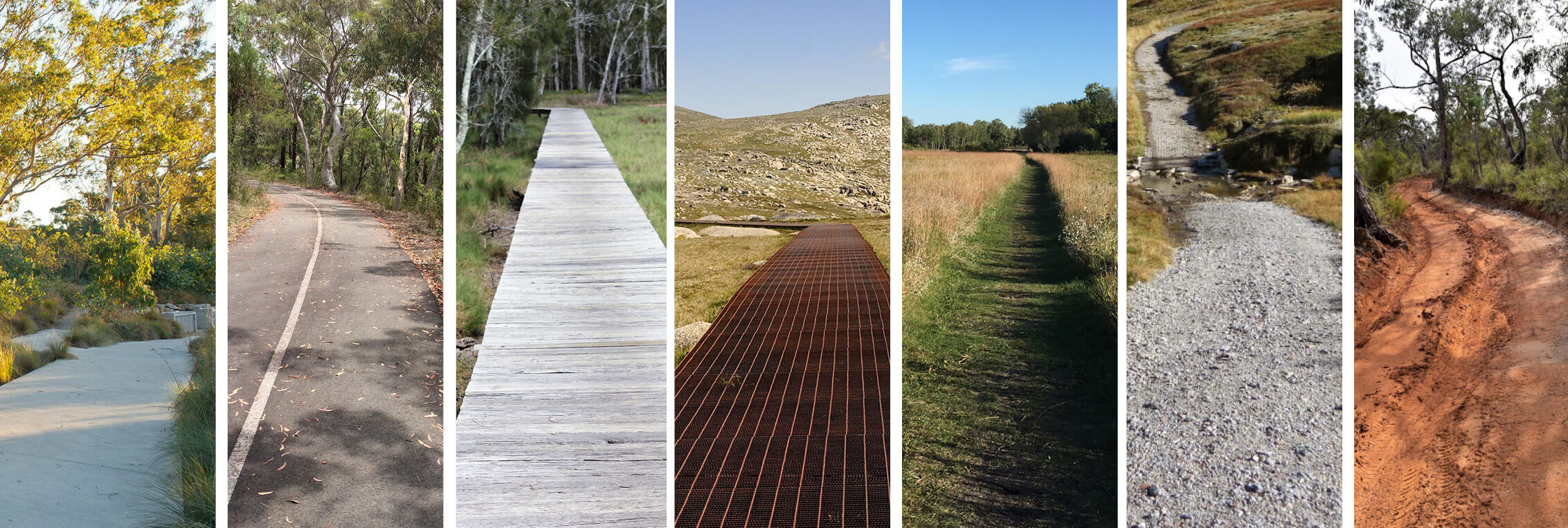
A clear hierarchy of path materials invites you into the park on your own terms.
New infrastructure
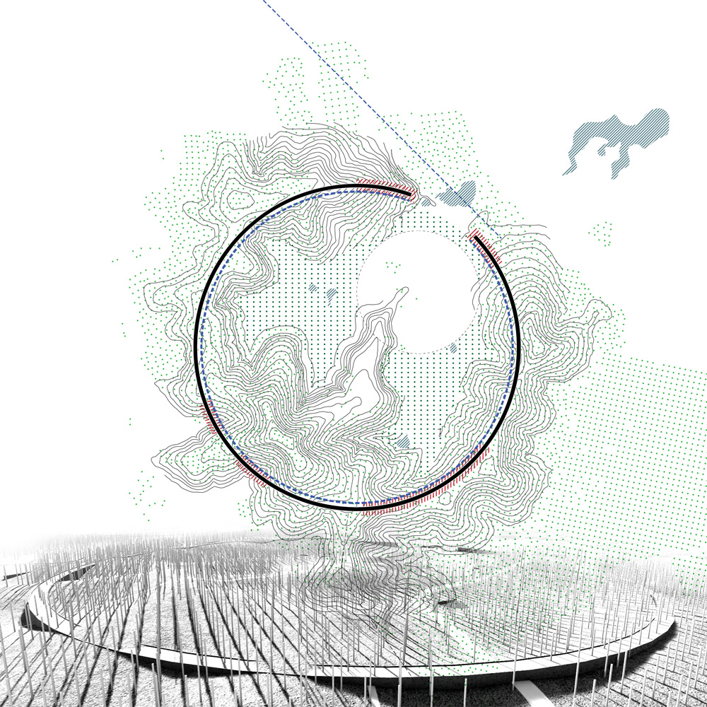
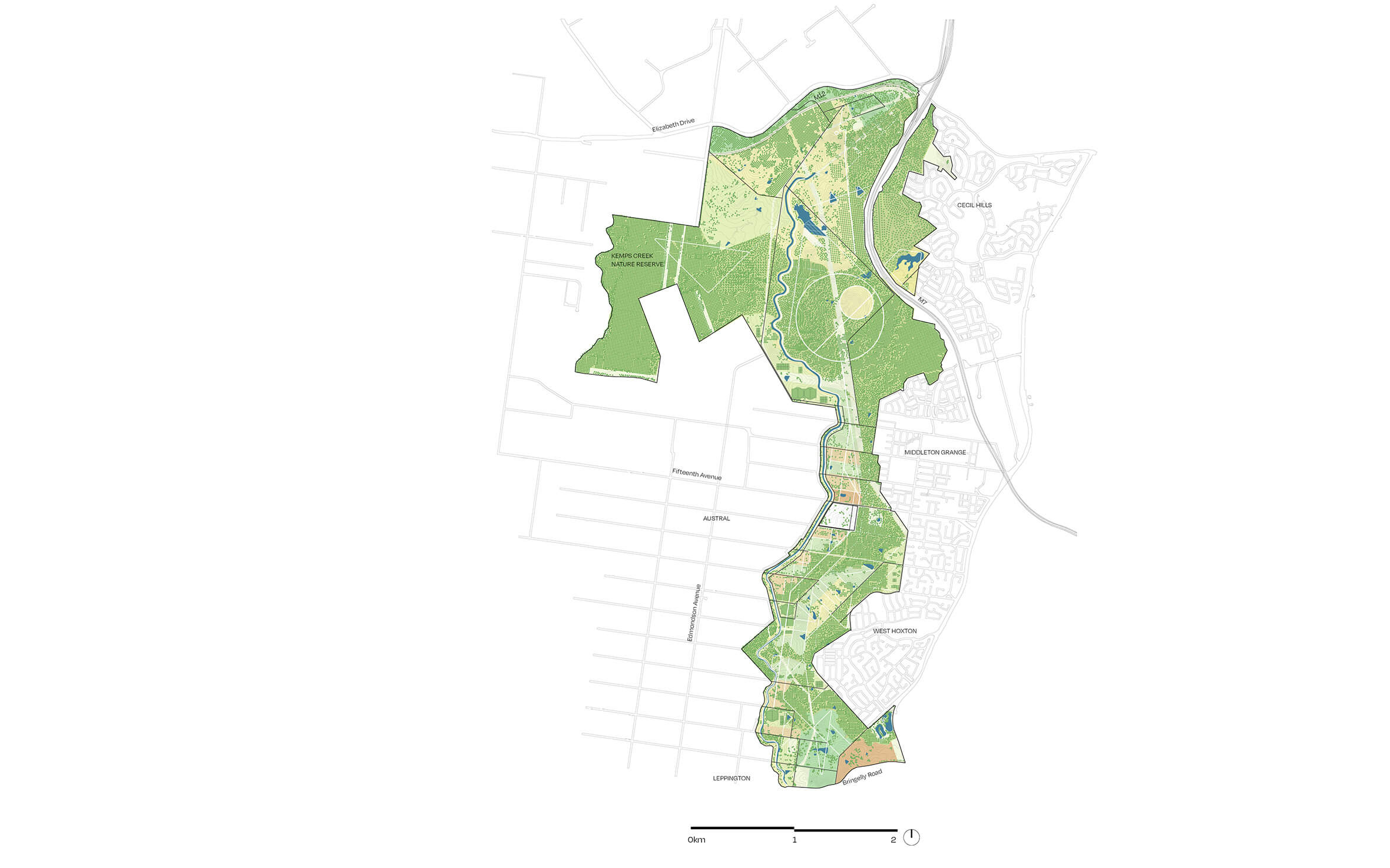
Precise, mega-scaled design gestures highlight specific characteristics of the landscape: a perfect circle defines the crest of a bowl-shaped landform; a cycleway skims across two mirrored dams; a straight, level walkway creates a datum through undulating hills and against a meandering canal. These interventions become iconic destinations built around key meaning of place. They focus programming in a vast terrain, becoming places for events, places to sleep on country, places to walk and discover, places to jog, cycle, picnic or paddle.
We took inspiration from the robust infrastructure of adjacent freeways and canals as well as textures and light at different times of day.
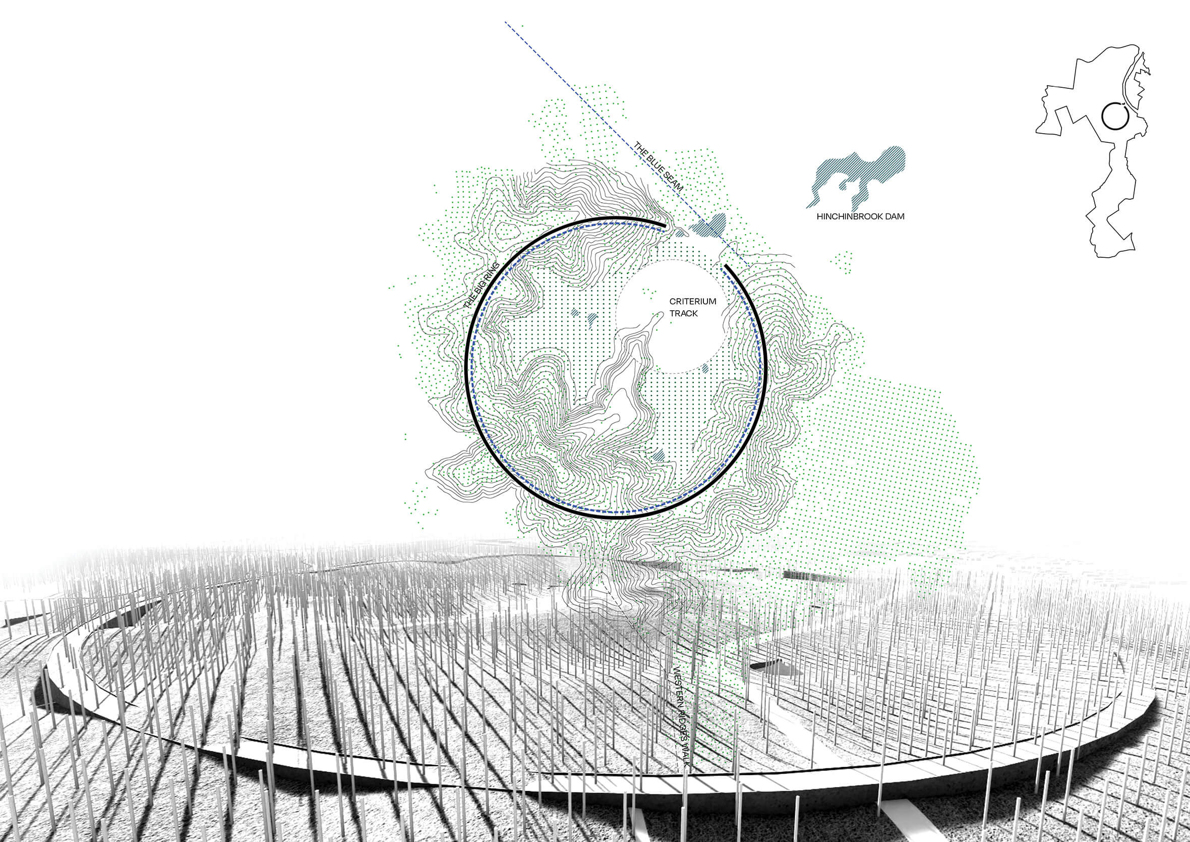
The Big Ring is a circular walkway embedded in the ridgetop with elevated viewing points at the ends. The structure is robust enough to accommodate amenities and vehicles, to support festivals, markets, education and tourism experiences. It could also store water for irrigation to encourage local rainforest species and create a cooler microclimate within the ring
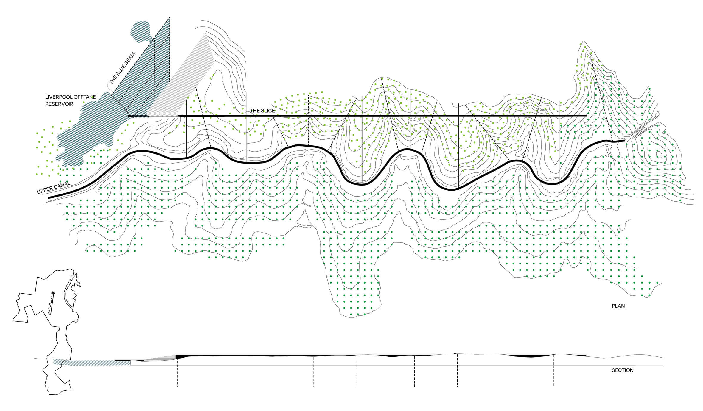
The Slice. The Slice forms a direct route between destinations that contrasts with the folded landform. It forms a long straight path in contrast to the curves of the Upper Canal and the slow arc of the Big Ring. There is the opportunity to accommodate amenities and services within the structure to support future uses
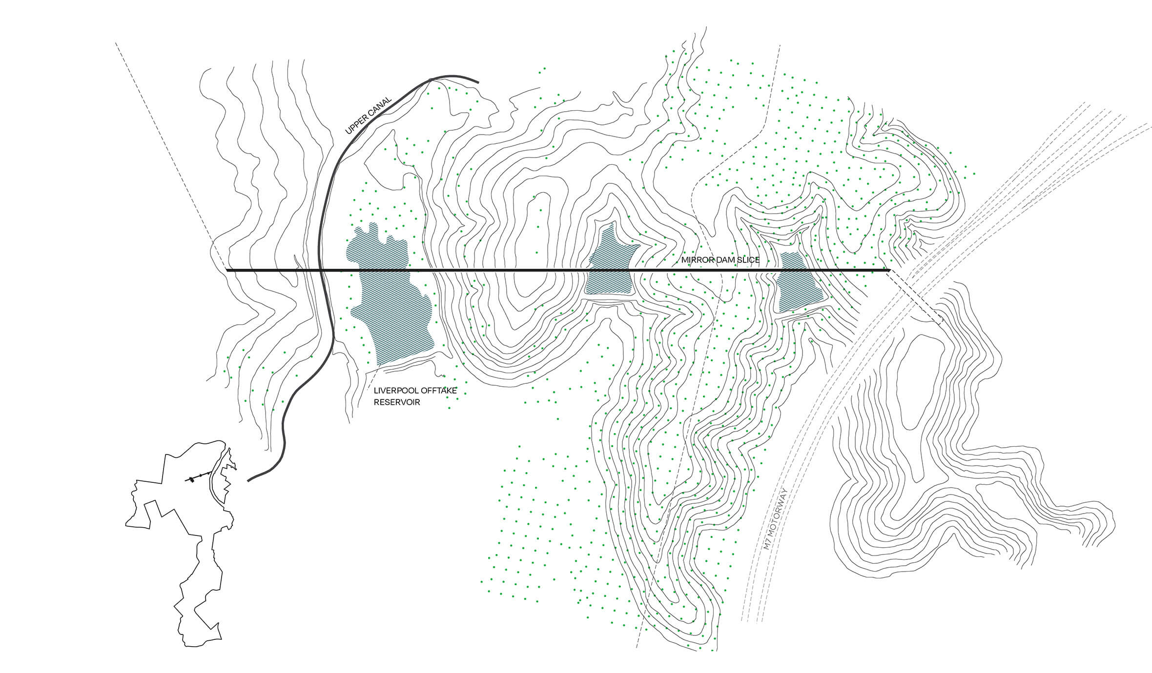
The shared path bridges across twin ‘mirror’ dams and cuts through a low hill to connect the M7 cycleway with the M12. The path can be accessed from Hinchinbrook Dam or the adventure sports hub at Wylde MTB, revealing the undulations and water systems of the landscape
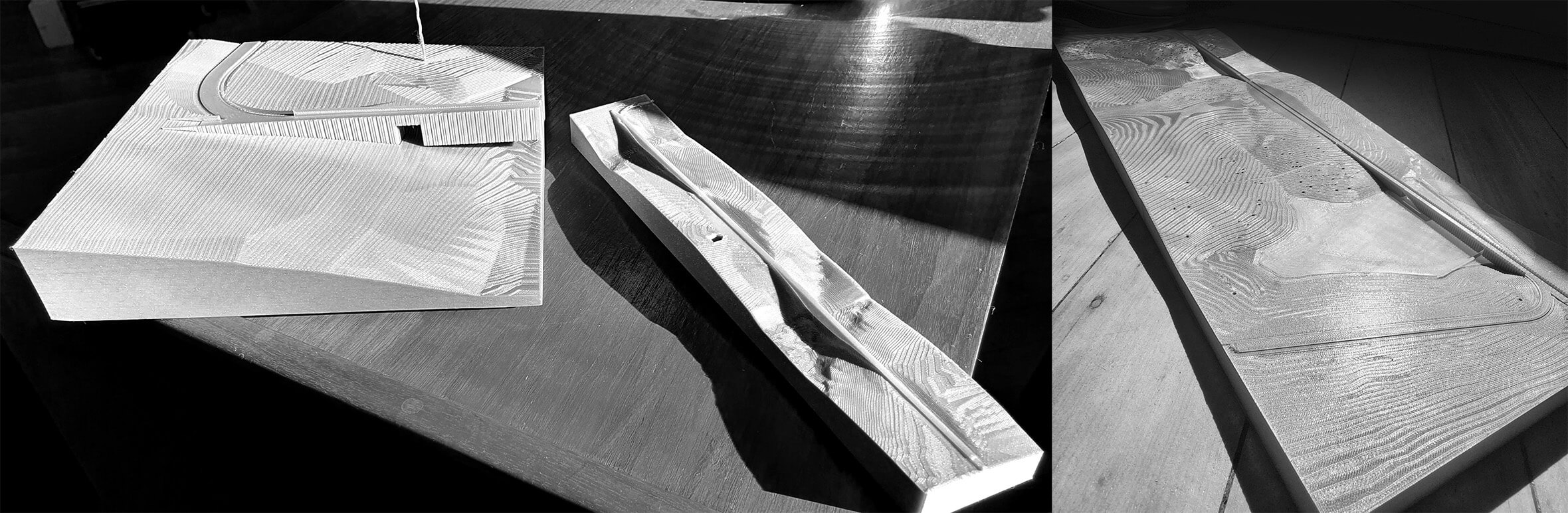
3D printed model showing the slice against the undulating topography
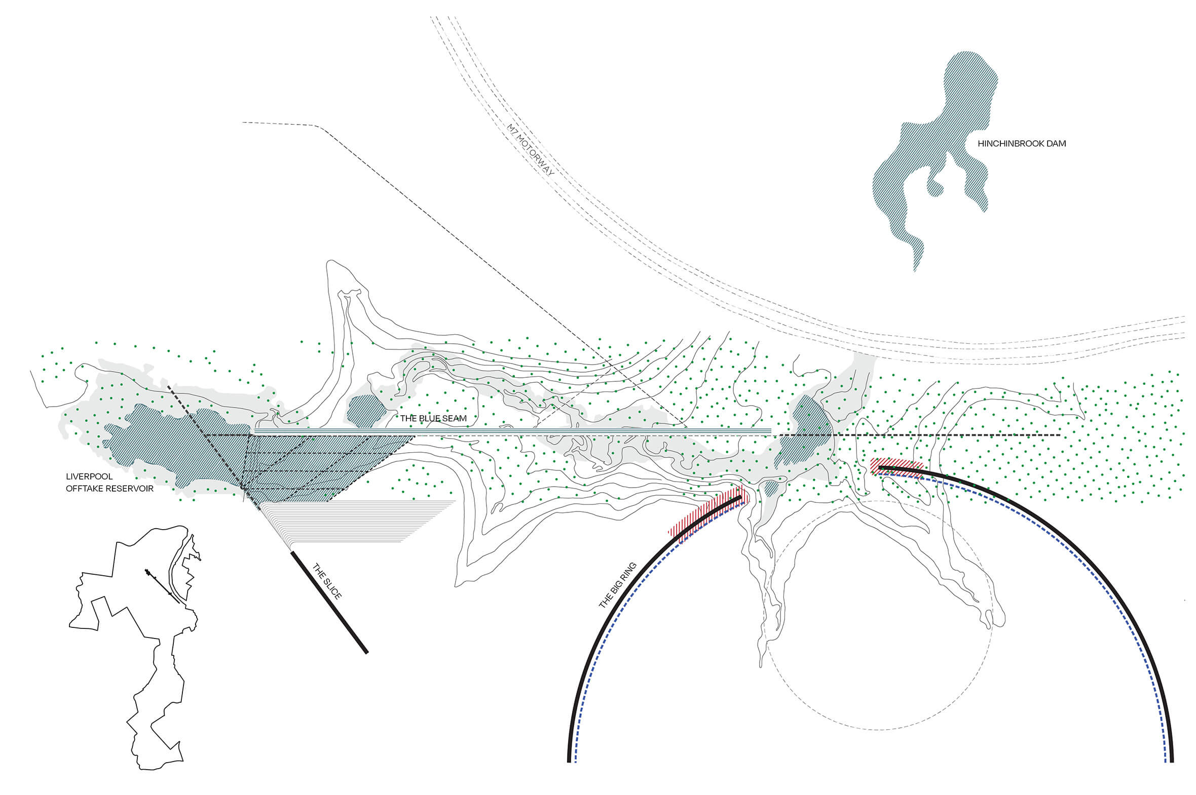
The Blue Seam celebrates the path of water through a major gully in the parklands. It forms a cool, linear park with water play and camping linking Liverpool Offtake Reservoir to Hinchinbrook Dam
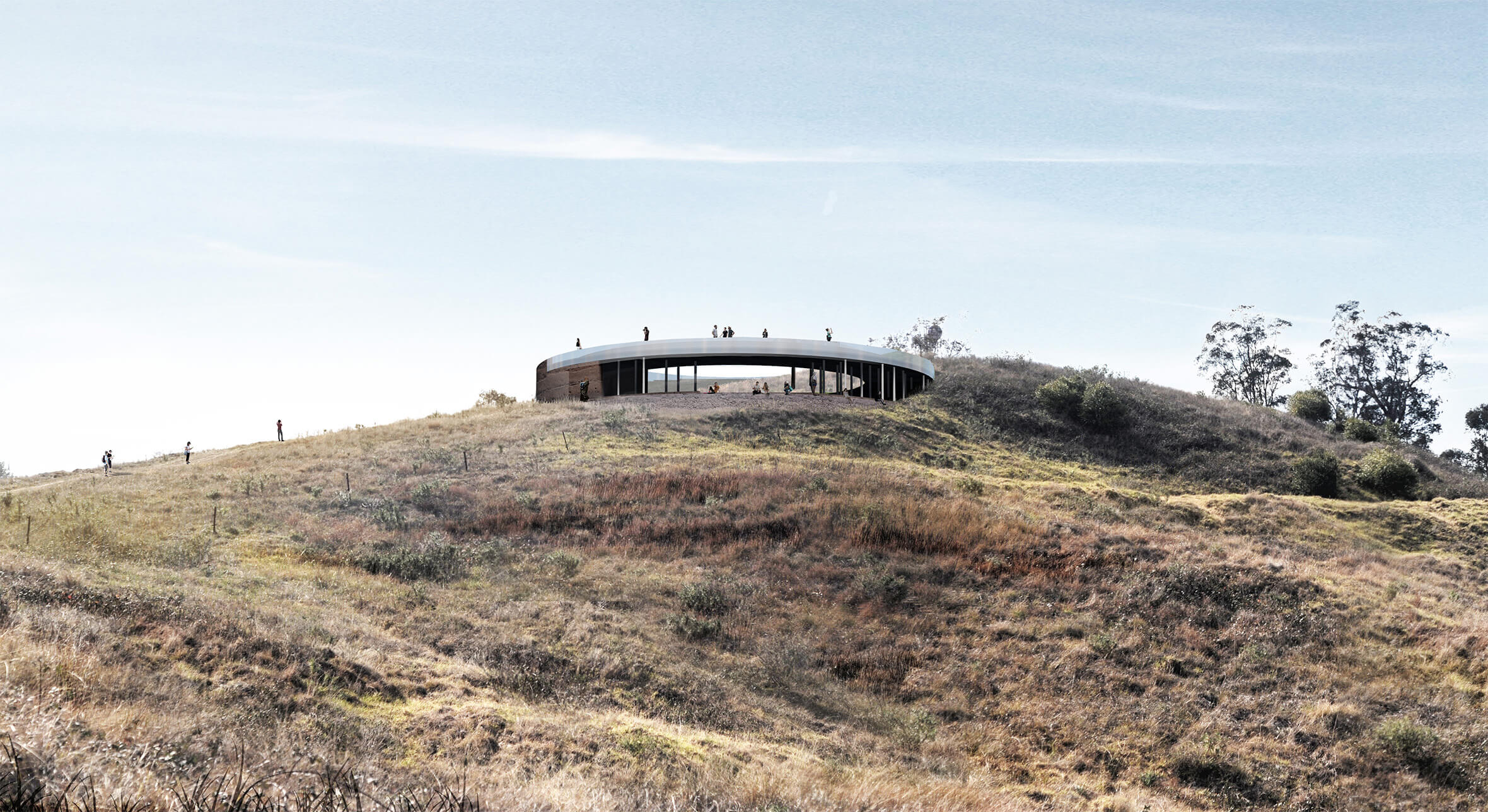
The Lookout is a multipurpose structure that creates a destination on the highest point of the Southern Parklands. It forms part of a series of buildings on the ridge including water tanks, a cafe and a boutique hotel, subtly sited within the landscape.
The Lookout is a multipurpose structure that creates a destination on the highest point of the Southern Parklands. It forms part of a series of buildings on the ridge including water tanks, a cafe and a boutique hotel, subtly sited within the landscape.
The Lookout is a multipurpose structure that creates a destination on the highest point of the Southern Parklands. It forms part of a series of buildings on the ridge including water tanks, a cafe and a boutique hotel, subtly sited within the landscape.
Interested in learning more about Tyrrell Studio? Get in touch.