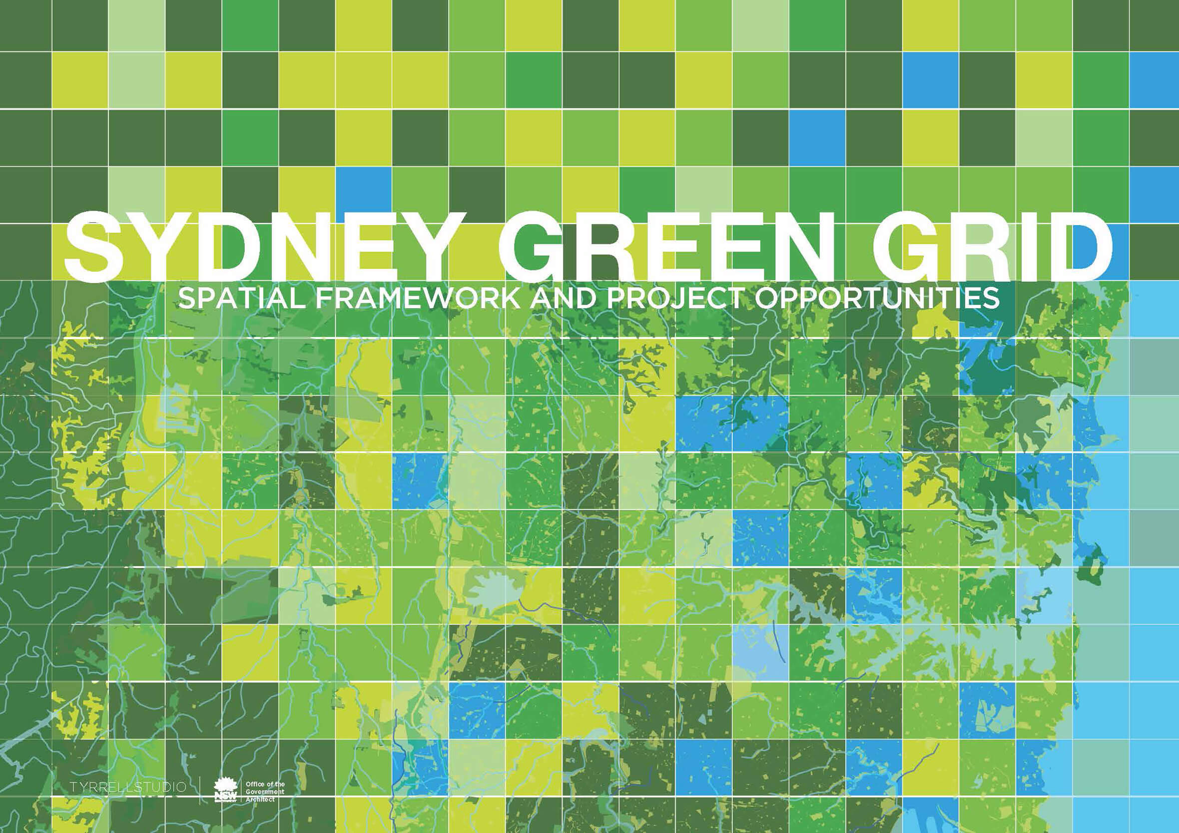
Greater Sydney Green Grid
‘A new area for landscape architectural practice in Australia’ Jury Report
Winner of the 2020 AILA NSW Award of Excellence for Planning
A living, digital resource of Sydney’s green infrastructure
In 2016, the NSW Government Architect and Greater Sydney Commission engaged us to develop the strategic vision for the Sydney Green Grid into a comprehensive spatial framework. This involved collating extensive GIS data and identifying and prioritising hundreds of projects so they could be embedded into Sydney’s district plans. Following the success of the project, in 2018, we were engaged to transform the Green Grid Spatial Framework into a GIS dataset with an accompanying methodology to help government agencies coordinate green infrastructure projects across the Sydney Basin.
The Greater Sydney Green Grid is a planned network of open space for recreation, biodiversity, and waterway health. It connects strategic, district and local centres, public transport hubs and residential areas.
A tool for collaboration
As we developed our implementation methodology, we interviewed state government agencies to understand their decision-making process, agendas and barriers to developing and delivering strategic Green Grid projects. Their responses were eye-opening. All were keen to deliver great results within their own department, but there was little cross departmental collaboration. We realised that this was the potential of the project, to create a digital platform for collaboration across all levels of government to track delivery of the city’s future green infrastructure network.
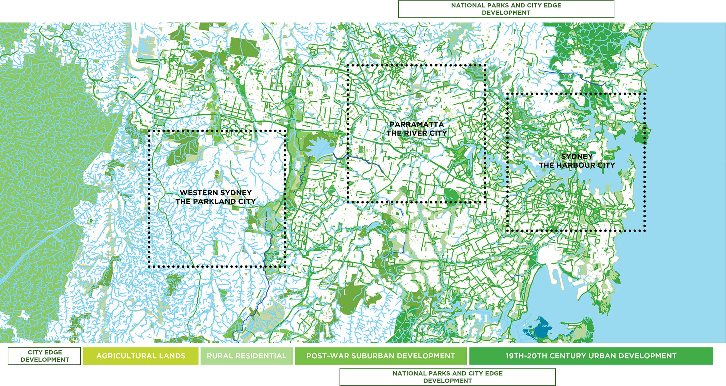
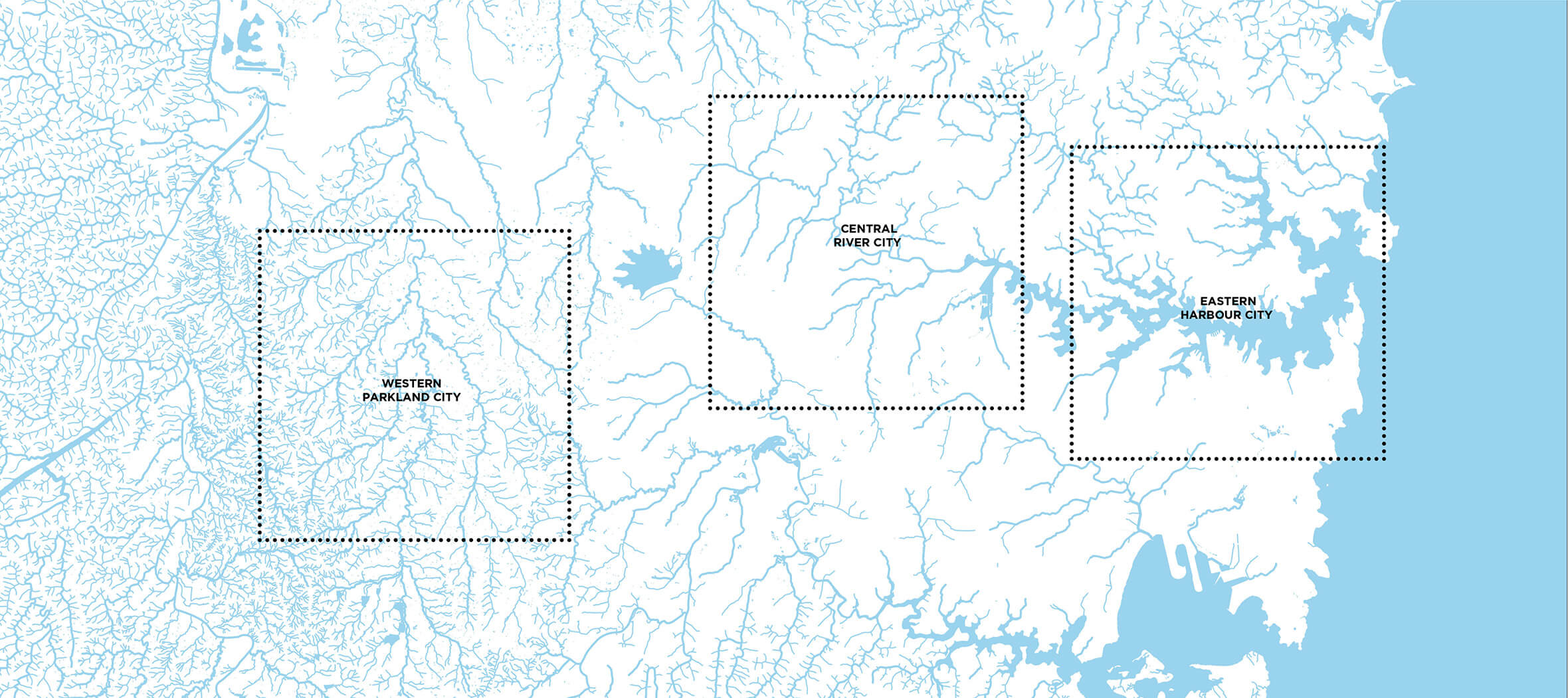
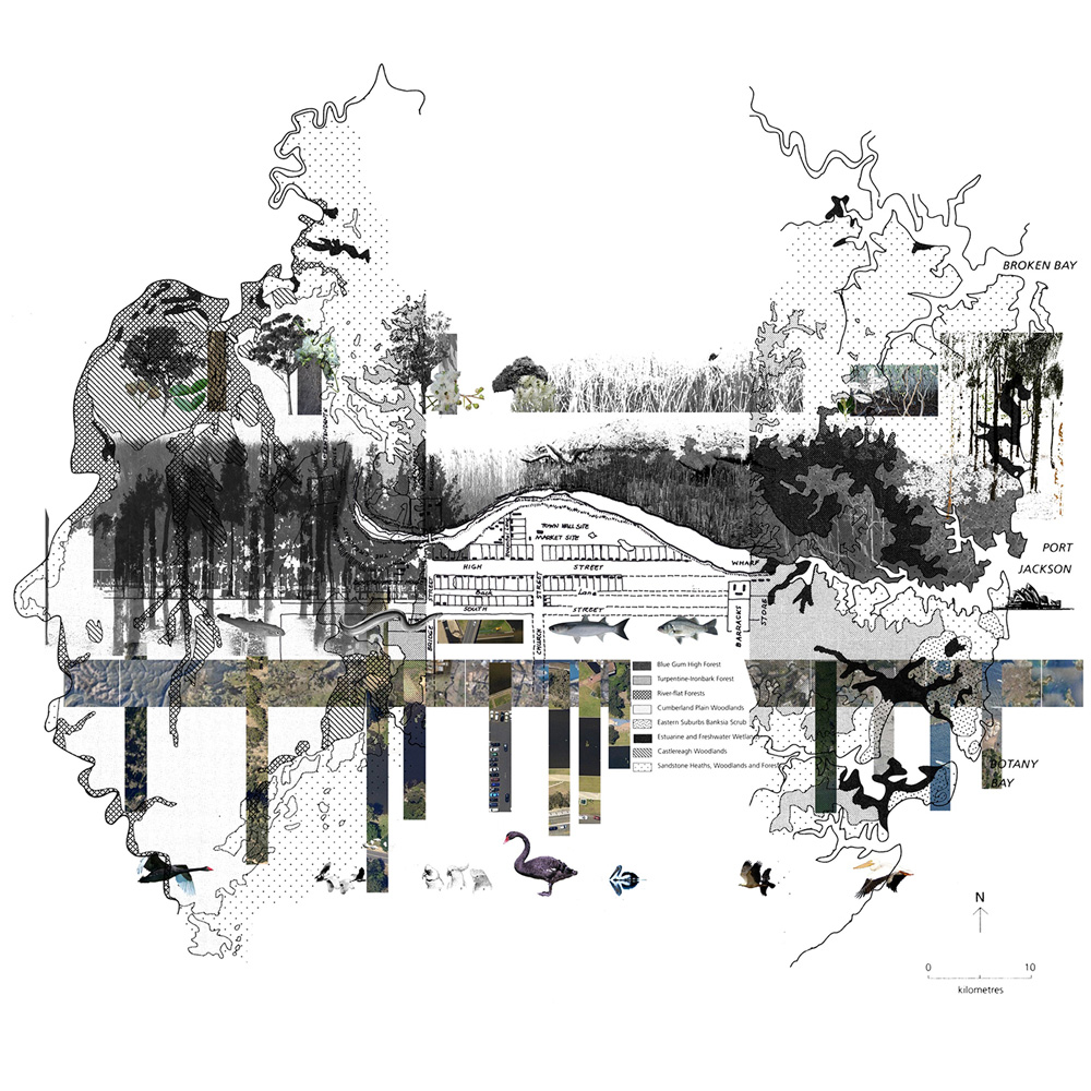
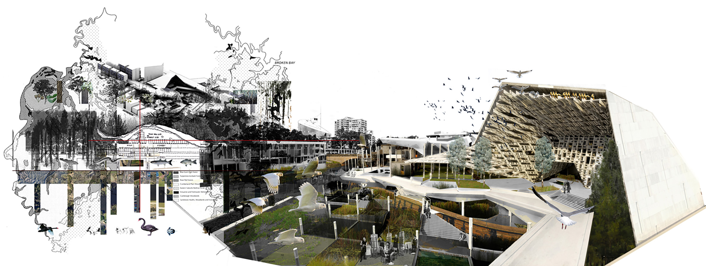
A geological timeline of Sydney’s development shows the sandstone coves of Sydney harbour, alluvial sands of the Parramatta River and ephemeral creeks on Wianamatta clay. These unique landscape characteristics became the basis for the identity of the three cities.
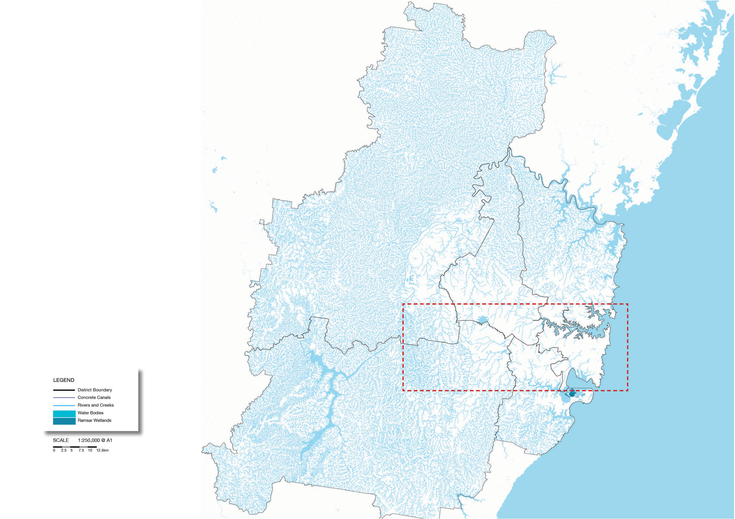
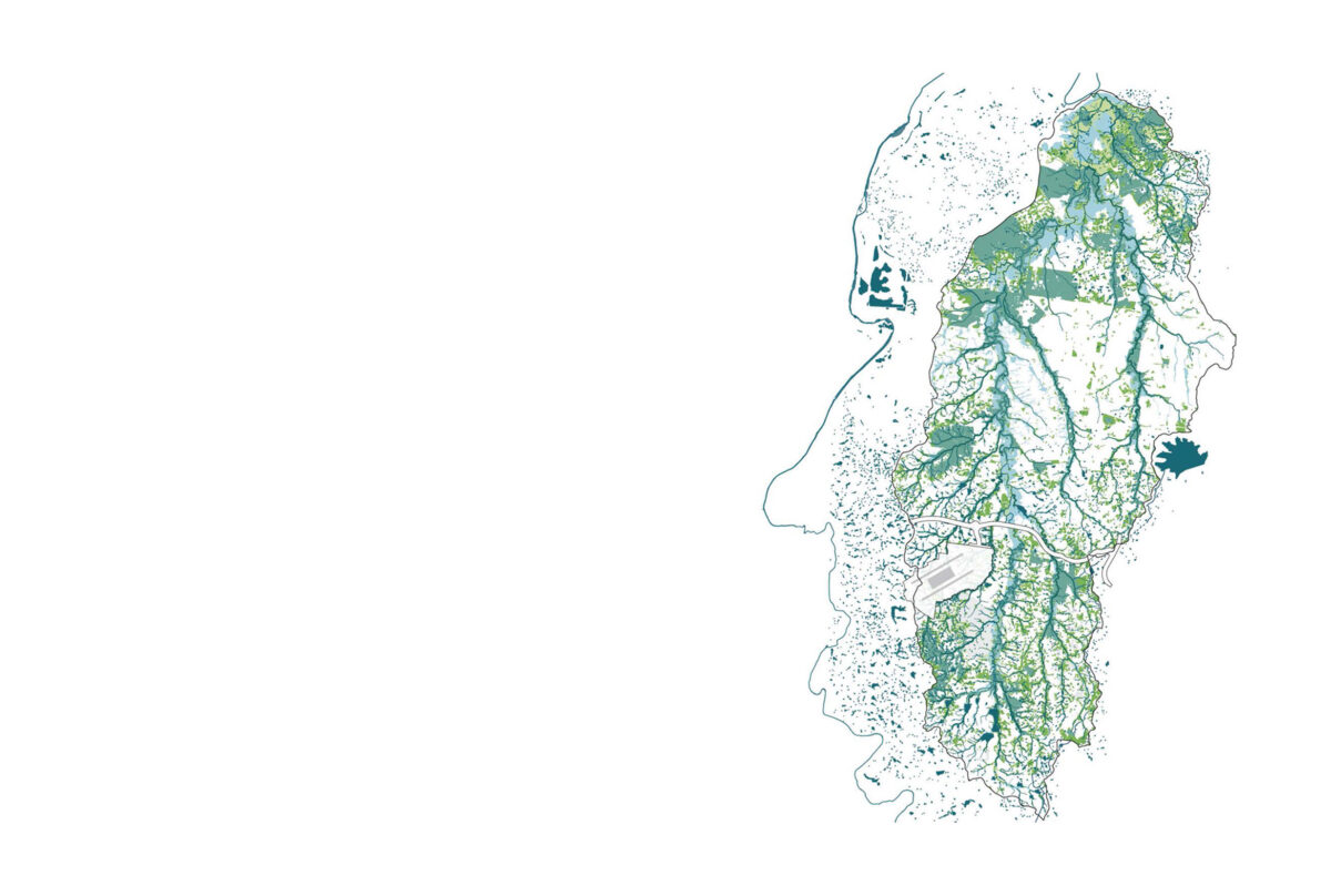
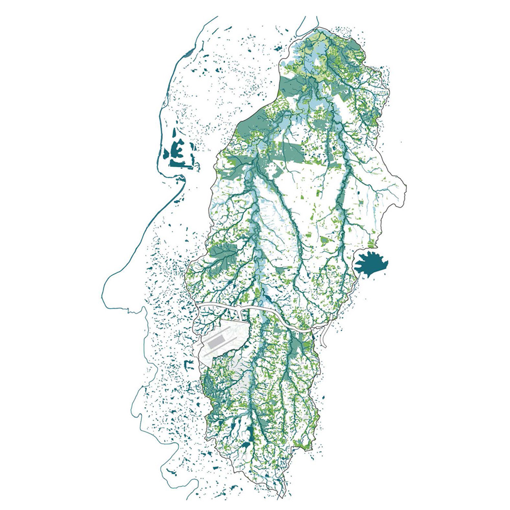
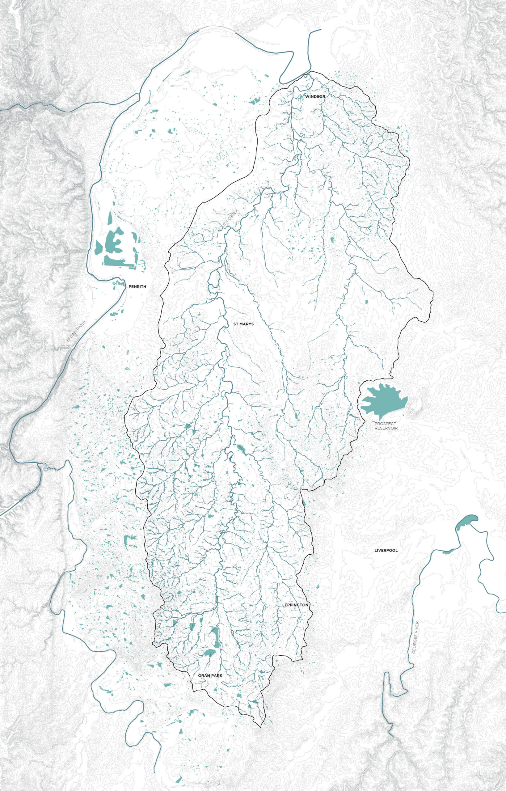
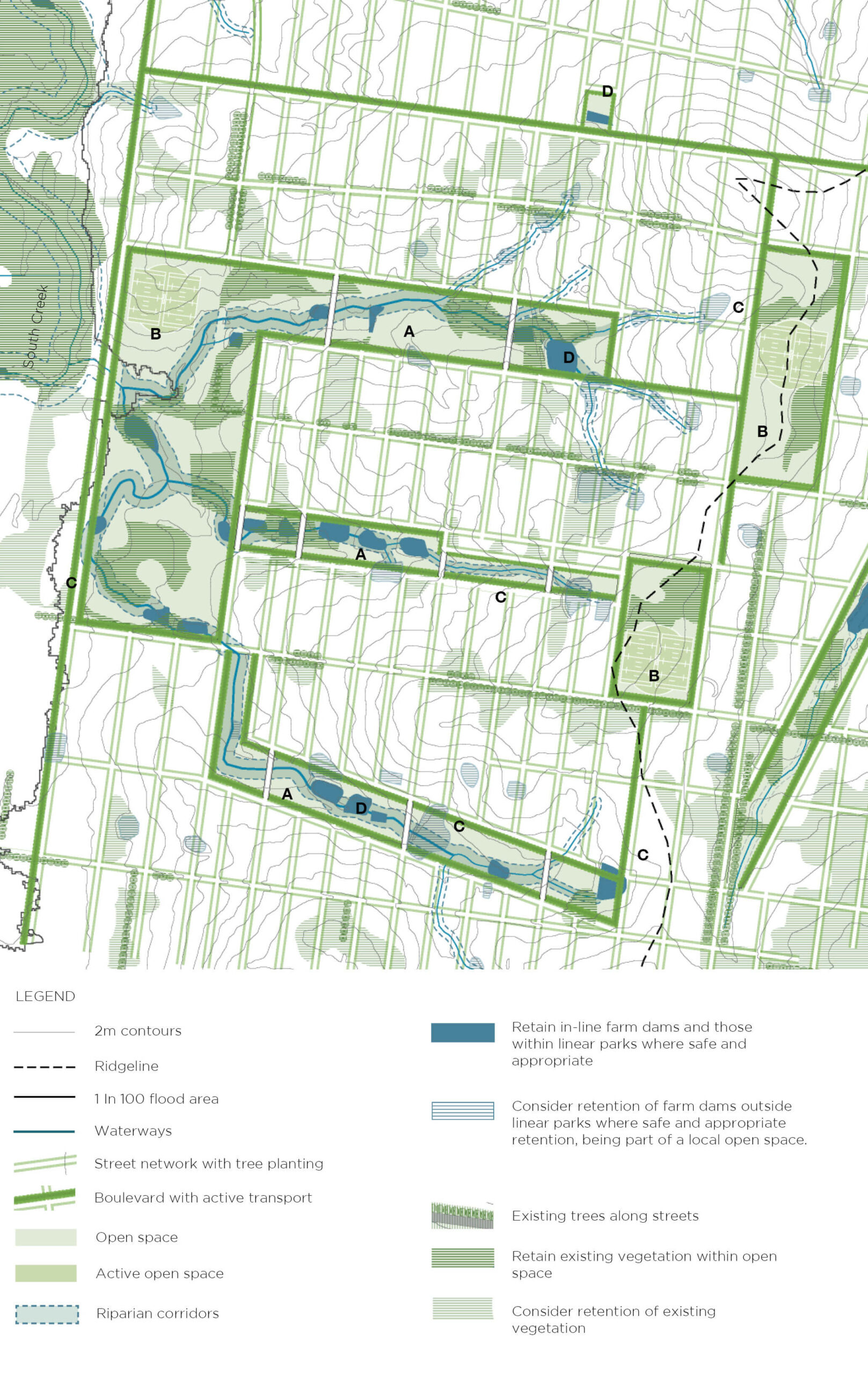
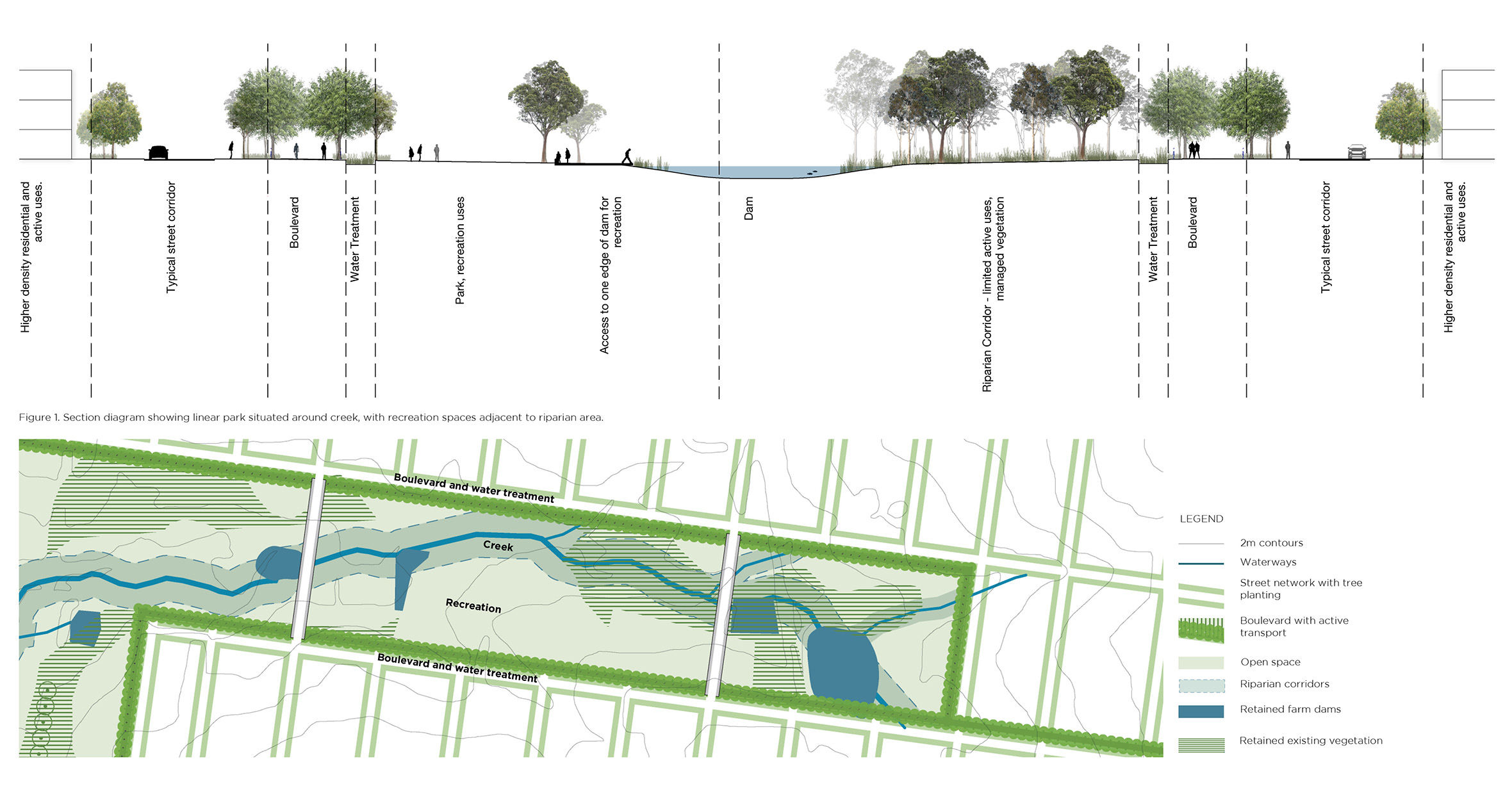
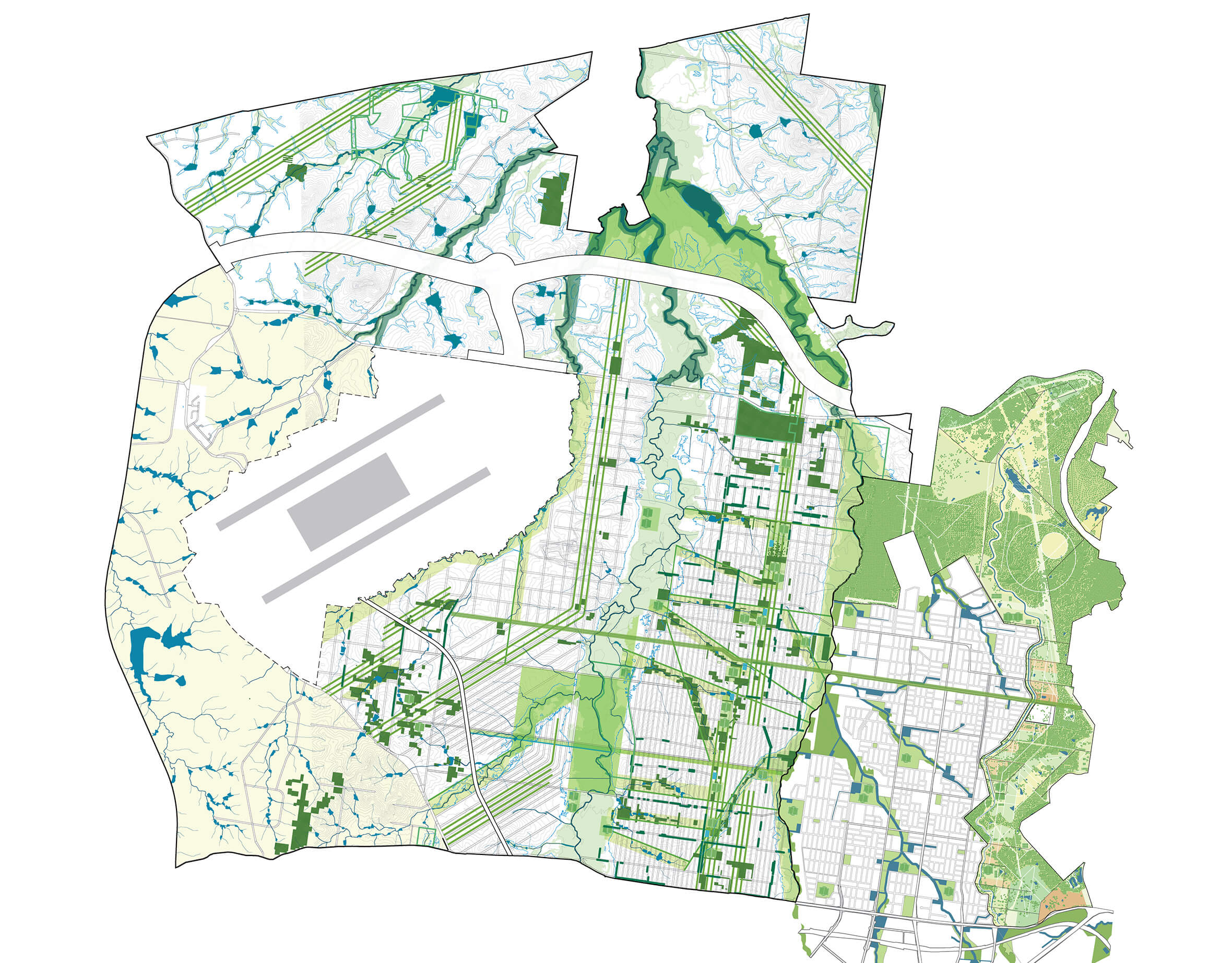
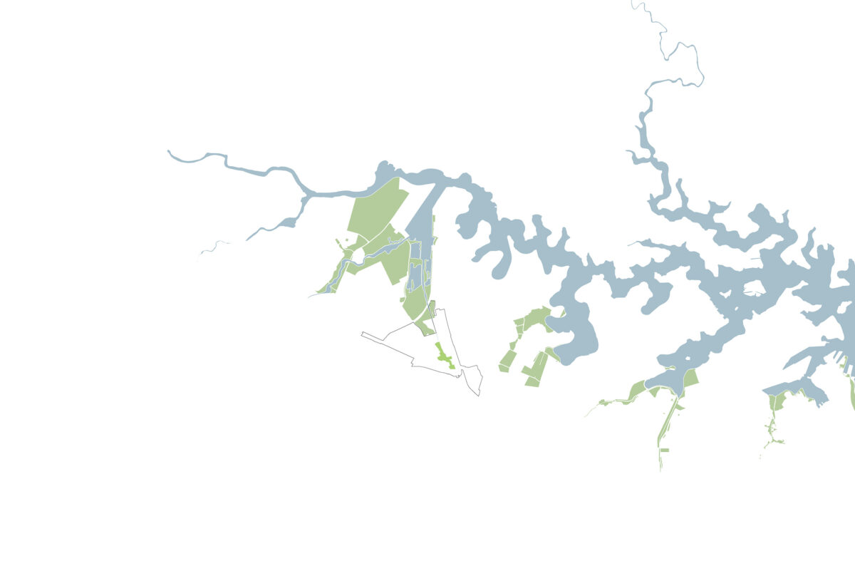
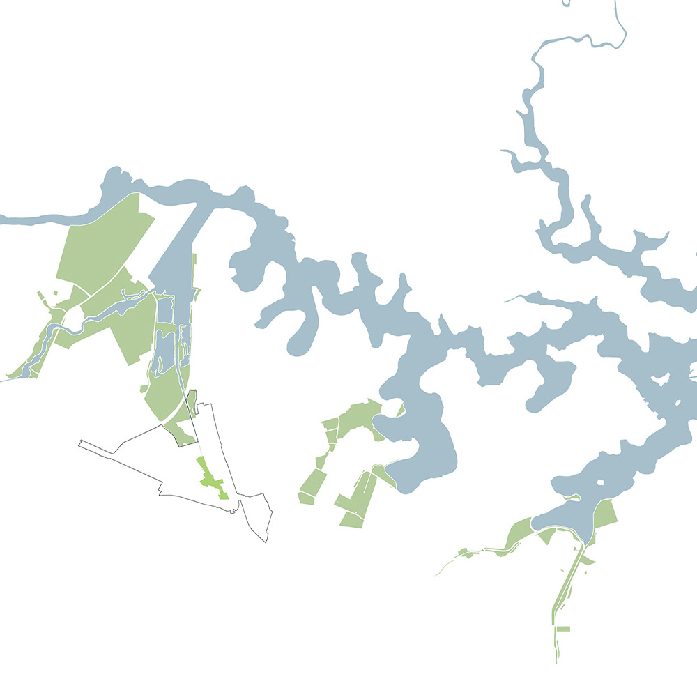
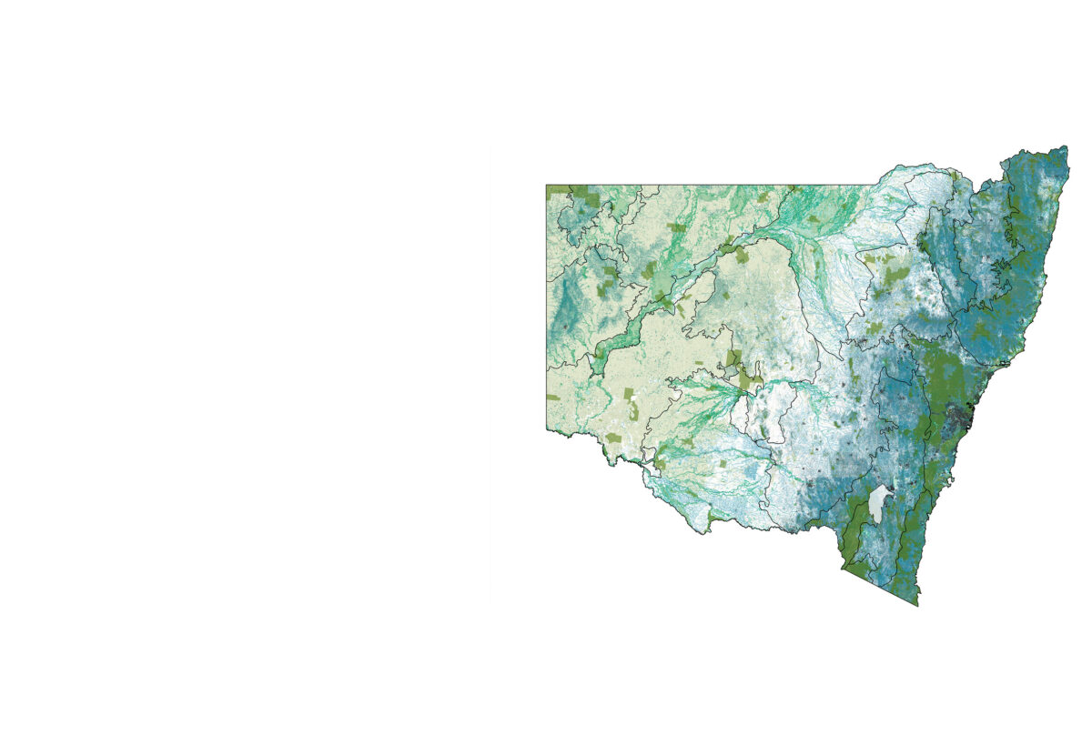
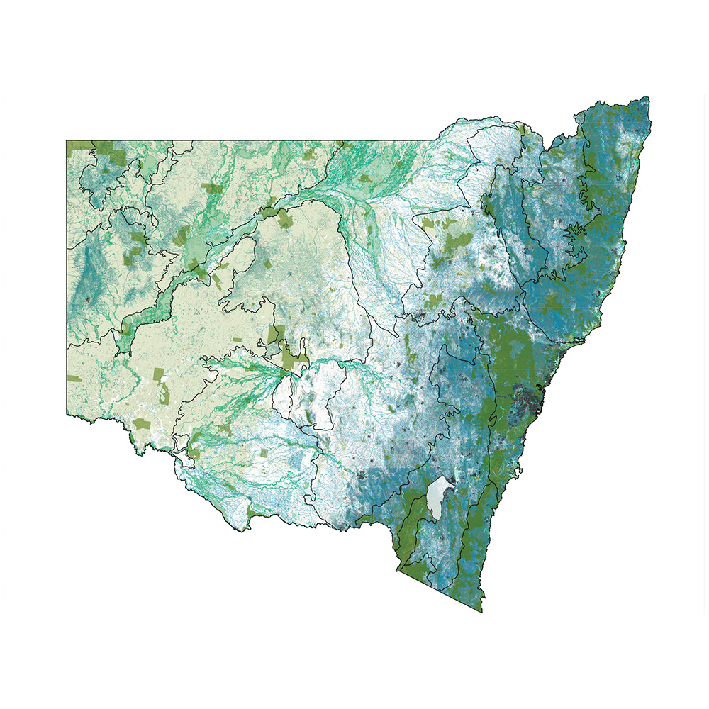
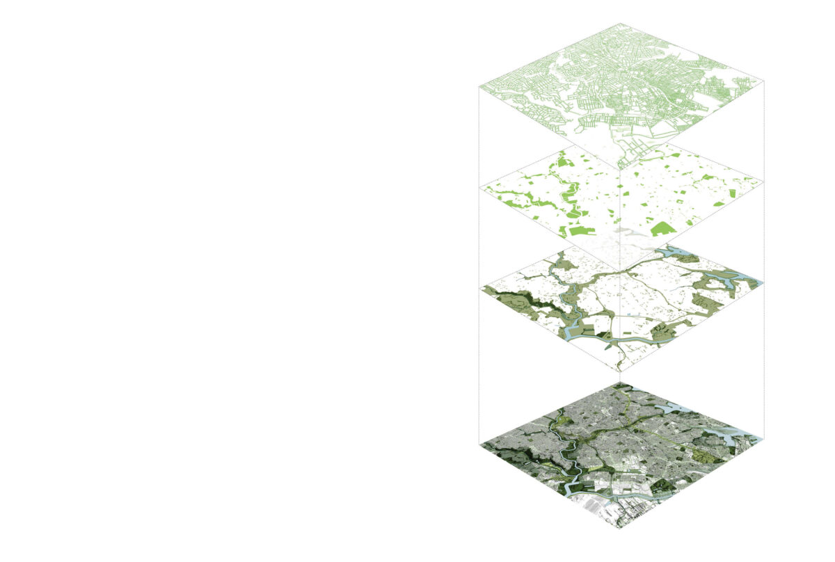
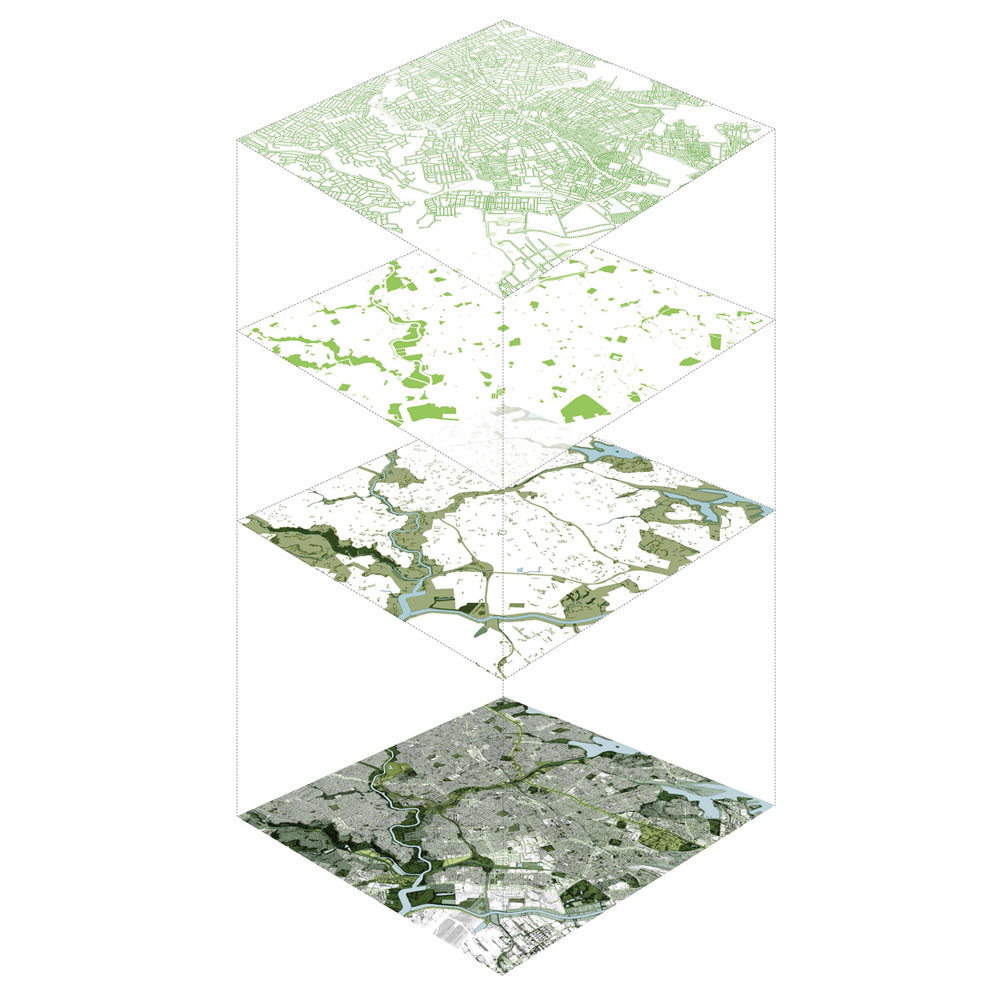
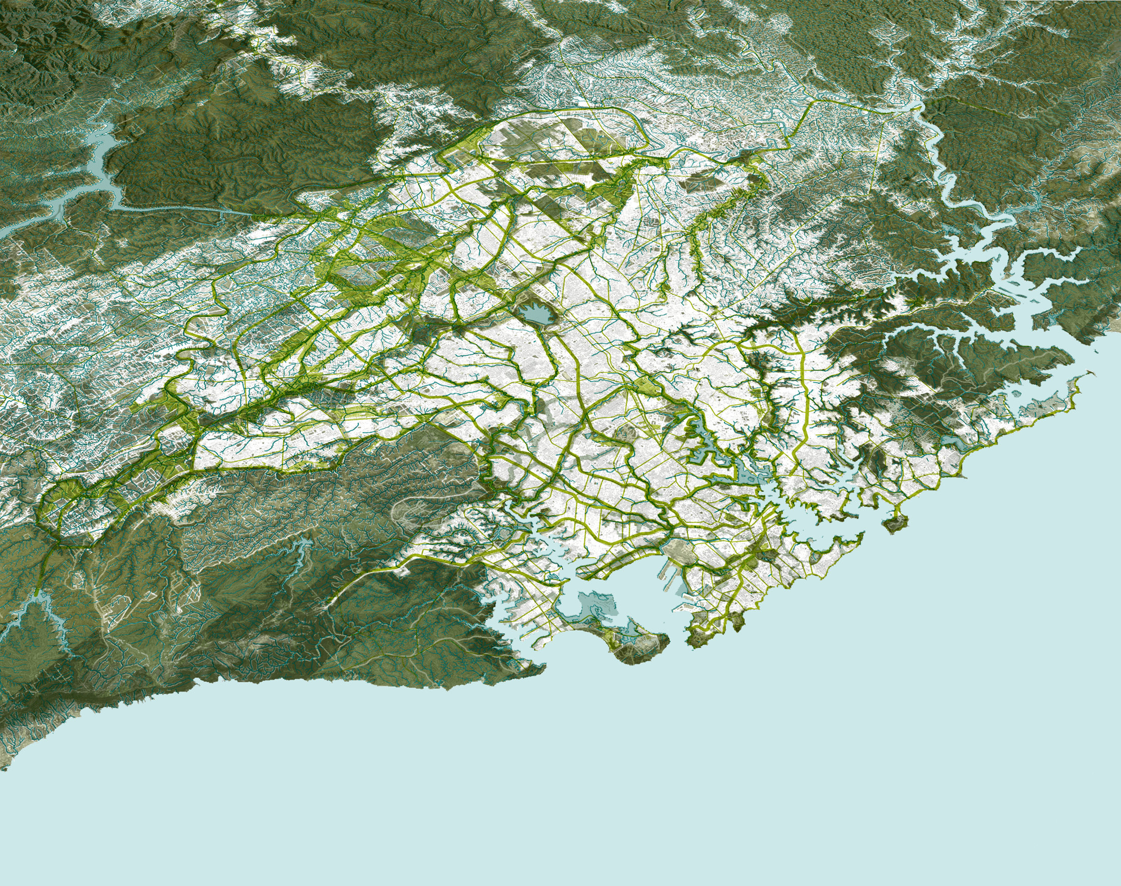
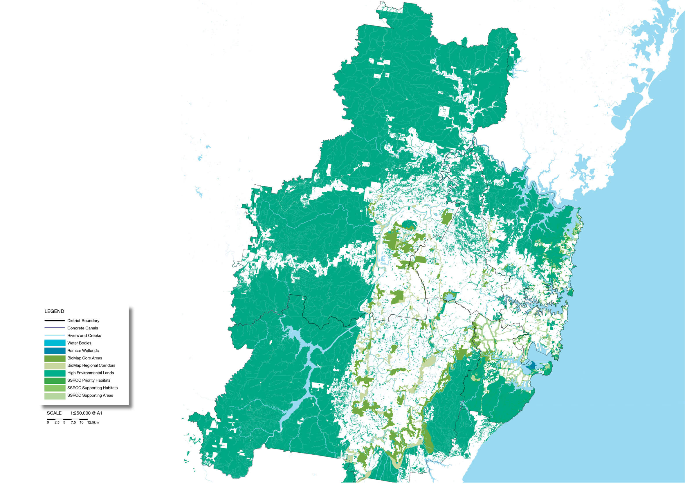
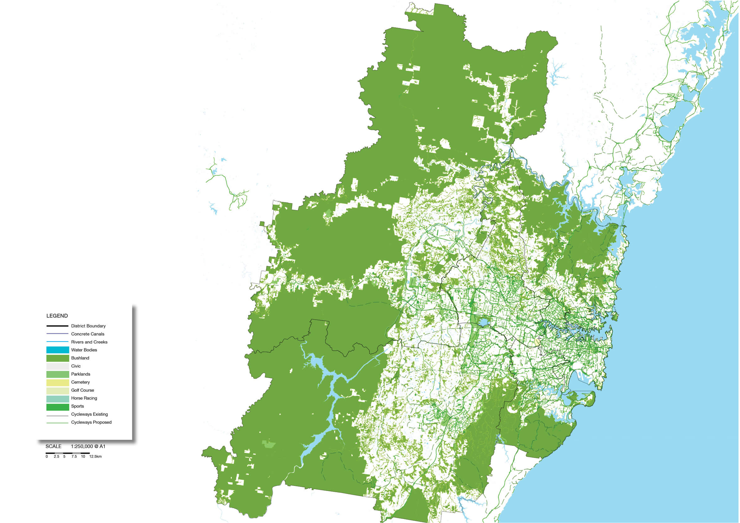
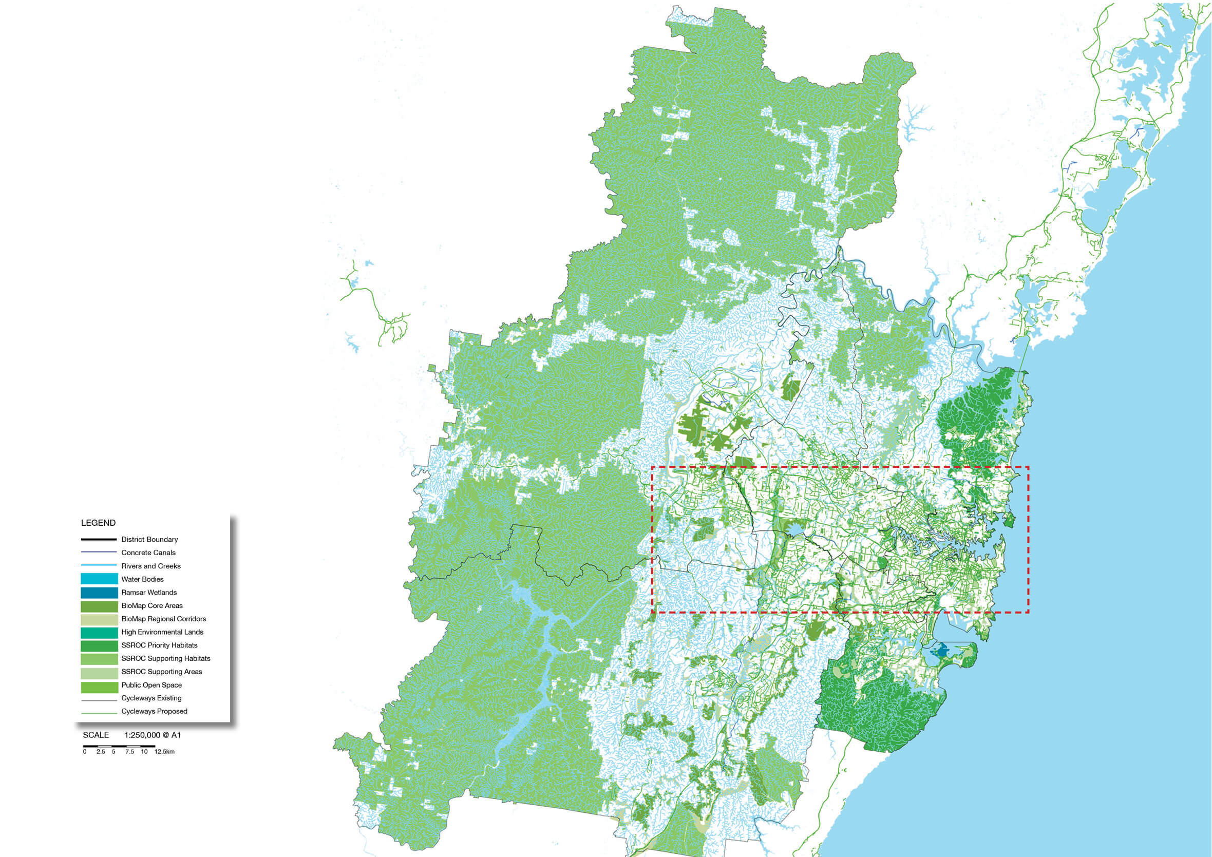
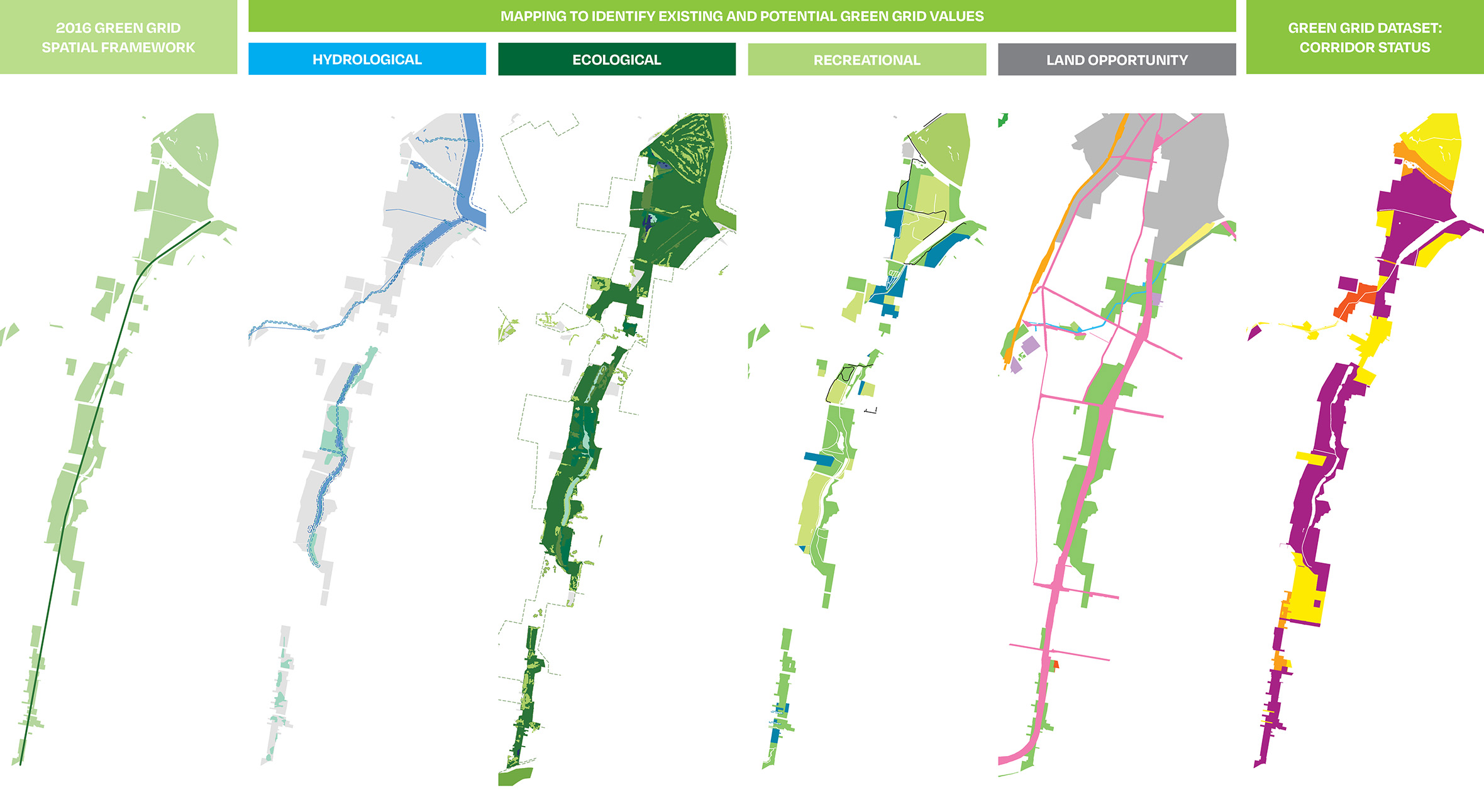
Our SGG Spatial Framework mapped the fragmented datasets of the city, then split the data into hydrological, recreational and ecological layers for the entire Sydney Basin. We combined these new layers to produce a map of the existing blue-green infrastructure network.
Our SGG Spatial Framework mapped the fragmented datasets of the city, then split the data into hydrological, recreational and ecological layers for the entire Sydney Basin. We combined these new layers to produce a map of the existing blue-green infrastructure network.
Our SGG Spatial Framework mapped the fragmented datasets of the city, then split the data into hydrological, recreational and ecological layers for the entire Sydney Basin. We combined these new layers to produce a map of the existing blue-green infrastructure network.
Our SGG Spatial Framework mapped the fragmented datasets of the city, then split the data into hydrological, recreational and ecological layers for the entire Sydney Basin. We combined these new layers to produce a map of the existing blue-green infrastructure network.
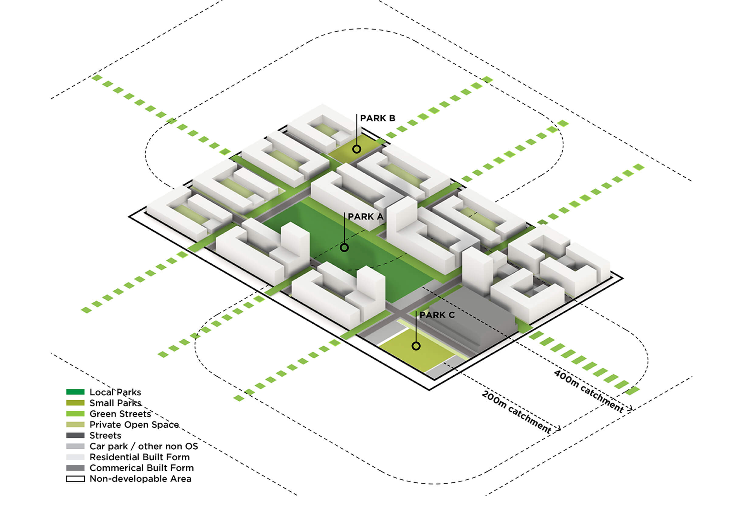
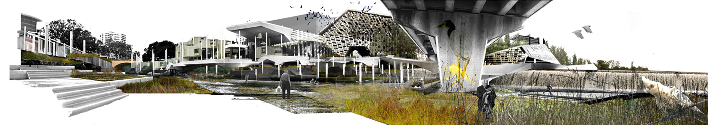
The Sydney Green Grid Spatial Framework identifies strategic green infrastructure corridors at a metropolitan and district scale.
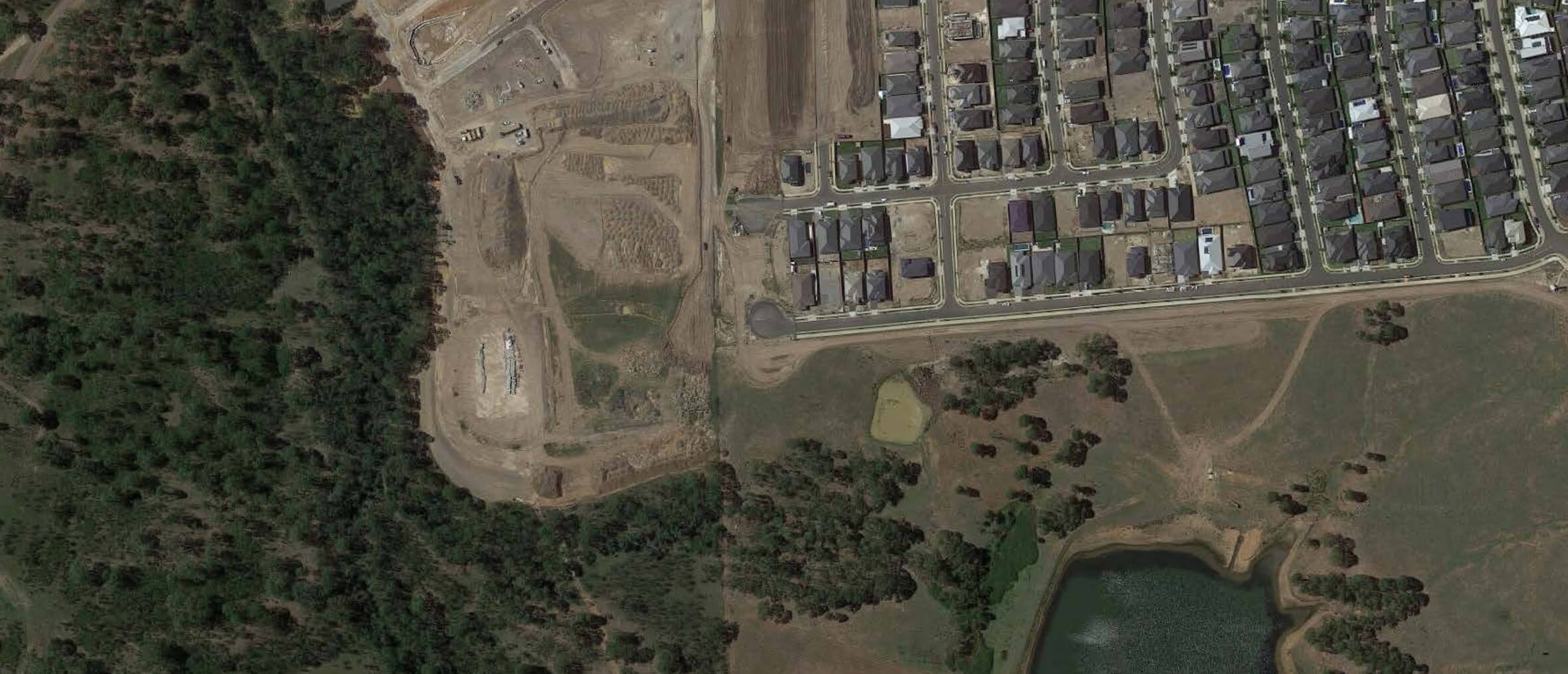
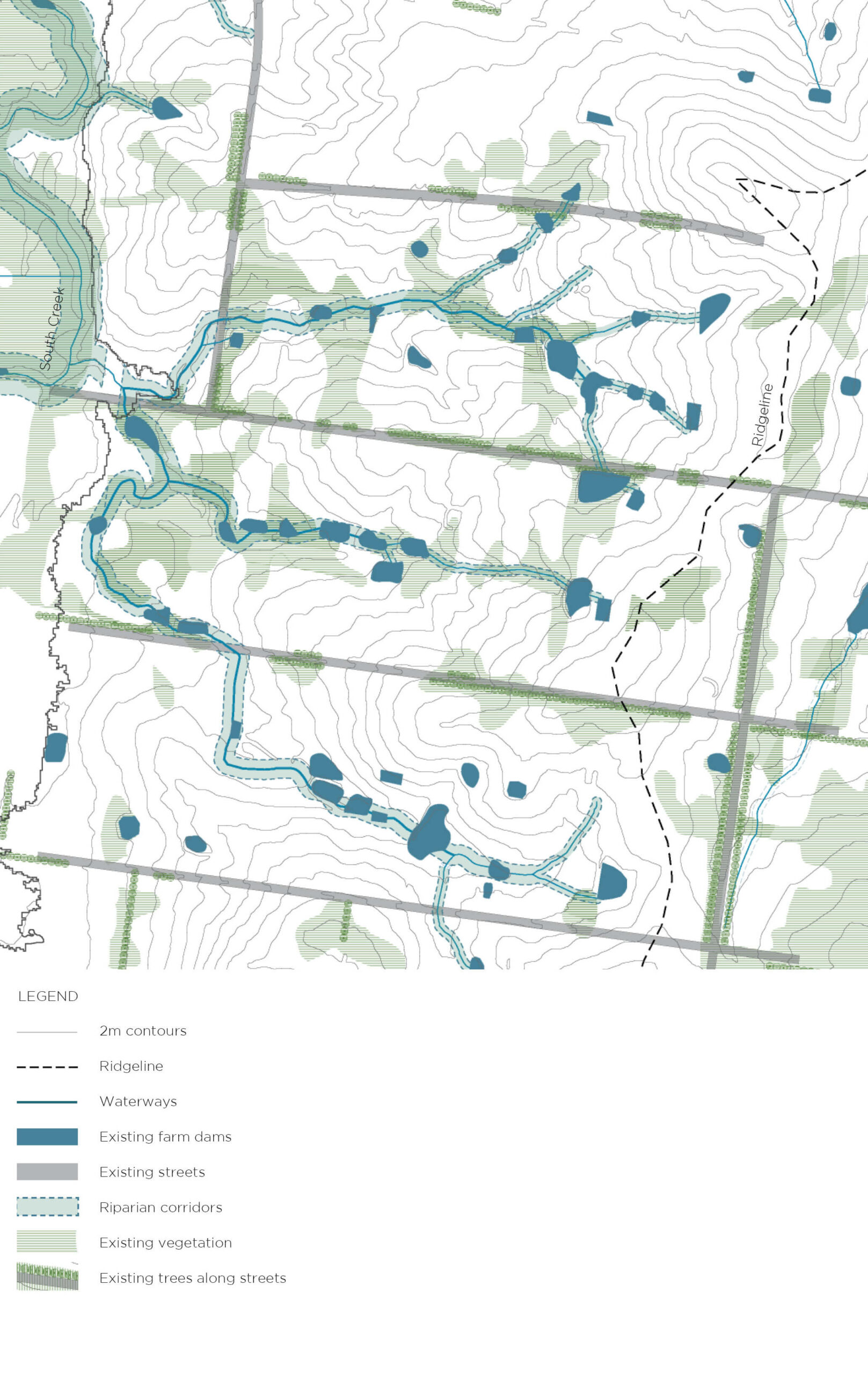
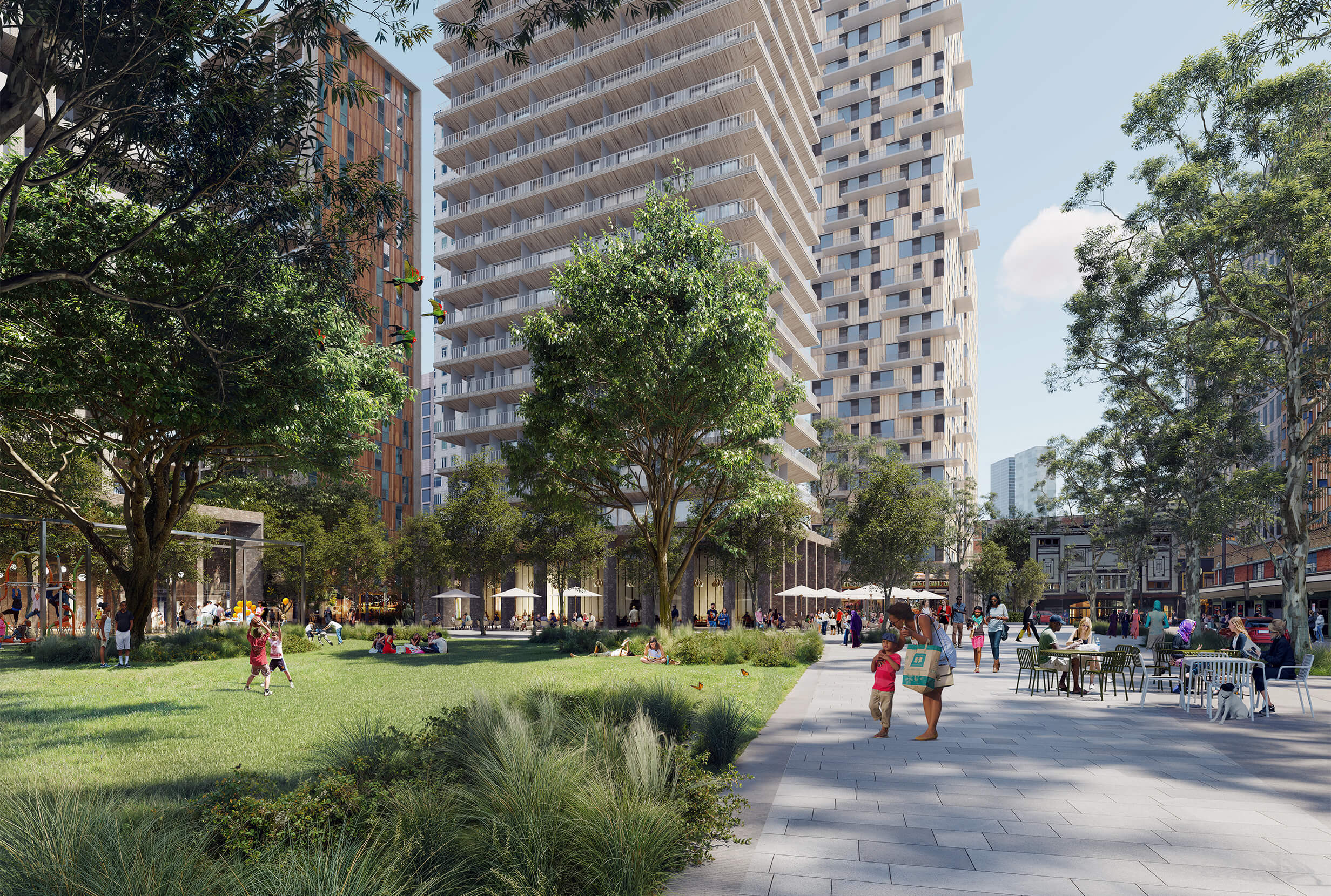
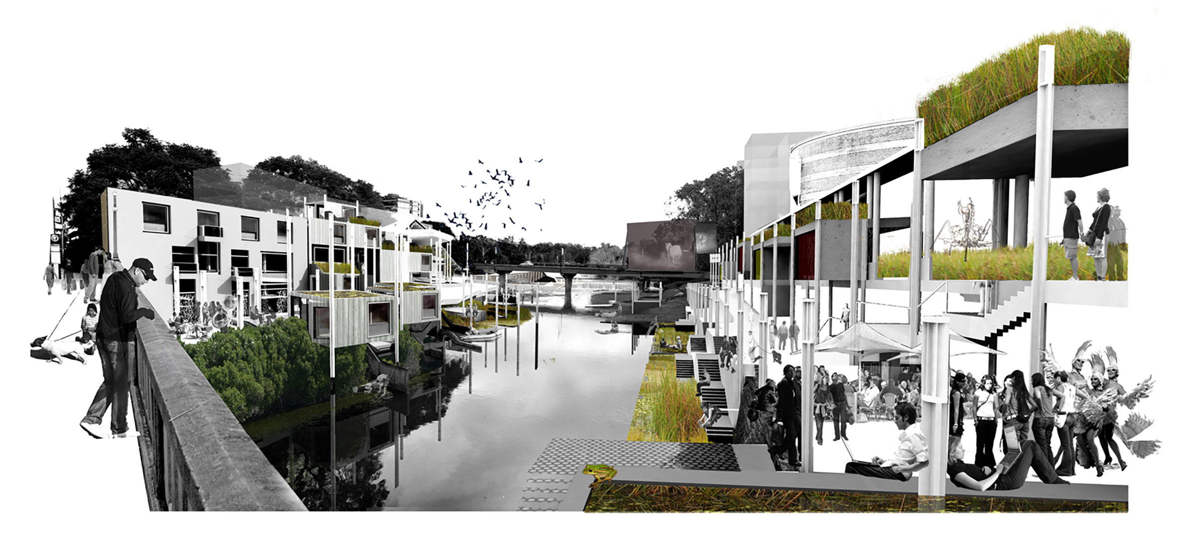
The GIS Dataset allows the SGG network to be interpreted at a local scale in relation to the city and its varied development patterns.
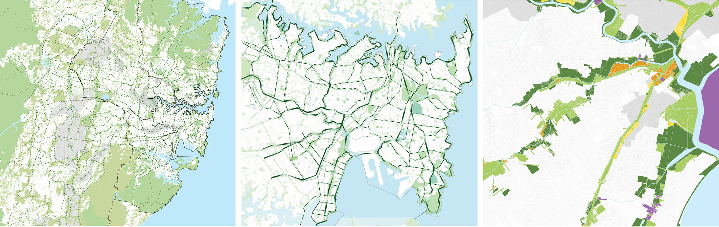
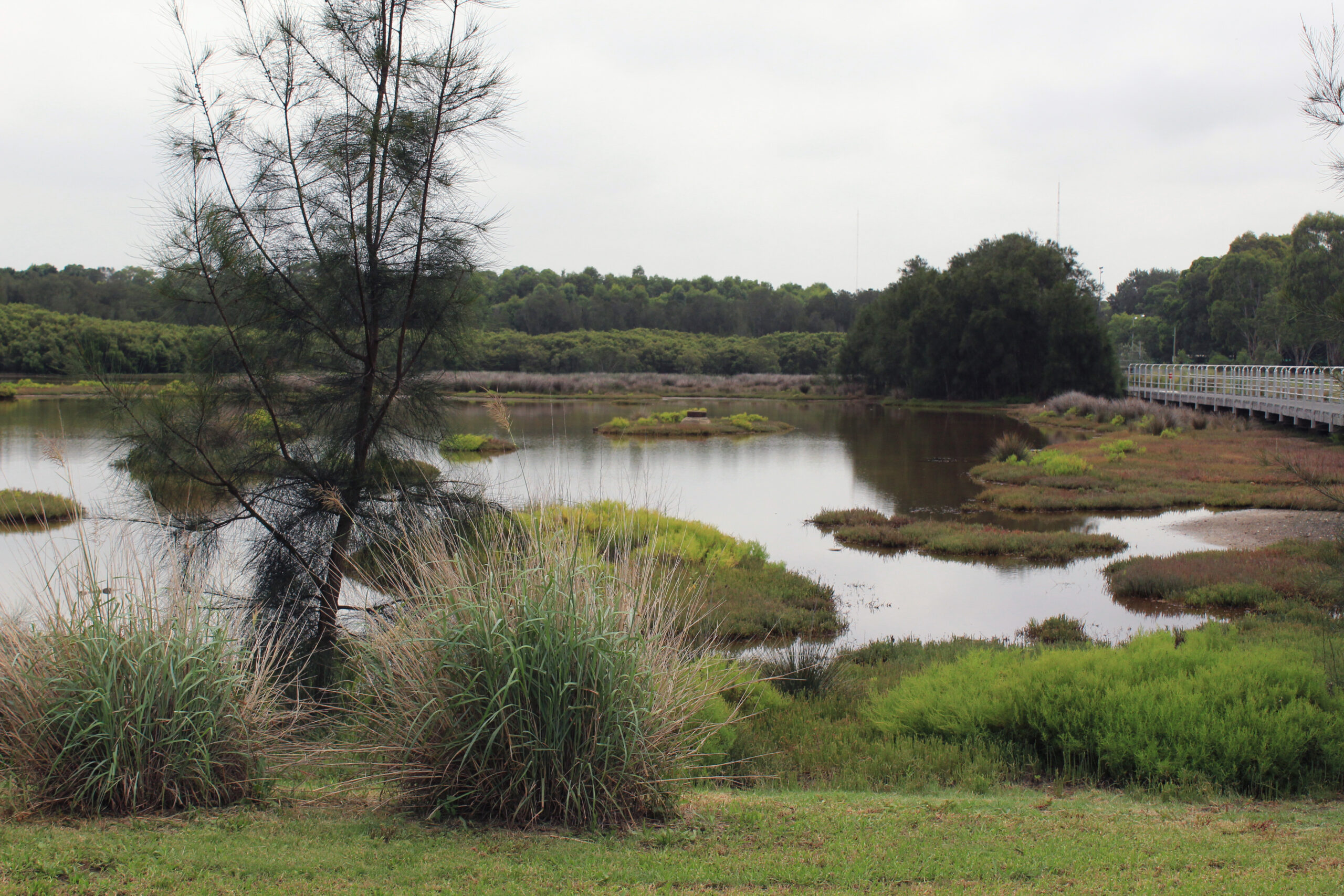
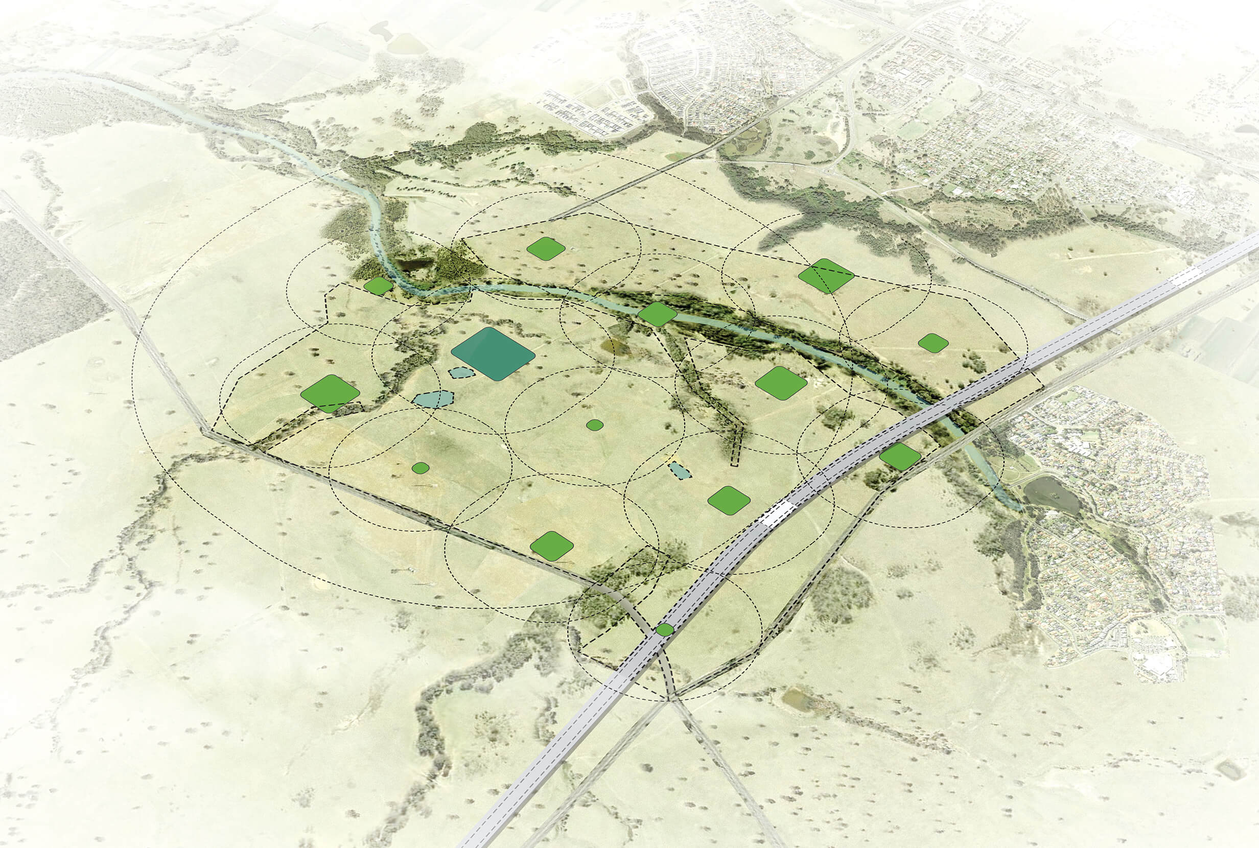
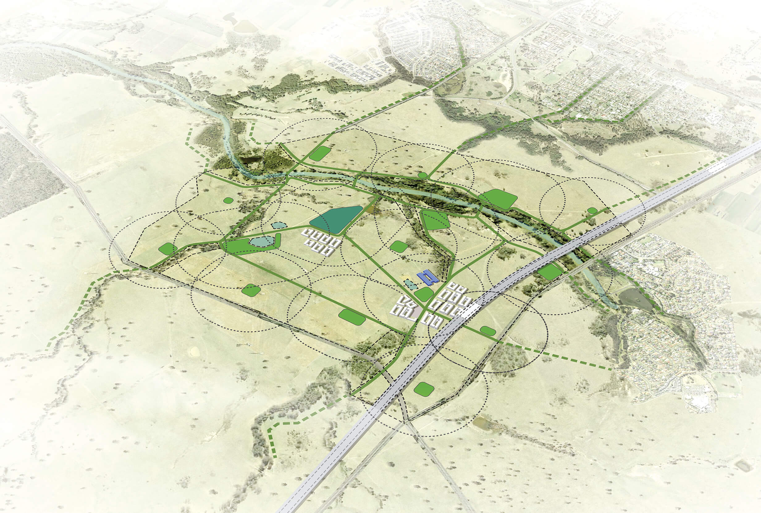
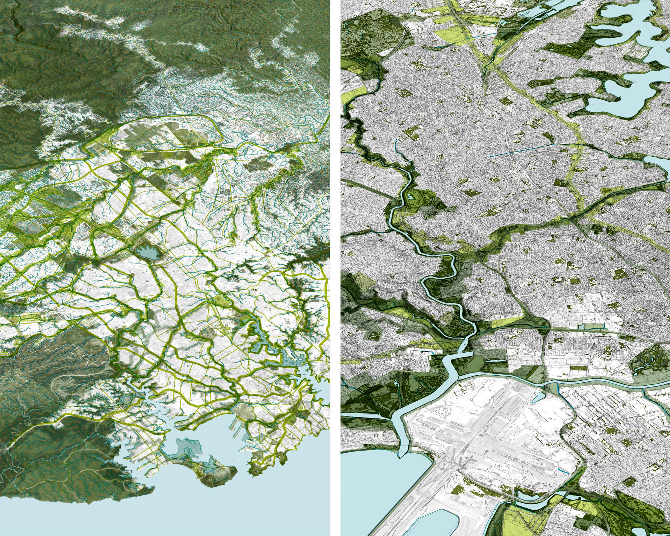
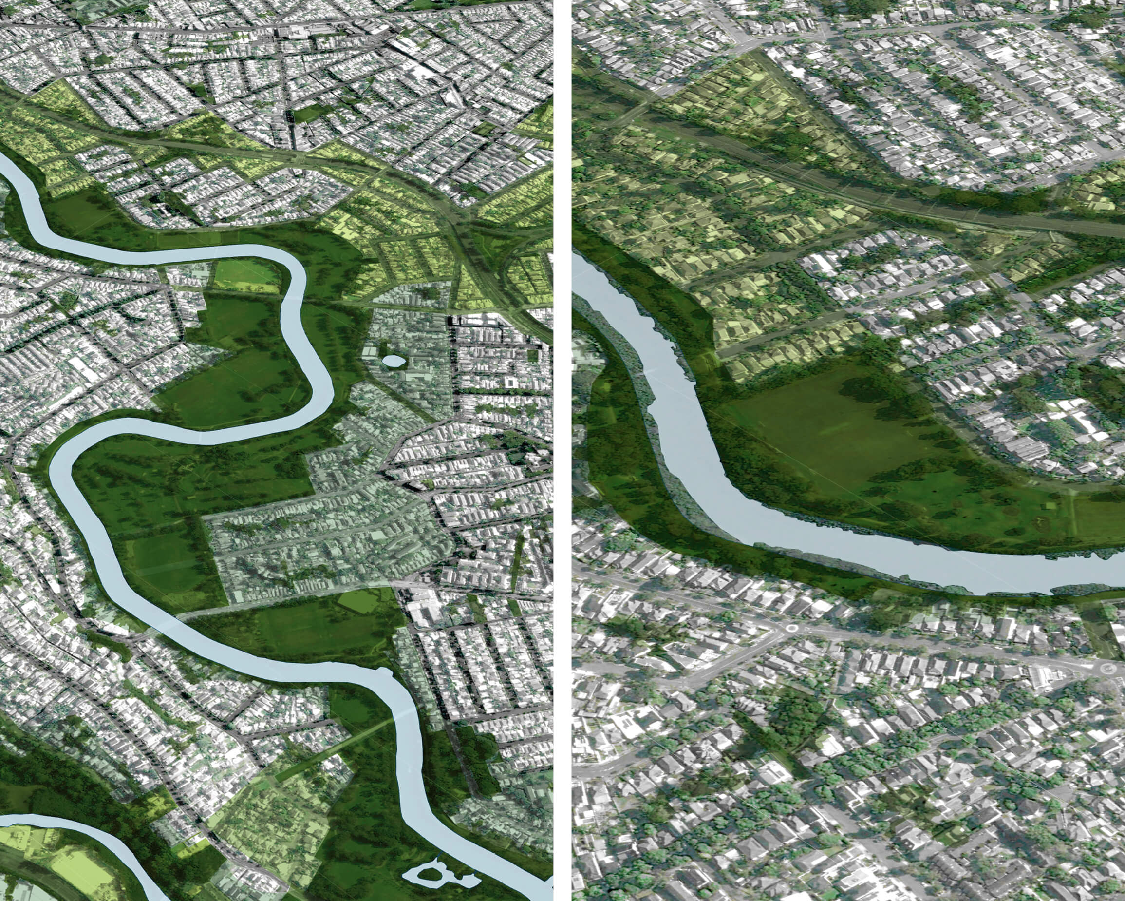
The Green Grid methodology creates an open space planning approach that is at once mega scaled and site-specific. Building on landscape features will help Sydney to evolve with a genuine sense of the specific natural systems that support it, woven throughout its six districts. Images show the green grid corridor at metropolitan, district and local scales (left to right.)
A coordinated approach to funding
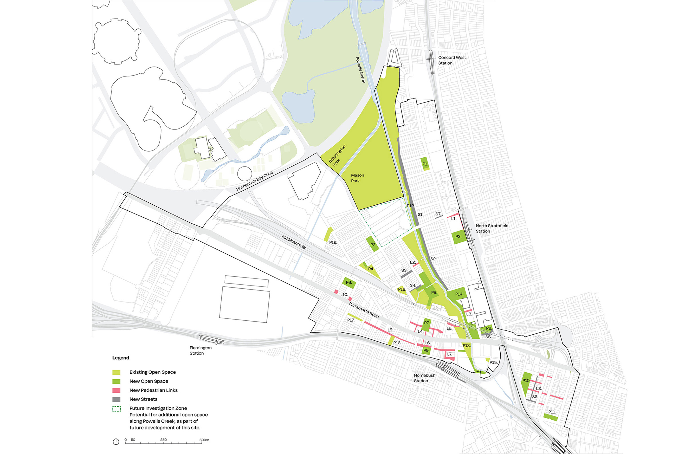
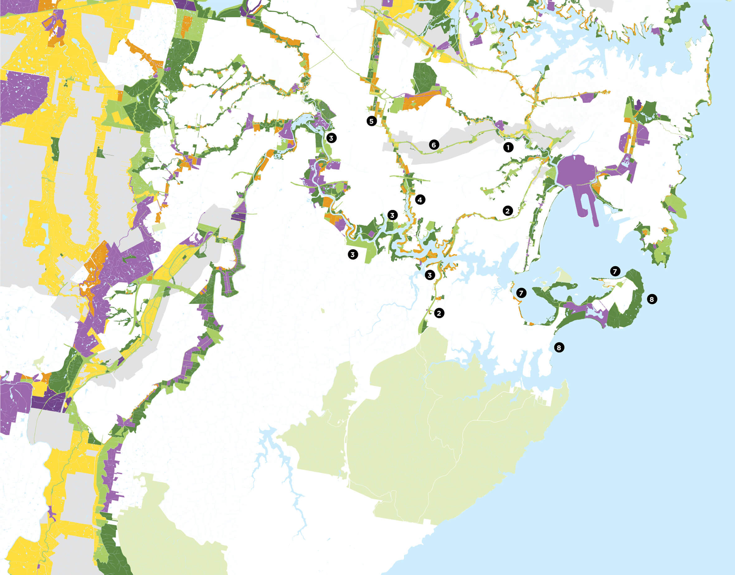
Green infrastructure is currently delivered by many agencies, using funding from a variety of sources. Our work allows each agency to input data about the allocation and source of funding and develop a streamlined approach. The GIS dataset links the spatial framework of the Green Grid network to other planning tools and datasets, including demographics, infrastructure, transport, housing performance, zoning, planning priorities, recreation, ecology and hydrology. This enables seamless integration with the decision-making workflows of different organisations, developing an evidence base to support targeted planning and funding of Sydney’s green infrastructure network.
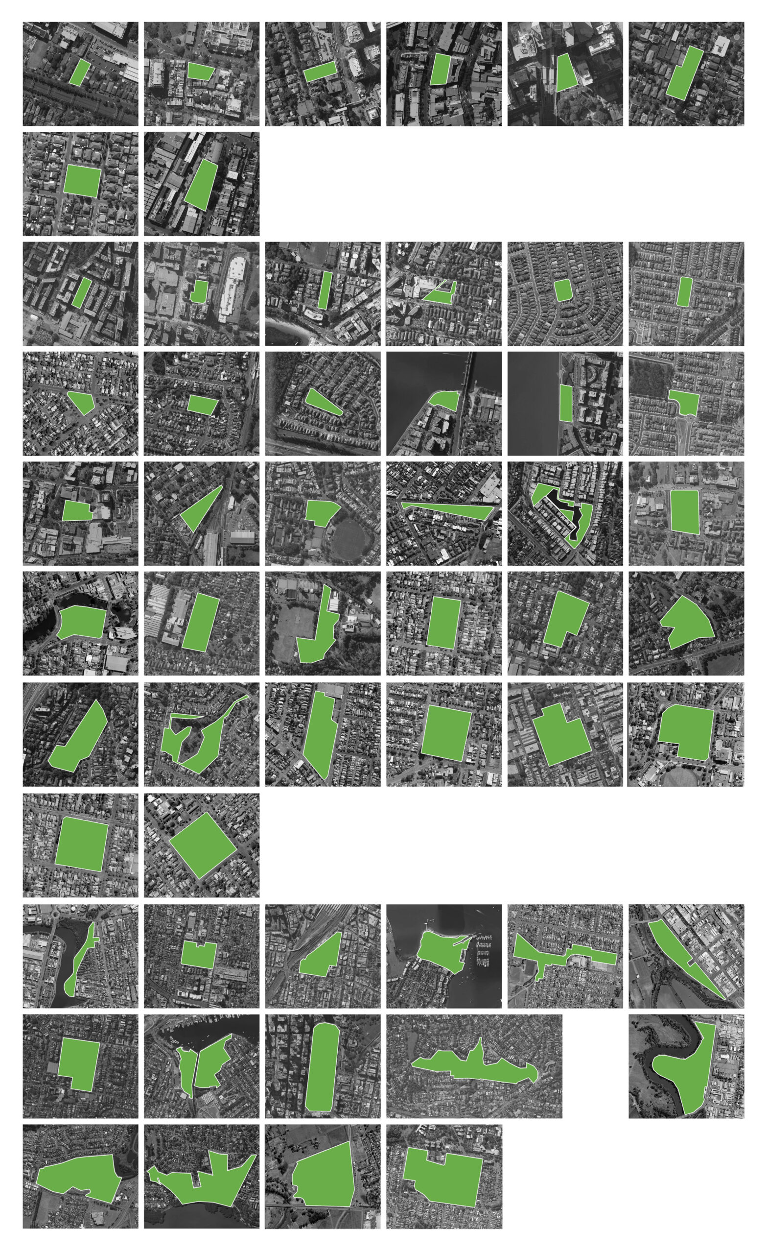
We uncovered project opportunities through detailed mapping of land ownership, zoning and natural performance, together with stakeholder workshops. This developed a set of maps for each priority corridor showing the land opportunities in each project.
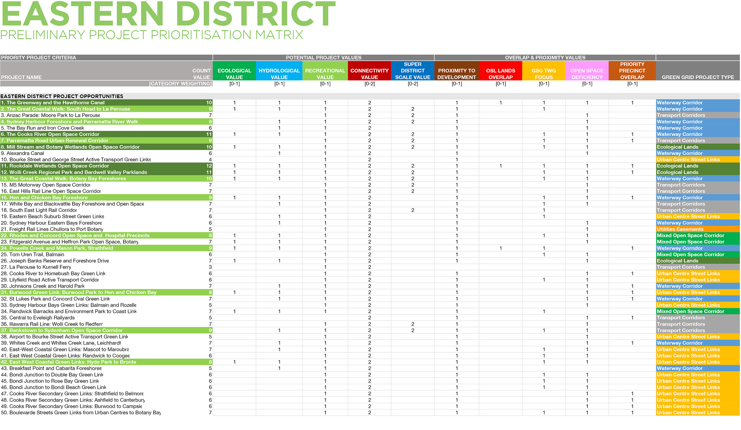
We generated a scoring system for proposed projects based on their potential to reconnect fragmented layers. Priority projects displayed high hydrological, ecological and recreational performance potential, plus proximity to future development plans, strategic lands, complementary infrastructural projects or local government priorities.
A connected network of 50 priority corridors will serve as the core corridors of the Green Grid as it is delivered.
See all the reports
The Sydney Green Grid Spatial Framework Reports can be downloaded here.